Kamuli
Kamuli | |
|---|---|
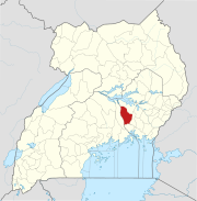
 Kamuli Location in Uganda | |
| Coordinates: 00°56′42″N 33°07′30″E / 0.94500°N 33.12500°ECoordinates: 00°56′42″N 33°07′30″E / 0.94500°N 33.12500°E | |
| Country | |
| Region | Eastern Uganda |
| Sub-region | Busoga sub-region |
| District | Kamuli District |
| Elevation | 3,600 ft (1,100 m) |
| Population (2020 Estimate) | |
| • Total | 67,800[1] |

Kamuli is a town in the Eastern Region of Uganda. It is the main municipal, administrative, and commercial centre of Kamuli District, and the district headquarters are located there. The district is named after the town.[2]
Location[]
Kamuli is approximately 63 kilometres (39 mi), by road, north of Jinja, the largest city in the Busoga sub-region, on an all weather tarmac road.[3]
This is about 131 kilometres (81 mi), by road, west of Mbale, the largest city in Uganda's Eastern Region.[4] The coordinates of Kamuli Town are 0°56'42.0"N, 33°07'30.0"E (Latitude:0.9450; Longitude:33.1250).[5]
Population[]
According to the 2014 national census and population survey, the population of Kamuli Municipality was 58,984. In July 2020, the Uganda Bureau of Statistics, estimated the mid-year population of the town at 67,800.[1]
Administration[]
The town is administered by a Municipal Council headed by a mayor. There is an elected Municipal Council of fifteen councillors. The annual budget for the municipality in the 2019/2020 financial year that ended on 30 June 2020 was UGX:6,921,343,000 (US$1,908,570).[6]
Points of interest[]
The following points of interest lie within the town limits or close to its borders:[7]
1. The headquarters of Kamuli District Administration
2. The offices of Kamuli Town Council
3. Kamuli Central Market
4. Kamuli Mission Hospital, a 160-bed private hospital, owned by the Roman Catholic Diocese of Jinja
5. Kamuli General Hospital, a 100-bed public hospital, owned by the Ugandan Government, which serves as the district hospital for Kamuli District and surrounding communities.
6. Kamuli Sugar Limited, a sugar factory located approximately 12 kilometres (7 mi) south of Kamuli, along the Kamuli-Mbulamuti Road.
Notable people[]
- Rebecca Kadaga, politician[8]
References[]
- ^ Jump up to: a b UBOS (14 June 2020). "The Population of The Regions of the Republic of Uganda And All Cities And Towns of More Than 15,000 Inhabitants". Citypopulation.de Quoting Uganda Bureau of Statistics (UBOS). Retrieved 29 December 2020.
- ^ Geoffrey Namukoye (24 August 2015). "Kamuli Receives Municipality Status With Mixed Feelings". New Vision. Retrieved 29 December 2020.
- ^ Google (29 December 2020). "Distance Between Jinja, Uganda And Kamuli, Uganda" (Map). Google Maps. Google. Retrieved 29 December 2020.
- ^ Google (29 December 2020). "Travel Distance From Mbale, Uganda To Kamuli, Uganda" (Map). Google Maps. Google. Retrieved 29 December 2020.
- ^ Google (29 December 2020). "Location of Kamuli Town" (Map). Google Maps. Google. Retrieved 29 December 2020.
- ^ Government Budget Office (2019). "Kamuli Municipal Council, Budget Framework Paper For Financial Year 2019/2020" (PDF). Kampala: Uganda Government Budget Office. Retrieved 29 December 2020.
- ^ Google (29 December 2020). "Satellite Map of Kamuli Town And Surrounding Communities" (Map). Google Maps. Google. Retrieved 29 December 2020.
- ^ Taddeo Bwambale (5 December 2020). "Kadaga Says Battle For Kamuli Seat With Musumba A No-Contest". New Vision. Kampala. Retrieved 29 December 2020.
External links[]
 Definitions from Wiktionary
 Media from Wikimedia Commons
 News from Wikinews
 Quotations from Wikiquote
 Texts from Wikisource
 Textbooks from Wikibooks
 Resources from Wikiversity
| Authority control |
|
|---|
| hide | ||
|---|---|---|
Capital: Kamuli | ||
| Towns and villages |
|  |
| Economy | ||
| Energy | ||
| Health | ||
| Notable landmarks |
| |
| Education |
| |
| Transport |
| |
| Notable people |
| |
- Populated places in Eastern Region, Uganda
- Cities in the Great Rift Valley
- Kamuli District
- Busoga