Kanakono
Kanakono | |
|---|---|
Town, sub-prefecture, and commune | |
 Kanakono Location in Ivory Coast | |
| Coordinates: 10°21′N 6°14′W / 10.350°N 6.233°WCoordinates: 10°21′N 6°14′W / 10.350°N 6.233°W | |
| Country | |
| District | Savanes |
| Region | Bagoué |
| Department | Tengréla |
| Population (2014)[1] | |
| • Total | 22,901 |
| Time zone | UTC+0 (GMT) |

Kanakono is a town in the far north of Ivory Coast. It is a sub-prefecture and commune of Tengréla Department in Bagoué Region, Savanes District. The border with Mali is five kilometres east of town.
In 2014, the population of the sub-prefecture of Kanakono was 22,901.[2]
Villages[]
The 6 villages of the sub-prefecture of Kanakono and their population in 2014 are:[2]
- Kanakono (10 127)
- Lomara (4 727)
- Popo (2 248)
- Pourou (2 834)
- Sissengue (2 463)
- Zanikaha (502)
Notes[]
- ^ "Côte d'Ivoire". geohive.com. Retrieved 11 December 2015.
- ^ a b "RGPH 2014, Répertoire des localités, Région Bagoué" (PDF). ins.ci. Retrieved 5 August 2019.
Regional seat: Boundiali | ||
| Boundiali Department | 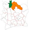 | |
| Kouto Department | ||
| Tengréla Department | ||
* also a commune | ||
This Savanes District location article is a stub. You can help Wikipedia by . |
Categories:
- Sub-prefectures of Bagoué
- Communes of Bagoué
- Savanes District geography stubs