Kaneville, Illinois
Kaneville, Illinois | |
|---|---|
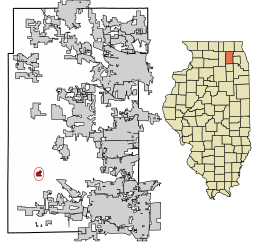 Location of Kaneville in Kane County, Illinois | |
 Location of Illinois in the United States | |
| Coordinates: 41°50′07″N 88°31′19″W / 41.83528°N 88.52194°W | |
| Country | United States |
| State | Illinois |
| County | Kane |
| Township | Kaneville |
| Government | |
| • Village President | David Kovach |
| Area | |
| • Total | 0.32 sq mi (0.81 km2) |
| • Land | 0.32 sq mi (0.81 km2) |
| • Water | 0.00 sq mi (0.00 km2) |
| Population (2010) | |
| • Total | 484 |
| • Estimate (2019)[2] | 480 |
| • Density | 1,523.81/sq mi (589.22/km2) |
| Time zone | UTC-6 (CST) |
| • Summer (DST) | UTC-5 (CDT) |
| ZIP Code(s) | 60144 |
| Area code(s) | 630 |
| FIPS code | 17-38895 |
| Wikimedia Commons | Kaneville, Illinois |
| Website | villageofkaneville |

Kaneville is a village in southwestern Kane County, Illinois, United States. It was incorporated in November 2006, and the first elected officials were chosen in elections held on April 17, 2007. The village had a population of 484 at the 2010 census.[3] Kaneville is part of the Chicago metropolitan area. The village was originally called "Royalton", but this was found to be taken by another settlement. The name was then changed to "Kaneville", referring to Elias Kane.[4]
Geography[]
Kaneville is in southwestern Kane County, in the southeast part of Kaneville Township. It is 12 miles (19 km) northwest of Aurora and 48 miles (77 km) west of the Chicago Loop.
According to the 2010 census, Kaneville has a total area of 0.31 square miles (0.80 km2), all land.[5]
Demographics[]
| Historical population | |||
|---|---|---|---|
| Census | Pop. | %± | |
| 2010 | 484 | — | |
| 2019 (est.) | 480 | [2] | −0.8% |
| U.S. Decennial Census[6] | |||
Notable natives[]
- Grace Ravlin, painter[7]
References[]
- ^ "2019 U.S. Gazetteer Files". United States Census Bureau. Retrieved July 14, 2020.
- ^ a b "Population and Housing Unit Estimates". United States Census Bureau. May 24, 2020. Retrieved May 27, 2020.
- ^ "Geographic Identifiers: 2010 Demographic Profile Data (G001): Kaneville village, Illinois". American Factfinder. U.S. Census Bureau. Retrieved February 12, 2019.[dead link]
- ^ "Several Towns Named After Founders and Heroes". The Daily Herald. December 28, 1999. p. 220. Retrieved August 17, 2014 – via Newspapers.com.

- ^ "G001 - Geographic Identifiers - 2010 Census Summary File 1". United States Census Bureau. Archived from the original on 2020-02-13. Retrieved 2015-08-04.
- ^ "Census of Population and Housing". Census.gov. Retrieved June 4, 2015.
- ^ Jules Heller; Nancy G. Heller (19 December 2013). North American Women Artists of the Twentieth Century: A Biographical Dictionary. Routledge. ISBN 978-1-135-63882-5.
External links[]
Coordinates: 41°50′07″N 88°31′19″W / 41.83528°N 88.52194°W
Municipalities and communities of Kane County, Illinois, United States | ||
|---|---|---|
| Cities | ||
| Villages | ||
| Townships | ||
| CDP | ||
| Other unincorporated communities | ||
| Footnotes | ‡This populated place also has portions in an adjacent county or counties | |
| ||
This Kane County, Illinois location article is a stub. You can help Wikipedia by . |
- Villages in Illinois
- Villages in Kane County, Illinois
- 2006 establishments in Illinois
- Chicago metropolitan area geography stubs