Kantishna River
| Kantishna River | |
|---|---|
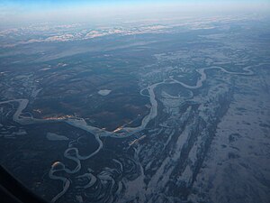 Confluence of the Kantishna River (bottom left) with the Tanana River | |
 Location of the mouth of the Kantishna River in Alaska | |
| Native name | Khenteethno' |
| Location | |
| Country | United States |
| State | Alaska |
| District | Denali Borough, Yukon–Koyukuk Census Area |
| Physical characteristics | |
| Source | confluence of McKinley River and |
| • location | near Chilchukabena Lake, Denali National Park and Preserve, Denali Borough |
| • coordinates | 63°51′58″N 151°33′22″W / 63.86611°N 151.55611°W[1] |
| • elevation | 647 ft (197 m)[2] |
| Mouth | Tanana River[3] |
• location | 32 miles (51 km) northwest of Nenana, Yukon–Koyukuk Census Area |
• coordinates | 64°45′44″N 149°57′56″W / 64.76222°N 149.96556°WCoordinates: 64°45′44″N 149°57′56″W / 64.76222°N 149.96556°W[1] |
• elevation | 279 ft (85 m)[1] |
| Length | 108 mi (174 km)[3] |
| Basin features | |
| Tributaries | |
| • left | |
| • right | Bearpaw River, Toklat River |

The Kantishna River (Lower Tanana: Khenteethno) is a 108-mile (174 km) tributary of the Tanana River in the U.S. state of Alaska.[3] Formed by the confluence of the McKinley River with in Denali National Park and Preserve, it drains part of the north slope of the Alaska Range including the Denali massif.[4] The direction of flow is generally north-northeast.[3] The Toklat River is a major tributary.[4]
Boating[]
Boaters can float the Kantishna River and some of its tributaries in canoes, folding canoes and kayaks, or inflatable canoes and kayaks. Some trips begin at Lake Minchumina, run about 50 miles (80 km) down the Muddy River to Birch Creek, then downstream to the Birch–McKinley confluence (the source of the Kantishna) and then down the Kantishna to the Tanana. The entire trip is rated Class I (easy) on the International Scale of River Difficulty. Dangers include the possibility of dangerous winds on Minchumina Lake, as well as overhanging trees, stumps, and logs along the streams.[5]
Another tributary, Moose Creek, can be floated for about 50 miles (80 km) beginning at Wonder Lake or Kantishna and entering the Kantishna River along its middle reaches near Bearpaw. From there to the Tanana, the run is the same as the Lake Minchumina float. The Moose Creek segment includes Class II (medium) rapids.[5]
See also[]
References[]
- ^ Jump up to: a b c "Kantishna River". Geographic Names Information System. United States Geological Survey. March 31, 1981. Retrieved October 21, 2013.
- ^ Derived by entering source coordinates in Google Earth.
- ^ Jump up to: a b c d Orth, Donald J.; United States Geological Survey (1971) [1967]. Dictionary of Alaska Place Names: Geological Survey Professional Paper 567 (PDF). University of Alaska Fairbanks. United States Government Printing Office. p. 495. Archived from the original (PDF) on October 17, 2013. Retrieved October 14, 2013.
- ^ Jump up to: a b Alaska Atlas & Gazetteer (7th ed.). Yarmouth, Maine: DeLorme. 2010. pp. 102–03 and 113–14. ISBN 978-0-89933-289-5.
- ^ Jump up to: a b Jettmar, Karen (2008) [1993]. The Alaska River Guide: Canoeing, Kayaking, and Rafting in the Last Frontier (3rd ed.). Birmingham, Alabama: Menasha Ridge Press. pp. 165–66. ISBN 978-0-89732-957-6.
External links[]
 Media related to Kantishna River at Wikimedia Commons
| hide Authority control | |
|---|---|
| General |
|
| National libraries | |
- Rivers of Denali Borough, Alaska
- Rivers of Alaska
- Rivers of Yukon–Koyukuk Census Area, Alaska
- Denali National Park and Preserve
- Tributaries of the Yukon River
- Rivers of Unorganized Borough, Alaska