Kapatagan, Lanao del Sur
Kapatagan | |
|---|---|
| Municipality of Kapatagan | |
 Seal | |
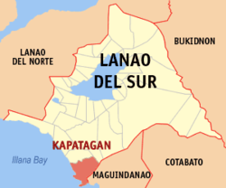 Map of Lanao del Sur with Kapatagan highlighted | |
OpenStreetMap  | |
 Kapatagan Location within the Philippines | |
| Coordinates: 7°27′03″N 124°07′55″E / 7.450919°N 124.131989°ECoordinates: 7°27′03″N 124°07′55″E / 7.450919°N 124.131989°E | |
| Country | Philippines |
| Region | Bangsamoro Autonomous Region in Muslim Mindanao |
| Province | Lanao del Sur |
| District | 2nd district |
| Barangays | 15 (see Barangays) |
| Government | |
| • Type | Sangguniang Bayan |
| • Mayor | Raida B. Maglangit |
| • Vice Mayor | Nhazruddin B. Maglangit |
| • Representative | Yasser A. Balindong |
| • Municipal Council | Members |
| • Electorate | 10,646 voters (2019) |
| Area | |
| • Total | 288.13 km2 (111.25 sq mi) |
| Elevation | 296 m (971 ft) |
| Highest elevation | 824 m (2,703 ft) |
| Lowest elevation | 9 m (30 ft) |
| Population (2020 census) [3] | |
| • Total | 20,498 |
| • Density | 71/km2 (180/sq mi) |
| • Households | 2,456 |
| Economy | |
| • Income class | 4th municipal income class |
| • Poverty incidence | 62.59% (2015)[4] |
| • Revenue | ₱135,070,059.90 (2020) |
| • Assets | ₱181,921,750.43 (2020) |
| • Expenditure | ₱134,065,236.03 (2020) |
| • Liabilities | ₱52,121,833.12 (2020) |
| Service provider | |
| • Electricity | Lanao del Sur Electric Cooperative (LASURECO) |
| Time zone | UTC+8 (PST) |
| ZIP code | 9700 |
| PSGC | |
| IDD : area code | +63 (0)63 |
| Native languages | Maranao Tagalog |
| Website | www |

Kapatagan, officially the Municipality of Kapatagan (Maranao: Inged a Kapatagan; Tagalog: Bayan ng Kapatagan), is a 4th class municipality in the province of Lanao del Sur, Philippines. According to the 2020 census, it has a population of 20,498 people. [3]
Barangays[]
Kapatagan is politically subdivided into 15 barangays.
- Bakikis
- Barao
- Bongabong
- Daguan
- Inudaran
- Kabaniakawan
- Kapatagan
- Lusain
- Matimos
- Minimao
- Pinantao.[5]
- Salaman
- Sigayan
- Tabuan
- Upper Igabay
Climate[]
| Climate data for Kapatagan, Lanao del Sur | |||||||||||||
|---|---|---|---|---|---|---|---|---|---|---|---|---|---|
| Month | Jan | Feb | Mar | Apr | May | Jun | Jul | Aug | Sep | Oct | Nov | Dec | Year |
| Average high °C (°F) | 28 (82) |
28 (82) |
29 (84) |
29 (84) |
28 (82) |
28 (82) |
27 (81) |
27 (81) |
28 (82) |
28 (82) |
28 (82) |
28 (82) |
28 (82) |
| Average low °C (°F) | 22 (72) |
22 (72) |
23 (73) |
23 (73) |
24 (75) |
23 (73) |
23 (73) |
23 (73) |
23 (73) |
23 (73) |
23 (73) |
23 (73) |
23 (73) |
| Average precipitation mm (inches) | 236 (9.3) |
225 (8.9) |
244 (9.6) |
235 (9.3) |
304 (12.0) |
287 (11.3) |
200 (7.9) |
175 (6.9) |
158 (6.2) |
200 (7.9) |
287 (11.3) |
243 (9.6) |
2,794 (110.2) |
| Average rainy days | 24.3 | 22.3 | 26.0 | 27.2 | 28.3 | 27.2 | 25.8 | 24.8 | 22.2 | 25.4 | 27.2 | 25.8 | 306.5 |
| Source: Meteoblue (modeled/calculated data, not measured locally)[6] | |||||||||||||
Demographics[]
| Year | Pop. | ±% p.a. |
|---|---|---|
| 1990 | 5,784 | — |
| 1995 | 6,702 | +2.80% |
| 2000 | 7,804 | +3.32% |
| 2007 | 19,598 | +13.54% |
| 2010 | 13,432 | −12.85% |
| 2015 | 15,521 | +2.79% |
| 2020 | 20,498 | +5.62% |
| Source: Philippine Statistics Authority [7] [8] [9][10] | ||
Economy[]
| Poverty Incidence of Kapatagan | |
| Source: Philippine Statistics Authority[11][12][13][14][15][16] | |
References[]
- ^ Municipality of Kapatagan | (DILG)
- ^ "2015 Census of Population, Report No. 3 – Population, Land Area, and Population Density" (PDF). Philippine Statistics Authority. Quezon City, Philippines. August 2016. ISSN 0117-1453. Archived (PDF) from the original on May 25, 2021. Retrieved July 16, 2021.
- ^ a b Census of Population (2020). "BARMM". Total Population by Province, City, Municipality and Barangay. PSA. Retrieved 8 July 2021.
- ^ https://psa.gov.ph/sites/default/files/City%20and%20Municipal-level%20Small%20Area%20Poverty%20Estimates_%202009%2C%202012%20and%202015_0.xlsx; publication date: 10 July 2019; publisher: Philippine Statistics Authority.
- ^ (Txt message - Pinantao is an old town before kapatagan municipality)
- ^ "Kapatagan, Lanao del Sur : Average Temperatures and Rainfall". Meteoblue. Retrieved 27 January 2019.
- ^ Census of Population (2015). "ARMM – Autonomous Region in Muslim Mindanao". Total Population by Province, City, Municipality and Barangay. PSA. Retrieved 20 June 2016.
- ^ Census of Population and Housing (2010). "ARMM – Autonomous Region in Muslim Mindanao". Total Population by Province, City, Municipality and Barangay. NSO. Retrieved 29 June 2016.
- ^ Censuses of Population (1903–2007). "ARMM – Autonomous Region in Muslim Mindanao". Table 1. Population Enumerated in Various Censuses by Province/Highly Urbanized City: 1903 to 2007. NSO.
- ^ "Province of Lanao del Sur". Municipality Population Data. Local Water Utilities Administration Research Division. Retrieved 17 December 2016.
- ^ "Poverty incidence (PI):". Philippine Statistics Authority. Retrieved 28 December 2020.
- ^ https://psa.gov.ph/sites/default/files/NSCB_LocalPovertyPhilippines_0.pdf; publication date: 29 November 2005; publisher: Philippine Statistics Authority.
- ^ https://psa.gov.ph/sites/default/files/2003%20SAE%20of%20poverty%20%28Full%20Report%29_1.pdf; publication date: 23 March 2009; publisher: Philippine Statistics Authority.
- ^ https://psa.gov.ph/sites/default/files/2006%20and%202009%20City%20and%20Municipal%20Level%20Poverty%20Estimates_0_1.pdf; publication date: 3 August 2012; publisher: Philippine Statistics Authority.
- ^ https://psa.gov.ph/sites/default/files/2012%20Municipal%20and%20City%20Level%20Poverty%20Estima7tes%20Publication%20%281%29.pdf; publication date: 31 May 2016; publisher: Philippine Statistics Authority.
- ^ https://psa.gov.ph/sites/default/files/City%20and%20Municipal-level%20Small%20Area%20Poverty%20Estimates_%202009%2C%202012%20and%202015_0.xlsx; publication date: 10 July 2019; publisher: Philippine Statistics Authority.
External links[]
- Kapatagan Profile at PhilAtlas.com
- Philippine Standard Geographic Code
- Philippine Census Information
- Local Governance Performance Management System
Places adjacent to Kapatagan, Lanao del Sur | ||||||||||||||||
|---|---|---|---|---|---|---|---|---|---|---|---|---|---|---|---|---|
| ||||||||||||||||

This article about a location in the Bangsamoro Autonomous Region in Muslim Mindanao is a stub. You can help Wikipedia by . |
Categories:
- Municipalities of Lanao del Sur
- Bangsamoro geography stubs