Karbinci Municipality
Municipality of Karbinci
Општина Карбинци | |
|---|---|
Rural municipality | |
 Flag  Coat of arms | |
 | |
| Country | |
| Region | |
| Municipal seat | Karbinci |
| Government | |
| • Mayor | Zoran Minov (VMRO-DPMNE) |
| Area | |
| • Total | 229.7 km2 (88.7 sq mi) |
| Population | |
| • Total | 4,012 |
| • Density | 17.47/km2 (45.2/sq mi) |
| Time zone | UTC+1 (CET) |
| Area code(s) | 032 |
| Website | http://www.OpstinaKarbinci.gov.mk/ |
Karbinci (Macedonian: ![]() Карбинци (help·info)) is a municipality in the eastern part of North Macedonia. Karbinci is also the name of the village where the municipal seat is found. Karbinci Municipality is part of the Eastern Statistical Region.
Карбинци (help·info)) is a municipality in the eastern part of North Macedonia. Karbinci is also the name of the village where the municipal seat is found. Karbinci Municipality is part of the Eastern Statistical Region.
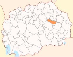
Geography[]
The municipality borders Probištip Municipality, Češinovo-Obleševo Municipality and Zrnovci Municipality to the north and east, and Radoviš Municipality and Štip Municipality to the west and south.
Demographics[]
The 2002 Macedonian census recorded 4,012 residents of Karbinci Municipality.[1] Ethnic groups in the municipality:
- Macedonians = 3,200 (79.8%)
- Turks = 728 (18.2%)
- others.
| Demographics Karbinci Municipality | ||
|---|---|---|
| Census year | Population | |
| 1994 | 4,342 | |
| 2002 | 4,012 | |
Inhabited places[]
The number of the inhabited places in the municipality is 29.
| Inhabited places in Karbinci Municipality | ||
|---|---|---|
| Villages: Argulica | Batanje | Vrteška | Golem Gaber | Gorni Balvan | | Dolni Balvan | | Ebeplija | | Kalauzlija | Karbinci | | Kozjak | Krupište | Kurfalija | | Kučica | | | | Nov Karaorman | | | Prnalija | Radanje | | Tarinci | Crvulevo | ||
References[]
- ^ 2002 census results in English and Macedonian (PDF)
| hide | ||
|---|---|---|
| Eastern | ||
| Northeastern | ||
| Pelagonia | ||
| Polog | ||
| Skopje | ||
| Southeastern | ||
| Southwestern | ||
| Vardar | ||
| City of Skopje |
| |
| Former |
| |

Categories:
- Karbinci Municipality
- Municipalities of North Macedonia