Karjat taluka
Coordinates: 18°33′4″N 75°0′38″E / 18.55111°N 75.01056°E

Karjat taluka | |
|---|---|
Taluka | |
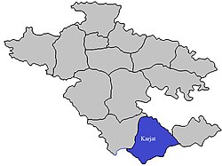 Location of Karjat in Ahmednagar in Maharashtra | |
| Country | |
| State | Maharashtra |
| District | Ahmednagar |
| Headquarters | Karjat |
| Area | |
| • Total | 1,503.61 km2 (580.55 sq mi) |
| Population (2001) | |
| • Total | 205,585 |
| • Density | 140/km2 (350/sq mi) |
Karjat taluka, is a taluka in Karjat subdivision of Ahmednagar district in Maharashtra State of India.[1][2]
Area[]
The table below shows area of the taluka by land type.[1]
| Type of Land | Area (km2) | % of Total Area |
|---|---|---|
| Agriculture | 1147.52 | 76.32 |
| Forest | 130.68 | 8.69 |
| Other | 225.41 | 14.99 |
| Total | 1503.61 | 100 |
Villages[]
There are around 118 villages in Karjat taluka. For list of villages see Villages in Karjat taluka.[1]
Population[]
The table below shows population of talukas by Gender as per 2001 census.[1]
| Population | % of Total Population | Number of Literate | Literacy (% of Population) | |
|---|---|---|---|---|
| Male | 106347 | 51.73 | 109470 | 102.94 |
| Female | 99238 | 48.27 | 80757 | 81.38 |
| Total | 205585 | 100 | 190227 | 92.53 |
Rainfall[]
The Table below shows the details of average rainfall from June–October for the period 1981 to 2011.[3]
| Year | Rainfall (mm) | Year | Rainfall (mm) | Year | Rainfall (mm) | Year | Rainfall (mm) |
| 1981 | 542 | 1991 | 391 | 2001 | 495 | 2011 | 413 |
| 1982 | 552 | 1992 | 352 | 2002 | 436 | 2012 | |
| 1983 | 779 | 1993 | 651 | 2003 | 281 | 2013 | |
| 1984 | 532 | 1994 | 493 | 2004 | 565 | 2014 | |
| 1985 | 456 | 1995 | 498 | 2005 | 606 | 2015 | |
| 1986 | 637 | 1996 | 514 | 2006 | 746 | 2016 | |
| 1987 | 432 | 1997 | 328 | 2007 | 401 | 2017 | |
| 1988 | 689 | 1998 | 920 | 2008 | 763 | 2018 | |
| 1989 | 864 | 1999 | 405 | 2009 | 710 | 2019 | |
| 1990 | 597 | 2000 | 400 | 2010 | 729 | 2020 |
See also[]
- Talukas in Ahmednagar district
- Villages in Karjat taluka
References[]
- ^ a b c d "New Page 2". Archived from the original on 29 September 2011. Retrieved 21 April 2015.
- ^ "Maps, Weather, and Airports for Karjat, India". Retrieved 21 April 2015.
- ^ "RainFall Information of district Ahmednagar". Archived from the original on 8 December 2015. Retrieved 21 April 2015.
Categories:
- Talukas in Ahmednagar district
- Talukas in Maharashtra
- Nashik Division geography stubs