Rahata taluka
Rahata taluka | |
|---|---|
 Location of Rahata in Ahmednagar district in Maharashtra | |
| Country | |
| State | Maharashtra |
| District | Ahmednagar district |
| Headquarters | Shrirampur |
| Area | |
| • Total | 759.19 km2 (293.12 sq mi) |
| Population (2001) | |
| • Total | 288,003 |
| • Density | 380/km2 (980/sq mi) |
| Demographics | |
| • Sex ratio | 68.16 |
Rahata taluka, is a taluka in Shrirampur subdivision of Ahmednagar district in Maharashtra State of India.[1]
Area[]
The table below shows area of the taluka by land type.[2]
| Type of Land | Area (km2) | % of Total Area |
|---|---|---|
| Agriculture | 689.39 | 90.81 |
| Forest | 16.13 | 2.12 |
| Other | 53.67 | 7.07 |
| Total | 759.19 | 100 |
Villages[]
There are around 60 villages in Rahata taluka. For list of villages see Villages in Rahata taluka.
Population[]
The table below shows population of the taluka by sex. The data is as per 2001 census.[3]
| Population | % of Total Population | Number of Literate | Literacy (% of Population) | |
|---|---|---|---|---|
| Male | 148642 | 51.61 | 112294 | 75.55 |
| Female | 139361 | 48.39 | 84002 | 60.28 |
| Total | 288003 | 100 | 196296 | 68.16 |
Rain Fall[]
The Table below details of rainfall from year 1981 to 2004.[4]
| Year | Rainfall (mm) |
|---|---|
| 2000 | 525 |
| 2001 | 413 |
| 2002 | 385 |
| 2003 | 249 |
| 2004 | 491 |
See also[]
- Talukas in Ahmednagar district
- Villages in Rahata taluka
References[]
Ahmednagar district topics | ||
|---|---|---|
| History | 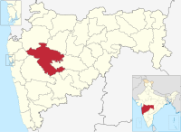 | |
| Geography | ||
| Talukas | ||
| Cities and towns | ||
| Monuments | ||
| Education | ||
| Lok Sabha constituencies | ||
| Vidhan Sabha constituencies | ||
| Dams in District | ||
Categories:
- Cities and towns in Ahmednagar district
- Talukas in Ahmednagar district
- Talukas in Maharashtra