Katsina
Katsina city | |
|---|---|
 Gobarau Minaret | |
| Nickname(s): KT, KT 1T, Katsina ta dikko dakin kara. | |
 Katsina city Location in Nigeria | |
| Coordinates: 12°59′20″N 07°36′03″E / 12.98889°N 7.60083°ECoordinates: 12°59′20″N 07°36′03″E / 12.98889°N 7.60083°E | |
| Country | |
| State | |
| Government | |
| • Chairman | Hamisu Gambo |
| • Emir | Abdulmumini Kabir Usman |
| Area | |
| • Total | 142 km2 (55 sq mi) |
| Population (2006) | |
| • Total | 318,459 |
| Time zone | West African Time |
| 3-digit postal code prefix | 820 |
| ISO 3166 code | NG.KT.KA |
| Climate | BSh |

Katsina is a Local Government Area and the state capital of Katsina State in northern Nigeria.[1] Katsina is located some 260 kilometres (160 mi) east of the city of Sokoto and 135 kilometres (84 mi) northwest of Kano, close to the border with Niger Republic.
In 2016, Katsina's estimated population was 429,000.[2]
The city is the centre of an agricultural region production of groundnuts, cotton, hides, millet and guinea corn[1] and also has mills for producing peanut oil and steel, it was also a center for large scale poultry farming of cows, goats, sheeps and chickens.
The city has a largely Muslims population mainly from the Hausa and Fulani ethnics group.
Former Nigerian late President Umaru Yar'Adua was a nobleman of Katsina.[3]
The incumbent Governor of Katsina State is Aminu Bello Masari,[4] who was sworn in as the executive Governor of the State on 29th of May 2015, who had succeeded Barrister Ibrahim Shema.[5]

Katsina Emirate[]
The Katsina Royal Palace 'Gidan Korau' is a huge complex located in the centre of the ancient city. It is a symbol of culture, history and traditions of 'Katsinawa'. According to historical account, it was built in 1348 CE by Muhammadu Korau, who is believed to have been the first Muslim King of Katsina. This explains why it is traditionally known as 'Gidan Korau' (House of Korau). It is one of the oldest and among the first generation palaces, along with Daura, Kano and Zazzau. The palace was encircled with a rampart, 'Ganuwar Gidan Sarki' (which is now gone). The main gate which leads to the palace is known as 'Kofar Soro', while the gate at the backyard is called 'Kofar Bai' (now gone). The Emir's residential quarters at the epicenter of the Palace is a large compound built in the typical traditional architectural style]].[6] The current Emir of Katsina is Alhaji Abdulmumini Kabir Usman.a Fulani legacy
Other Local governments[]
Katsina State has 34 local governments. The local government area of Katsina is an area of 142 km2, with a population of 318,459 at the 2006 census. The local government are as follows;
- Batagarawa
- Bindawa
- Rimi
- Charanchi
- Bakori
- Danja
- Funtua
- Jibiya
- Batsari
- Kankara
- Kankia
- Faskari
- Malumfashi
- Kafur
- Kurfi
- Matazu
- Musawa
- Dan-Musa
- Safana
- Dutsin-Ma
- Dandume
- Baure
- Katsina
- Mani
- Kusada
- Sabuwa
- Mashi
- Zango
- Sandamu
- Daura
- Madawa
- Ingawa
- Kaita
- Dutse
Source: Katsina culture and history board, office of the surveyor of Katsina State
The postal code of the area is 820.[7]
History[]
Surrounded by city wall 21 kilometres (13 mi) in length, Katsina is believed to have been founded circa 1100.[1] In pre-Islamic times, Katsina's semi-divine ruler was known as the Sarki, who faced a summary death-sentence if found to be ruling incompetently. From the 17th to the 18th century, Katsina was the commercial heart of Hausaland and became the largest of the seven Hausa city-states. Katsina was conquered by the Fulani during the Fulani War in 1807. In 1903, the Emir, Abubakar dan Ibrahim, accepted British rule, which continued until Nigerian independence from Britain in 1960.
During sub-Saharan trade, the city of Katsina was known to be one of the most vibrant and strong commercial centres, and was believed to be the strongest with the Hausa kingdoms in terms of commerce, trade and craft. The German explorer Friedrich Hornemann reached Katsina, the first Westerner to do so, at the beginning of the 19th century.
The city's history of western-style education dates back to the early 1950s, when the first middle school in northern Nigeria was established. There are now several institutions of higher learning, including two universities: Umaru Musa Yar'adua University and the private Katsina University. The city of Katsina is also home to a famous 18th-century mosque featuring the Gobarau Minaret, a 15-metre (50 ft) tower made from mud and palm branches.[1]
2020 Boko Haram incident[]
In December, 2020, over 300 schoolboys were kidnapped from their boarding school in Katsina.[8] 344 of the boys were returned safely within a week.[8] Boko Haram took credit for the incident,[8] but local officials expressed skepticism about the claim, noting that Boko Haram had not been previously active in the region.[9]

The Emir of Katsina, Muhammad Dikko dan Gidado, and other officials, 1911
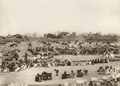
Livestock market in Katsina, 1911

Aerial view of Katsina


Higher education institutions in the city of Katsina.[]
- Umaru Musa Yar'adua University Katsina(UMYU)
- Al-Qalam University Katsina (former Katsina University Katsina).
- Hassan Usman Katsina Polytechnic
- Katsina State Institute of Technology and Management (KTSITM).
- National Open University of Nigeria (NOUN).
- Cherish Enterprises Institute.[1]
- Katsina Community College of Education [Affiliated to Ahmadu Bello University Zaria (A.B.U) suncais ground.]
Geography[]
Climate[]
According to the Köppen Climate Classification system, Katsina has a hot semi-arid climate, abbreviated "BSh" on climate maps.[10]
| hideClimate data for Katsina | |||||||||||||
|---|---|---|---|---|---|---|---|---|---|---|---|---|---|
| Month | Jan | Feb | Mar | Apr | May | Jun | Jul | Aug | Sep | Oct | Nov | Dec | Year |
| Record high °C (°F) | 36.7 (98.1) |
39.4 (102.9) |
41.7 (107.1) |
42.2 (108.0) |
42.2 (108.0) |
41.1 (106.0) |
36.1 (97.0) |
33.3 (91.9) |
35.0 (95.0) |
37.2 (99.0) |
37.2 (99.0) |
36.7 (98.1) |
42.2 (108.0) |
| Average high °C (°F) | 30.1 (86.2) |
32.8 (91.0) |
36.4 (97.5) |
38.6 (101.5) |
37.8 (100.0) |
34.6 (94.3) |
30.8 (87.4) |
28.8 (83.8) |
30.9 (87.6) |
34.0 (93.2) |
33.1 (91.6) |
30.2 (86.4) |
33.2 (91.8) |
| Daily mean °C (°F) | 21.1 (70.0) |
23.6 (74.5) |
27.8 (82.0) |
30.8 (87.4) |
31.0 (87.8) |
28.6 (83.5) |
25.9 (78.6) |
24.6 (76.3) |
25.8 (78.4) |
26.7 (80.1) |
24.1 (75.4) |
21.2 (70.2) |
25.9 (78.6) |
| Average low °C (°F) | 12.0 (53.6) |
14.3 (57.7) |
19.1 (66.4) |
23.1 (73.6) |
24.2 (75.6) |
22.7 (72.9) |
21.1 (70.0) |
20.6 (69.1) |
20.7 (69.3) |
19.3 (66.7) |
15.1 (59.2) |
12.1 (53.8) |
18.7 (65.7) |
| Record low °C (°F) | 5.0 (41.0) |
5.6 (42.1) |
4.4 (39.9) |
11.7 (53.1) |
18.3 (64.9) |
16.7 (62.1) |
15.0 (59.0) |
16.7 (62.1) |
16.7 (62.1) |
8.3 (46.9) |
5.6 (42.1) |
5.6 (42.1) |
4.4 (39.9) |
| Average precipitation mm (inches) | 0.5 (0.02) |
0.5 (0.02) |
0.5 (0.02) |
5.0 (0.20) |
56.0 (2.20) |
84.0 (3.31) |
185.0 (7.28) |
274.0 (10.79) |
127.0 (5.00) |
10.0 (0.39) |
0.0 (0.0) |
0.0 (0.0) |
742.0 (29.21) |
| Average precipitation days (≥ 0.3 mm) | 0 | 0 | 0 | 1 | 5 | 8 | 15 | 17 | 13 | 2 | 0 | 0 | 61 |
| Average relative humidity (%) (at 07:00 LST) | 39 | 32 | 28 | 41 | 62 | 77 | 88 | 93 | 92 | 76 | 49 | 44 | 60 |
| Mean monthly sunshine hours | 279.0 | 257.1 | 257.3 | 261.0 | 288.3 | 267.0 | 244.9 | 220.1 | 246.0 | 285.2 | 285.0 | 275.9 | 3,166.8 |
| Mean daily sunshine hours | 9.0 | 9.1 | 8.3 | 8.7 | 9.3 | 8.9 | 7.9 | 7.1 | 8.2 | 9.2 | 9.5 | 8.9 | 8.6 |
| Source: Deutscher Wetterdienst[11] | |||||||||||||
Rainfall[]
Katsina State usually record 0mm of average rainfall from January to March, 1mm, 9mm and 41mm in April, May & June respectively, 85mm, 119mm, 40mm and 8mm for the months of July, August, September and October. While November and December records 0mm rainfall.[12]
The table below shows record of rainfall from 1990 to 2019 obtained from Nimet Katsina.
| S/N | Code | Years | January | February | March | April | May | Junr | July | August | September | October | November | December |
|---|---|---|---|---|---|---|---|---|---|---|---|---|---|---|
| 1. | 65028 | 1990 | 0 | 0 | 0 | 0 | 29.9 | 57.9 | 198.8 | 220.2 | 34.7 | 0 | 0 | 0 |
| 2. | 65028 | 1991 | 0 | 0 | 10.8 | 12.2 | 73.5 | 58.8 | 71.5 | 109.7 | 21.1 | 1.4 | 0 | 0 |
| 3. | 65028 | 1992 | 0 | 0 | 0 | 0 | 33.6 | 19.9 | 89.3 | 119.4 | 70.7 | 0.2 | 0 | 0 |
| 4. | 65028 | 1993 | 0 | 0 | 0 | 0 | 4.5 | 42.3 | 69 | 94.5 | 51.7 | 0 | 0 | 0 |
| 5. | 65028 | 1994 | 0 | 0 | 0 | 3.1 | 12.3 | 42.3 | 107.9 | 174.2 | 113.1 | 20.3 | 0 | 0 |
| 6. | 65028 | 1995 | 0 | 0 | 0 | 10 | 30 | 70 | 80 | 120 | 80 | 10 | 0 | 0 |
| 7. | 65028 | 1996 | 0 | 0 | 0 | 0 | 42.6 | 44.5 | 38.1 | 66.8 | 67.8 | 0 | 0 | 0 |
| 8. | 65028 | 1997 | 0 | 0 | 7.2 | 9.5 | 89.5 | 30.4 | 91.1 | 153.7 | 56.5 | 8.3 | 0 | 0 |
| 9. | 65028 | 1998 | 0 | 0 | 0 | 10.1 | 11.4 | 43.4 | 114.1 | 116.6 | 135.2 | 0.8 | 0 | 0 |
| 10. | 65028 | 1999 | 0 | 0 | 0 | 0 | 4.2 | 22.4 | 149.2 | 89.8 | 132.3 | 18.4 | 0 | 0 |
| 11. | 65028 | 2000 | 0 | 0 | 0 | 0 | 1.6 | 106.8 | 299.9 | 160.2 | 62.1 | 45 | 0 | 0 |
| 12. | 65028 | 2001 | 0 | 0 | 0 | 16.9 | 83.9 | 110.8 | 176 | 240.9 | 70.6 | 0 | 0 | 0 |
| 13. | 65028 | 2002 | 0 | 0 | 0 | 0 | 2.9 | 141.3 | 170.4 | 71.3 | 199.1 | 9.8 | 0 | 0 |
| 14. | 65028 | 2003 | 0 | 0 | 0 | 4 | 52.8 | 57.2 | 118.2 | 275.5 | 75.1 | 16.4 | 0 | 0 |
| 15. | 65028 | 2004 | 0 | 0 | 0 | 0 | 74.9 | 151.2 | 161.1 | 268.8 | 42 | 0 | 0 | 0 |
| 16. | 65028 | 2005 | 0 | 0 | 0 | 14.8 | 18.4 | 83.2 | 173.7 | 216.1 | 194 | 50.4 | 0 | 0 |
| 17. | 65028 | 2006 | 0 | 0 | 0 | 0 | 26.1 | 69.9 | 170.9 | 314.9 | 129.7 | 15 | 0 | 0 |
| 18. | 65028 | 2007 | 0 | 0 | 0 | 6.2 | 84.9 | 135.2 | 117.4 | 314.9 | 45.5 | 0 | 0 | 0 |
| 19. | 65028 | 2008 | 0 | 0 | 0 | 16.6 | 8.5 | 63.3 | 182.9 | 213.9 | 67.7 | 4.2 | 0 | 0 |
| 20. | 65028 | 2009 | 0 | 0 | 0 | 0 | 95 | 57.9 | 96.5 | 123.3 | 38.3 | 29 | 0 | 0 |
| 21. | 65028 | 2010 | 0 | 0 | 0 | 85.6 | 8.1 | 118.8 | 226.1 | 448.9 | 76.6 | 48.6 | 0 | 0 |
| 22. | 65028 | 2011 | 0 | 0 | 0 | 0 | 38 | 149.2 | 116.6 | 180.6 | 67.3 | 8 | 0 | 0 |
| 23. | 65028 | 2012 | 0 | 0 | 0 | 0 | 59.5 | 135.2 | 117.4 | 314.9 | 129.7 | 15 | 0 | 0 |
| 24. | 65028 | 2013 | 0 | 0 | 0 | 42.4 | 36.7 | 103.2 | 89 | 274.7 | 107.6 | 10.2 | 0 | 0 |
| 25. | 65028 | 2014 | 0 | 0 | 0 | 0 | 38.1 | 39.5 | 178.9 | 178.7 | 46.3 | 0 | 0 | 0 |
| 26. | 65028 | 2015 | 0 | 0 | 0 | 0 | 0 | 89.1 | 178.9 | 274.7 | 46.3 | 9 | 0 | 0 |
| 27. | 65028 | 2016 | 0 | 0 | 0 | 0 | 4.5 | 42.3 | 69 | 94.5 | 59.5 | 0 | 0 | 0 |
| 28. | 65028 | 2017 | 0 | 0 | 0 | 10.1 | 11.4 | 62 | 114.1 | 16.6 | 135.2 | 0.8 | 0 | 0 |
| 29. | 65028 | 2018 | 0 | 0 | 0 | 0 | 2.9 | 141.3 | 170.4 | 149.7 | 199.1 | 63.8 | 0 | 0 |
| 30. | 65028 | 2019 | 0 | 0 | 0 | 11.6 | 8.1 | 118.8 | 232.7 | 359.1 | 98.6 | 26.6 | 0 | 0 |
Source: Nigerian Meteorological Agency, Katsina 2021.
Temperature[]
Temperature is the degree of hotness or coldness of a body or place.
Highest Temperatures[]
The temperature of Katsina is usually high, with warmest month being April having the warmest average high temperature of 40.8°C while December having the lowest average high temperature of 31.4°C.[12]
The Table below contains the highest temperature each month from 1985 to 2017.
| S/N | Code | Shekara | Junairu | Febrelu | March | Aprelu | Mayu | Juni | Juli | Augusta | Satumba | Oktoba | Nuwamba | December |
|---|---|---|---|---|---|---|---|---|---|---|---|---|---|---|
| 1. | 65028 | 1985 | 31.7 | 29.7 | 36.5 | 36.5 | 38.6 | 35.9 | 31.6 | 31.3 | 33.2 | 35.5 | 33.9 | 28.2 |
| 2. | 65028 | 1986 | 38.9 | 34.7 | 37 | 40.2 | 39.2 | 37 | 31.5 | 31.4 | 32.2 | 35.4 | 33.3 | 37.4 |
| 3. | 65028 | 1987 | 30.4 | 33.6 | 36 | 37.6 | 40.1 | 36.6 | 35.1 | 32.6 | 34.4 | 35.7 | 34.1 | 30.1 |
| 4. | 65028 | 1988 | 28.4 | 32 | 36.7 | 39 | 39.2 | 35.3 | 31.9 | 29.5 | 31.9 | 34.3 | 33.7 | 28.5 |
| 5. | 65028 | 1989 | 26 | 28.4 | 35.2 | 39.3 | 38.3 | 36.2 | 32.4 | 30.9 | 32.6 | 33.6 | 33.6 | 29.6 |
| 6. | 65028 | 1990 | 32.2 | 30.1 | 33.5 | 39.9 | 38.1 | 36.7 | 31.7 | 31.4 | 33.9 | 36.7 | 35.5 | 34 |
| 7. | 65028 | 1991 | 29.4 | 35.9 | 35.9 | 39 | 35.3 | 35.1 | 31 | 30.5 | 34.4 | 36.4 | 33.3 | 28.9 |
| 8. | 65038 | 1992 | 29.1 | 30.1 | 36.4 | 39 | 36.5 | 35.6 | 31 | 30.3 | 32.4 | 35.7 | 31.5 | 30.2 |
| 9. | 65028 | 1993 | 36.5 | 32.5 | 36.5 | 39.3 | 39.3 | 36.5 | 33.3 | 31.5 | 33.1 | 36.9 | 35.5 | 29.5 |
| 10. | 65028 | 1994 | 29.5 | 31.6 | 38.2 | 38.7 | 38.9 | 35.4 | 31.8 | 29.5 | 31.4 | 34.1 | 32.3 | 27.4 |
| 11. | 65028 | 1995 | 27.7 | 31 | 38.1 | 38.8 | 38.3 | 36.1 | 32.9 | 30.9 | 32.6 | 35.4 | 32.2 | 31.7 |
| 12. | 65028 | 1996 | 32.1 | 34.8 | 37.6 | 39.3 | 38.3 | 34.5 | 33.6 | 30.3 | 32.3 | 35.3 | 31.2 | 31.8 |
| 13. | 65028 | 1997 | 31.3 | 28.5 | 34.8 | 38.3 | 36.5 | 35.1 | 32.4 | 31.7 | 33.6 | 36.5 | 35.6 | 30.4 |
| 14. | 65028 | 1998 | 29.4 | 33.5 | 33.9 | 40.2 | 39.3 | 35.6 | 32.1 | 30.8 | 31.6 | 34.9 | 34.9 | 30.6 |
| 15. | 65028 | 1999 | 30.8 | 34 | 39 | 39.5 | 39.3 | 38.1 | 31.7 | 29.5 | 31.4 | 33.4 | 33.2 | 29.7 |
| 16. | 65028 | 2000 | 31 | 28.6 | 35.2 | 40.5 | 39.6 | 35.3 | 31 | 31 | 32.9 | 33.8 | 33.8 | 29.6 |
| 17. | 65028 | 2001 | 29.3 | 30.4 | 36.9 | 38 | 37.8 | 34.3 | 31.3 | 30 | 32 | 34.8 | 33.6 | 31.9 |
| 18. | 65028 | 2002 | 26.3 | 31.6 | 37 | 39.8 | 40.8 | 36 | 32.5 | 31.1 | 32.2 | 32.4 | 33.8 | 31 |
| 19. | 65028 | 2003 | 34.7 | 35.3 | 39.6 | 39.4 | 34.4 | 35.6 | 31.3 | 30.8 | 32.8 | 33.8 | 33.5 | 31.7 |
| 20. | 65028 | 2004 | 32 | 29.9 | 40 | 39 | 36.5 | 32 | 30 | 33 | 36 | 34 | 33.9 | 31.9 |
| 21 | 65028 | 2005 | 13.4 | 19.4 | 22 | 24 | 25.2 | 24.2 | 22.7 | 21.6 | 22.3 | 20 | 16.2 | 14 |
| 22. | 65028 | 2006 | 15 | 18.1 | 20 | 21.4 | 26 | 25 | 23.2 | 22 | 22.2 | 22 | 15 | 11.8 |
| 23. | 65028 | 2007 | 12.8 | 13.6 | 18.3 | 22.7 | 24.4 | 23.8 | 21.5 | 20.3 | 20.5 | 17.6 | 13.3 | 10.7 |
| 24. | 65028 | 2008 | 9.5 | 14.4 | 20 | 21.2 | 23.2 | 22.8 | 21.1 | 19.5 | 19.8 | 17.5 | 13.3 | 11.5 |
| 25. | 65028 | 2009 | 11.1 | 14.2 | 19.2 | 23.4 | 24.2 | 22.4 | 22.4 | 21.1 | 22.1 | 21.5 | 14.6 | 13.6 |
| 26. | 65028 | 2010 | 14.5 | 17 | 19.7 | 23.8 | 23.7 | 23.8 | 22 | 20.7 | 21.9 | 19.6 | 14.3 | 14.1 |
| 27. | 65028 | 2011 | 13.3 | 17.9 | 17.5 | 22.3 | 24.7 | 23.8 | 20.6 | 20.5 | 21.2 | 21.2 | 16.1 | 12.2 |
| 28. | 65028 | 2012 | 12.6 | 16.4 | 18.6 | 25.4 | 26.3 | 23.4 | 21.3 | 20.4 | 21.8 | 22.1 | 19.0 | 14.6 |
| 29. | 65028 | 2013 | 30.7 | 34.3 | 39.8 | 37.8 | 38.8 | 35.6 | 32.5 | 29.9 | 32.8 | 34.9 | 34.9 | 31.1 |
| 30. | 65028 | 2014 | 30.8 | 32.2 | 37.5 | 39.7 | 37.6 | 36.6 | 33.4 | 30.7 | 32.5 | 35.9 | 34.8 | 30.7 |
| 31. | 65028 | 2015 | 28.2 | 35.1 | 36.1 | 37.5 | 40.3 | 37.4 | 33.4 | 33.1 | 32.5 | 35.9 | 33.3 | 36.1 |
| 32. | 65028 | 2016 | 28.2 | 32.5 | 38.5 | 40.5 | 39 | 35.1 | 32.2 | 30.9 | 32.3 | 36.5 | 35.5 | 30.7 |
| 33. | 65028 | 2017 | 27.8 | 31.6 | 37.5 | 39.5 | 39 | 34.7 | 31.9 | 31 | 32.9 | 35.7 | 34.1 | 30.2 |
Source: Nigerian Meteorological Agency, Katsina 2021
Lowest Temperatures[]
January is usually the coldest month of the year in Katsina having the lowest average low temperatures of 14.7°C.[12]
| S/N | Code | Shekara | Junairu | Febrelu | March | Aprelu | Mayu | Juni | Juli | Augusta | Satumba | Oktoba | Nuwamba | December |
|---|---|---|---|---|---|---|---|---|---|---|---|---|---|---|
| 1. | 65028 | 1985 | 16 | 14.7 | 22.6 | 24.2 | 26.7 | 24.4 | 22.2 | 22.2 | 22.6 | 21 | 17.5 | 14.7 |
| 2. | 65028 | 1986 | 12.7 | 18 | 23.4 | 26.2 | 26.6 | 25.2 | 21.9 | 21.8 | 22.2 | 20.8 | 17.9 | 12.8 |
| 3. | 65028 | 1987 | 13.1 | 16.7 | 21.4 | 22.3 | 25.2 | 24.9 | 23.9 | 22.6 | 23.6 | 22.5 | 17.5 | 14.5 |
| 4. | 65028 | 1988 | 14.4 | 16.4 | 21.6 | 26.6 | 24.5 | 24.5 | 22.7 | 21.2 | 22.3 | 19.6 | 16.2 | 13.5 |
| 5. | 65028 | 1989 | 11.1 | 13.8 | 18.9 | 23.1 | 25.1 | 24.4 | 22.2 | 21.7 | 22.8 | 20.6 | 15.8 | 13.8 |
| 6. | 65028 | 1990 | 15.5 | 14.3 | 17 | 25.7 | 25.7 | 25.1 | 22.4 | 25.8 | 23.4 | 21 | 18.1 | 17.4 |
| 7. | 65028 | 1991 | 13.7 | 18.9 | 21.7 | 25.5 | 24.5 | 24.4 | 16.2 | 12.6 | ||||
| 8. | 65028 | 1992 | 12.5 | 13.9 | 21.9 | 24.4 | 25.1 | 23.7 | 21.4 | 21.1 | 21.6 | 20.3 | 16.5 | 12.7 |
| 9. | 65028 | 1993 | 11.3 | 15 | 19.7 | 22.7 | 24.9 | 23.1 | 21.1 | 20.7 | 21.1 | 20.5 | 17.5 | 12.5 |
| 10. | 65028 | 1994 | 12.5 | 13.5 | 19.5 | 23.7 | 24.2 | 22.1 | 20 | 19.1 | 19.6 | 20.7 | 13.5 | 10.5 |
| 11. | 65028 | 1995 | 11.2 | 13 | 19.1 | 22.7 | 23.5 | 22.2 | 20.5 | 19.4 | 19.7 | 19.8 | 14 | 12.4 |
| 12. | 65028 | 1996 | 11.4 | 14.2 | 18.7 | 20.8 | 22.3 | 20.6 | 20 | 18.8 | 19 | 18.7 | 11.8 | 12.2 |
| 13. | 65028 | 1997 | 14 | 14.1 | 21.1 | 24.7 | 24.6 | 24 | 22.9 | 22.3 | 23.1 | 23.5 | 18.9 | 14.2 |
| 14. | 65028 | 1998 | 13.7 | 17.5 | 18.6 | 25.8 | 27.7 | 24.5 | 23.1 | 21.8 | 22.3 | 21.3 | 16.9 | 13.3 |
| 15. | 65028 | 1999 | 12.6 | 16 | 20.2 | 23.1 | 24.7 | 24.1 | 20.8 | 20.4 | 20.7 | 19 | 15.1 | 11.3 |
| 16. | 65028 | 2000 | 13 | 11.2 | 16.7 | 19 | 24.3 | 23.5 | 21 | 21 | 21.9 | 19.9 | 14.1 | 11 |
| 17. | 65028 | 2001 | 20.2 | 12.6 | 16.5 | 23 | 24.6 | 23.2 | 22 | 21 | 21.9 | 19.7 | 14.6 | 12.8 |
| 18. | 65028 | 2002 | 11.7 | 13.5 | 20 | 25.6 | 26 | 24 | 22.1 | 21.9 | 22.3 | 19.8 | 13.9 | 12.8 |
| 19. | 65028 | 2003 | 16.5 | 18.6 | 24.4 | 24 | 23.6 | 23.5 | 22.2 | 22.1 | 22.5 | 19.9 | 14.5 | 12.5 |
| 20. | 65028 | 2004 | 16 | 17.5 | 25 | 25 | 24.2 | 22 | 21 | 22 | 20 | 17 | 14.7 | 12.3 |
| 21 | 65028 | 2005 | 13.4 | 19.4 | 22 | 24 | 25.2 | 24.2 | 22.7 | 21.6 | 22.3 | 20 | 16.2 | 14 |
| 22 | 65028 | 2006 | 15 | 18.1 | 20 | 21.4 | 26 | 25 | 23.2 | 22 | 22.2 | 22 | 15 | 11.8 |
| 23. | 65028 | 2007 | 12.8 | 13.6 | 18.3 | 22.7 | 24.4 | 23.8 | 21.5 | 20.3 | 20.5 | 17.6 | 13.3 | 10.7 |
| 24. | 65028 | 2008 | 9.5 | 14.4 | 20 | 21.2 | 23.2 | 22.8 | 21.1 | 19.5 | 19.8 | 17.5 | 13.3 | 11.5 |
| 25. | 65028 | 2009 | 11.1 | 14.2 | 19.2 | 23.4 | 24.2 | 22.4 | 22.4 | 21.1 | 21.1 | 21.5 | 14.6 | 13.6 |
| 26. | 65028 | 2010 | 14.5 | 17 | 19.7 | 23.8 | 23.7 | 23.8 | 22 | 20.7 | 21.9 | 19.6 | 14.3 | 14.1 |
| 27. | 65028 | 2011 | 13.3 | 17.9 | 17.5 | 22.3 | 24.7 | 23.8 | 20.6 | 20.5 | 21.2 | 21.2 | 16.1 | 12.2 |
| 28. | 65028 | 2012 | 12.6 | 16.4 | 18.6 | 25.4 | 26.3 | 23.4 | 21.3 | 20.4 | 21.8 | 22.1 | 19.0 | 14.6 |
| 29. | 65028 | 2013 | 14.3 | 15.8 | 22.1 | 23.4 | 24.3 | 22.7 | 21.9 | 21 | 22.3 | 20.9 | 18.3 | 15.9 |
| 30. | 65028 | 2014 | 14.3 | 16.7 | 21.7 | 25.8 | 25.8 | 26.7 | 24.2 | 22.1 | 22.3 | 20.7 | 18.2 | 14.2 |
| 31. | 65028 | 2015 | 12.3 | 18.1 | 20.8 | 22.2 | 26.6 | 24.8 | 22.7 | 22.3 | 23.3 | 17.6 | 13.3 | |
| 32. | 65028 | 2016 | 13.5 | 16.5 | 24.2 | 27.1 | 26.8 | 24.9 | 23.2 | 22.2 | 22 | 22.3 | 18.7 | 13.1 |
| 33. | 65028 | 2017 | 13.4 | 16.4 | 19.9 | 25 | 27.1 | 24.8 | 23.1 | 22.4 | 23.1 | 19.9 | 16.6 | 15.4 |
Source: Nigerian Meteorological Agency, Katsina 2021
Notable residents[]
References[]
- ^ Jump up to: a b c d Katsina The Encyclopædia Britannica Online. Retrieved February 20, 2007.
- ^ Katsina (State, Nigeria) - Population Statistics, Charts, Map and Location, on March 21, 2016.
- ^ "Umaru Musa Yar'Adua | president of Nigeria". Encyclopedia Britannica. Retrieved 2018-12-03.
- ^ "Buhari, Katsina governor meet inside Aso Rock". Punch Newspapers. Retrieved 2018-12-03.
- ^ "Biography of Katsina former Governor Ibrahim Shehu Shema". Katsina Post. Retrieved 2018-12-03.
- ^ "KATSINA EMIRATE COUNCIL".. Retrieved 6 August 2015.
- ^ "Post Offices- with map of LGA". NIPOST. Archived from the original on 2009-10-07. Retrieved 2009-10-20.
- ^ Jump up to: a b c "Nigeria school attack: Hundreds of boys". BBC News. 2020-12-17. Archived from the original on 2021-02-28. Retrieved 2021-02-28.
- ^ Giles, Christopher (19 December 2020). "Nigeria school kidnappings: Is Boko Haram responsible?". BBC.
- ^ Climate Summary for Katsina
- ^ "Klimatafel von Katsina / Nigeria" (PDF). Baseline climate means (1961-1990) from stations all over the world (in German). Deutscher Wetterdienst. Retrieved 10 August 2016.
- ^ Jump up to: a b c d.o.o, Yu Media Group. "Katsina, Nigeria - Detailed climate information and monthly weather forecast". Weather Atlas. Retrieved 2021-08-19.
External links[]
 Media related to Katsina at Wikimedia Commons

| show Authority control |
|---|
- Katsina
- Populated places in Katsina State
- State capitals in Nigeria
- Local Government Areas in Katsina State
- Cities in Nigeria