Zaria
Zaria | |
|---|---|
 Gate to the palace of the Emir of Zazzau | |
 Flag | |
| Nickname(s): Zazzau | |
 Zaria | |
| Coordinates: 11°04′N 7°42′E / 11.067°N 7.700°E | |
| Country | |
| State | Kaduna State |
| City | Zaria, Nigeria |
| Area | |
| • Total | 563 km2 (217 sq mi) |
| Population (2021) | |
| • Total | 736,000[1] |
| Time zone | UTC+01:00 (WAT) |
| Climate | Aw |

Zaria is a metropolis city which at the present time lies within four (4) local government areas in Kaduna state and a major city in the state. These local government areas includes: , Sabon Gari Local Government, Giwa Local Government and areas in Kaduna state, Nigeria. It is the capital city to the Zazzau Emirate Council as well as being one of the original seven Hausa city-states. Today, it is known for housing Nigeria's largest university, Ahmadu Bello University, as well as being home to a number of prominent Nigerians.
From the 2006 population census, Zaria was estimated to have 736,000 [2] people. It is home to the Zazzau Emirate.
History[]

Zaria, initially known as Zazzau, was the capital of the Hausa kingdom of Zazzau.[3] Zazzau is thought to have been founded in or about 1536 and in the late 16th century it was renamed after Queen Zaria.[4] Human settlement predates the rise of Zazzau, as the region, like some of its neighbors, had a history of sedentary Hausa settlement, with institutional market exchange and farming.
Zaria was the most southern of the Hausa city-states. It was a trading destination for Saharan caravans as well as a prominent city in the Hausa slave trade. In the late 1450s, Islam arrived in Zaria by the way of its sister Habe cities, Kano and Katsina. Along with Islam, trade flourished between the cities as traders brought camel caravans filled with salt in exchange for slaves and grain. The city-state's power peaked under Queen Amina whose military campaigns established a tributary region including the kingdoms of Kano and Katsina. At the end of the 16th century, after Queen Amina's death, Zaria fell under the influence of the Jukun Kingdom and eventually became a tributary state itself.[3] Between the fifteenth and sixteenth century the kingdom became a tributary state of the Songhai Empire. In 1805 it was captured by the Fulani during the Fulani Jihad. British forces led by Frederick Lugard took the city in 1901.[citation needed]

A French hostage of the Islamist group Ansaru, held captive at Zaria,[5] escaped in 2013 and reached a police station in the city.
In December 2015, Nigeria's military was reported to have killed 300 Shia Muslims and buried their bodies in a mass grave. Although the government denies the event, it has been described as a massacre.[6]
Cityscape[]

The old part of the city, known as Birnin Zazzau[7] or Zaria-City, was originally surrounded by walls and fortress, which have been mostly removed.[8] The Emir's palace is in the old city. In the old city and the adjacent Tudun Wada neighbourhood people typically reside in traditional adobe compounds. These two neighborhoods are predominantly occupied by the indigenous Hausa.[7]
The neighborhoods of Samaru and Sabon Gari are predominantly occupied by Nigerians of southern origin, such as the Igbo.[7] These neighborhoods were formed during the colonial period.[4] The largest marketplace is in Sabon Gari.[7] Other more recent neighborhoods include Danmagaji/Wusasa, PZ, Kongo, GRA-Zaria, Hanwa, Bassawa, Lowcost Kofan-Gayan and Shikka.[8]
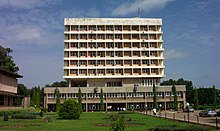
There is great variety in the architecture of Zaria, with buildings made of clay in the Hausa style juxtaposed with modern, multi-storied university and government buildings.[4]
The ward of is located north of the Zaria palace.[citation needed]
Transport and economy[]
Zaria's economy is primarily based on agriculture. Staples are guinea corn and millet. Cash crops include cotton, groundnuts and tobacco.[3] Not only is Zaria a market town for the surrounding area, it is the home of artisans from traditional crafts like leather work, dyeing and cap making, to tinkers, printshops and furniture makers.[7] Zaria is also the center of a textile industry that for over 200 years has made elaborately hand-embroidered robes that are worn by men throughout Nigeria and West Africa.[9]

Because Zaria is north of the rail junction at Kaduna, it has equal rail access to the seaports at Lagos and Port Harcourt. However, only the railway between Lagos and Kano is functional, as the eastern line of Nigeria's rail network is not operational. This means that Zaria currently has rail access to Lagos and Kano to the north but not Port Harcourt.[10][11]
From 1914 to 1927, Zaria was the break-of-gauge junction station for the Bauchi Light Railway to the tin mines at Jos.[citation needed]
Education[]
Zaria is home to Ahmadu Bello University, the largest university in Nigeria and the second largest on the African continent. The institution is very prominent in the fields of Agriculture, Science, Finance, Medicine and Law.[citation needed]
Zaria is also the base for the Nigerian College of Aviation Technology,[12] National Research Institute for Chemical Technology,[13] Barewa College, and a host of other historic secondary schools. The school is known for the large number of elites from the region that passed through its academic buildings and counts among its alumni five who were Nigerian heads of state, including the late president Umaru Musa Yar'Adua. (There are two other famous schools in the adjoining town of Wusasa, where the former Head of the Federal Military Government Yakubu Gowon resides: St. Bartholomew's School and Science School Kufena, formerly known as St. Paul's College.). Also MAISS-GIWA a school established by The Emir of Zazzau Dr. Shehu Idris is situated there. Barewa College (formerly Katsina middle school) and Alhudahuda college are other famous schools. Federal College of Education Zaria is also located there.[citation needed]
Climate[]
Zaria has a tropical savanna climate (Köppen climate classification Aw) with warm weather year-round, a wet season lasting from April to September, and a drier season from October to March.[14]
| hideClimate data for Zaria | |||||||||||||
|---|---|---|---|---|---|---|---|---|---|---|---|---|---|
| Month | Jan | Feb | Mar | Apr | May | Jun | Jul | Aug | Sep | Oct | Nov | Dec | Year |
| Daily mean °C (°F) | 22.7 (72.9) |
24.7 (76.5) |
28.3 (82.9) |
29.8 (85.6) |
28.2 (82.8) |
26.3 (79.3) |
24.7 (76.5) |
24.5 (76.1) |
24.8 (76.6) |
26.0 (78.8) |
24.3 (75.7) |
23.1 (73.6) |
25.6 (78.1) |
| Average precipitation mm (inches) | 0.0 (0.0) |
2.5 (0.10) |
5.1 (0.20) |
44.4 (1.75) |
119.4 (4.70) |
154.9 (6.10) |
221.0 (8.70) |
310.0 (12.20) |
222.3 (8.75) |
35.6 (1.40) |
2.5 (0.10) |
0.0 (0.0) |
1,117.6 (44.00) |
| Average relative humidity (%) (at 07:00 LST) | 36 | 34 | 38 | 60 | 84 | 87 | 91 | 94 | 93 | 86 | 54 | 43 | 69 |
| Source: Deutscher Wetterdienst[15] | |||||||||||||
Environment[]
Air quality[]
A 2019 study of air pollution in Zaria found that pollution concentrations were within the expected national standards for air pollution.[16]
Land use[]
Zaria's geography and previous land use meant that much of the city's historical land cover was barren.[17] A 2020 study found that barren land decreased from 1990 to 2020 while built environment increased 66 percent and vegetative land increased by 29%.[17] Vegetation had been decreasing from 1990 to 2005, but the study area found a dramatic increase due to agriculture and reforestation afterwards.[17] Predictive modeling based on local policy and urban development trends suggested that increase in urban and vegetative land cover would continue through 2050.[17]
Water supply and sanitation[]
Water provided to the city comes from .[18] As of 2012, the city of Zaria had 30% access to clean water supply.[18] The African Development Fund issued funding for an expansion project in 2013 for 100 million dollars of $480 million.[18][19] The project had problems with some of its local contractors, resulting in the African Development Bank banning four companies from further participating in bank funding projects.[20] As of August 2020, 60% of water in the system was unaccounted for because of illegal connections, poor metering practices, and poor maintenance.[20]
Notable births and residents[]
Notable births and current and former residents of Zaria include:
- Shola Ameobi, football player
- Umaru Dikko, minister in the second republic
- Nuhu Bamalli, minister of foreign affairs in the first republic, author, state commissioner, one time chairman of Laventis group of companies and Nigerian Bottling company, Magajin Garin Zazzau. The state polytechnic is named after him.
- Edoheart, musician, poet, dancer
- D'banj, musician/Artist
- Abubakar Imam, author and novelist
- Shehu Ladan, lawyer, philanthropist and former GMD of Nigerian National Petroleum Corporation (NNPC)
- Rilwanu Lukman, engineer and former Secretary General of OPEC
- Rumun Ndur, first Nigerian hockey player in the NHL. Slow skater but hard hitter
- Josephine Obiajulu Odumakin, women's rights activist
- Adewale Olukoju, athlete
- Namadi Sambo, former Vice President of Nigeria
- Masai Ujiri, President of the Toronto Raptors of the NBA and first international winner of the NBA Executive of the Year award
- Mukhtar Ramalan Yero, former Governor of Kaduna State
- Ibrahim Zakzaky, Islamic cleric, founder, Islamic Movement in Nigeria
- Alhaji Abdullahi Abubakar Kowa store, Businessman and the founder of the first store in Zaria.
- Joshua Selman, Apostle Joshua Selman is Nigerian Gospel minister and televangelist. He is the founder and senior pastor of the Eternity Network International – ENI, also called Koinonia, a Gospel fellowship in Samaru, Zaria, Kaduna State, Nigeria
See also[]
Bibliography[]
- Smith, Michael G. (1960) Government in Zazzau 1800–1950 International African Institute by the Oxford University Press, London, OCLC 293592; reprinted in 1964 and 1970.
- Dan Isaacs (28 September 2010). "Nigeria's emirs: Power behind the throne". BBC News. Retrieved 29 September 2010.
References[]
- ^ "Zaria population". World Population Review. Retrieved 13 July 2021.
- ^ "Zaria Population 2021 (Demographics, Maps, Graphs)". worldpopulationreview.com. Retrieved 13 July 2021.
- ^ Jump up to: a b c "The Britannica Encyclopedia". Retrieved 4 February 2007.
- ^ Jump up to: a b c "Zaria | Nigeria". Encyclopædia Britannica. Retrieved 5 November 2016.
- ^ Le Monde, 13 March 2015
- ^ "Mass graves for '300 Shia Nigerians' in Zaria". BBC News. 23 December 2015. Retrieved 5 November 2016.
- ^ Jump up to: a b c d e Gihring, Thomas (1984). "Intraurban Activity Patterns among Entrepreneurs in a West African Setting". Geografiska Annaler. Series B, Human Geography. 66 (1): 19–20. doi:10.2307/490525. JSTOR 490525.
- ^ Jump up to: a b "Welcome to Zaria" Archived 27 October 2009 at the Wayback Machine Biotechnology Society of Nigeria (BSN) at Ahmadu Bello University
- ^ Maiwada, Salihu and Renne, Elisha P. (2007) "New Technologies of Embroidered Robe Production and Changing Gender Roles in Zaria, Nigeria, 1950–2005" Textile History 38(1): pp. 25-58, page 25
- ^ "Can Nigeria's renovated railway unite north and south?". BBC News. 13 February 2013. Retrieved 11 December 2013.
- ^ "Trains in Nigeria: A slow but steady new chug". The Economist. 9 February 2013. Retrieved 4 March 2014.
- ^ "About Us". Nigerian College of Aviation Technology. Archived from the original on April 6, 2010. Retrieved March 27, 2010.
- ^ "National Research Institute for Chemical Technology (NARICT, Nigerian Institute of Transport Technology (NITT), National Research Institute for Chemical Technology): About Us". Archived from the original on July 24, 2011. Retrieved June 27, 2010.
- ^ Hotels.ng. "Ahmadu Bello University | Hotels.ng". Hotels.ng. Retrieved 5 November 2016.
- ^ "Klimatafel von Zaria / Nigeria" (PDF). Baseline climate means (1961-1990) from stations all over the world (in German). Deutscher Wetterdienst. Retrieved 10 August 2016.
- ^ Nimyel, S. H.; Namadi, M. M. (11 September 2019). "Determination of selected air quality parameters in Zaria and its environs, Kaduna State, Nigeria". Journal of Applied Sciences and Environmental Management. 23 (8): 1505–1510. doi:10.4314/jasem.v23i8.14. ISSN 2659-1502.
- ^ Jump up to: a b c d Koko, Auwalu Faisal; Yue, Wu; Abubakar, Ghali Abdullahi; Hamed, Roknisadeh; Alabsi, Akram Ahmed Noman (January 2020). "Monitoring and Predicting Spatio-Temporal Land Use/Land Cover Changes in Zaria City, Nigeria, through an Integrated Cellular Automata and Markov Chain Model (CA-Markov)". Sustainability. 12 (24): 10452. doi:10.3390/su122410452.
- ^ Jump up to: a b c "Nigeria - Zaria Water Supply Expansion and Sanitation Project". projectsportal.afdb.org. Retrieved 6 August 2021.
- ^ "AfDB-Assisted Zaria Water Supply, Expansion and Sanitation Project Launched - Nigeria". ReliefWeb. Retrieved 6 August 2021.
- ^ Jump up to: a b Bungane, Babalwa (21 August 2020). "AfDB bans four companies for fraud in Zaria Water Supply Expansion". ESI-Africa.com. Retrieved 6 August 2021.
External links[]
![]() Media related to Zaria at Wikimedia Commons
Media related to Zaria at Wikimedia Commons
![]() Zaria travel guide from Wikivoyage
Zaria travel guide from Wikivoyage
Coordinates: 11°04′00″N 07°42′00″E / 11.06667°N 7.70000°E

| show Authority control |
|---|
- Zaria
- Local Government Areas in Kaduna State
- Cities in Nigeria
- Populated places established in the 1530s