Kavali
Kavali
Kanakapatnam | |
|---|---|
Town | |
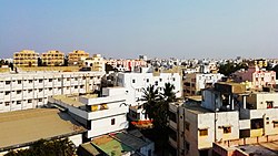 Kavali aerial view | |
 Kavali Location in Andhra Pradesh, India | |
| Coordinates: 14°54′47″N 79°59′35″E / 14.913001°N 79.992921°ECoordinates: 14°54′47″N 79°59′35″E / 14.913001°N 79.992921°E | |
| Country | |
| State | |
| District | Nellore district |
| Government | |
| • Type | Municipal Council |
| • Body | Kavali Municipal Council |
| • Chairman | Vacant |
| • Deputy Chairman | Vacant |
| • MLA | Ramireddy Pratap Kumar Reddy (YSRCP) |
| • MP | Adala Prabhakara Reddy |
| Area | |
| • Total | 22.55 km2 (8.71 sq mi) |
| Elevation | 20 m (70 ft) |
| Population (2011)[1] | |
| • Total | 90,099 |
| • Density | 4,000/km2 (10,000/sq mi) |
| Languages | |
| • Official | Telugu |
| Time zone | UTC+5:30 (IST) |
| PIN | 524201,02,03 |
| Vehicle registration | AP-26 |
| Website | https://cdma.ap.gov.in/en/kavali-municipality |

Kavali is a town[3][4] in Nellore district of Andhra Pradesh of India.Kavali Municipality is Located 14.920 North Longitude & 79.980 East Latitude & 8 KM.[5][6] It is also known as Kanakapatnam, because it is home to many wealthy individuals and due to the prophecy from Potuluri Veerabrahmendra Swami, 'Wealth will flow into this place.' [7][8] It is one of the few cities from Andhra Pradesh which were selected for Atal Mission for Rejuvenation and Urban Transformation (AMRUT) Scheme.[9][10]
Etymology[]
In the local language, Kavali means patrol. The name arises from the fact that in 1515, the king of Udayagiri, Harihara Rayulu stationed his army at this town.
Geography[]
Kavali is located at 14°54′47″N 79°59′35″E / 14.913001°N 79.992921°E. It has an average elevation of 17 metres (56 ft). The town is at a distance of 8 km from the Bay of Bengal.
Education[]
As per the school information report for the academic year 2018–19, the town has a total of 57 schools. These include 34 private, 2 ZPHS and 21 municipal schools.[11]
6 engineering colleges are present in the town, but one engineering college is closed, 5 running, 1 post graduation college which provide various UG and PG courses.
Demographics[]
As of the 2011 Census of India, the town had a population of 150,333. The total population is 75,206 males, 75,127 females and children (in the age group of 0–6 years). The average literacy rate stands at 81.09% with 60,497 literates, significantly higher than the national average of 73.00%.[12]
Climate[]
| hideClimate data for Kavali (1995–2010, extremes 1995–2010) | |||||||||||||
|---|---|---|---|---|---|---|---|---|---|---|---|---|---|
| Month | Jan | Feb | Mar | Apr | May | Jun | Jul | Aug | Sep | Oct | Nov | Dec | Year |
| Record high °C (°F) | 34.5 (94.1) |
38.2 (100.8) |
40.8 (105.4) |
44.2 (111.6) |
47.2 (117.0) |
45.2 (113.4) |
40.2 (104.4) |
39.5 (103.1) |
39.8 (103.6) |
38.2 (100.8) |
35.6 (96.1) |
32.6 (90.7) |
47.2 (117.0) |
| Average high °C (°F) | 29.8 (85.6) |
31.7 (89.1) |
34.1 (93.4) |
36.3 (97.3) |
39.3 (102.7) |
37.8 (100.0) |
35.8 (96.4) |
34.9 (94.8) |
34.6 (94.3) |
32.4 (90.3) |
30.5 (86.9) |
29.4 (84.9) |
33.9 (93.0) |
| Average low °C (°F) | 20.5 (68.9) |
21.8 (71.2) |
23.9 (75.0) |
26.3 (79.3) |
28.4 (83.1) |
28.4 (83.1) |
27.2 (81.0) |
26.6 (79.9) |
26.1 (79.0) |
25.1 (77.2) |
23.2 (73.8) |
21.2 (70.2) |
24.9 (76.8) |
| Record low °C (°F) | 16.4 (61.5) |
18.2 (64.8) |
19.0 (66.2) |
20.4 (68.7) |
21.6 (70.9) |
21.3 (70.3) |
21.3 (70.3) |
22.3 (72.1) |
21.8 (71.2) |
19.5 (67.1) |
18.0 (64.4) |
17.2 (63.0) |
16.4 (61.5) |
| Average rainfall mm (inches) | 25.5 (1.00) |
26.1 (1.03) |
9.7 (0.38) |
12.0 (0.47) |
80.0 (3.15) |
60.8 (2.39) |
78.1 (3.07) |
105.1 (4.14) |
118.7 (4.67) |
359.9 (14.17) |
280.9 (11.06) |
76.2 (3.00) |
1,235 (48.62) |
| Average rainy days | 0.7 | 1.0 | 0.4 | 0.8 | 2.2 | 3.8 | 5.5 | 6.6 | 6.8 | 9.9 | 8.8 | 3.4 | 49.7 |
| Average relative humidity (%) (at 17:30 IST) | 68 | 66 | 67 | 68 | 54 | 48 | 53 | 56 | 63 | 72 | 74 | 72 | 75 |
| Source: India Meteorological Department[13][14] | |||||||||||||
Transport[]

The nearest airport is under construction at Dagadarthi which is 25 km from the town.[15][16] National Highway 16, a part of Golden Quadrilateral highway network, bypasses the town.[17] NNational Highway 167BG which starts at National Highway 167B near Seetharamapuram village in Nellore district ends at kavali.[18] Kavali railway station is located on the Howrah–Chennai main line. It is classified as a B–category station in the Vijayawada railway division of South Central Railway zone.[19] The Andhra Pradesh State Road Transport Corporation operates bus services from Kavali bus station.[20] The nearest planned upcoming sea port is Ramayapatnam port which is at a distance of 20 km from the town.[21][22][23]
References[]
- ^ Jump up to: a b "Statistical Information of ULBs and UDAs" (PDF). Directorate of Town and Country Planning. Government of Andhra Pradesh. 27 February 2019. p. 3. Retrieved 20 May 2019.
- ^ "Elevation for Rajam". Veloroutes. Retrieved 21 August 2014.
- ^ "ALPHABETICAL LIST OF TOWNS AND THEIR POPULATION" (PDF).
- ^ "Cities having population 1 lakh and above, Census 2011" (PDF).
- ^ "Definition of Towns, Urban Agglomerations and Tier Cities in India". GKToday. Retrieved 27 March 2020.
- ^ "Cities and Towns - Arthapedia". arthapedia.in. Retrieved 27 March 2020.
- ^ "Kavali-Kanakapatnam Nellore Dt". Andhrafriends.com. Retrieved 27 March 2020.
- ^ "potuluri - Synonyms of potuluri | Antonyms of potuluri | Definition of potuluri | Example of potuluri | Word Synonyms API | Word Similarity API". wordsimilarity.com. Retrieved 27 March 2020.
- ^ "Amaravati included in AMRUT scheme". The Hindu. Special Correspondent. 24 October 2015. ISSN 0971-751X. Retrieved 27 March 2020.CS1 maint: others (link)
- ^ "Smart Cities Council India | Siddipet, Kavali selected for AMRUT Cities". india.smartcitiescouncil.com. Retrieved 27 March 2020.
- ^ "School Information". Commissionerate of School Education. Government of Andhra Pradesh. Retrieved 7 May 2019.
- ^ "Chapter–3 (Literates and Literacy rate)" (PDF). Registrar General and Census Commissioner of India. Retrieved 20 August 2014.
- ^ "Station: Kavali Climatological Table 1981–2010" (PDF). Climatological Normals 1981–2010. India Meteorological Department. January 2015. pp. 403–404. Archived from the original (PDF) on 5 February 2020. Retrieved 18 February 2020.
- ^ "Extremes of Temperature & Rainfall for Indian Stations (Up to 2012)" (PDF). India Meteorological Department. December 2016. p. M10. Archived from the original (PDF) on 5 February 2020. Retrieved 18 February 2020.
- ^ "Airports Authority of India to develop greenfield airport in Nellore". The New Indian Express. Retrieved 27 March 2020.
- ^ India, The Hans (11 January 2019). "Dagadarthi airport will be ready in 14 months". The Hans Indian. Retrieved 27 March 2020.
- ^ "National Highways Development Project Map". National Highways Authority of India. Archived from the original on 22 April 2017. Retrieved 21 April 2017.
- ^ "New national highways declaration notification" (PDF). The Gazette of India - Ministry of Road Transport and Highways. Retrieved 24 March 2019.
- ^ "Vijayawada Division – a profile" (PDF). Indian Railways. Retrieved 13 February 2013.
- ^ "Bus Stations in Districts". Andhra Pradesh State Road Transport Corporation. Archived from the original on 22 March 2016. Retrieved 9 March 2016.
- ^ "Ramayapatnam port may materialise soon, Andhra government approves establishment proposal". The New Indian Express. Retrieved 27 March 2020.
- ^ "Andhra Pradesh government proposes seaport worth Rs 10k cr at Ramayapatnam". The Economic Times. 25 December 2019. Retrieved 27 March 2020.
- ^ Special Correspondent (13 February 2020). "Parties speak in one voice on Ramayapatnam port project". The Hindu. ISSN 0971-751X. Retrieved 27 March 2020.
| Wikimedia Commons has media related to Kavali. |
| show Authority control |
|---|
- Towns in Nellore district