Kayan River
| Kayan River Sungai Kayan, Sungai Bulungan, Sungai Kajan, Sungai Ulungan, Boetoengan Rivier, Bulungan River, Boeloengan Rivier | |
|---|---|
 Panoramic Kayan River | |
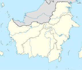 Location of river mouth | |
| Location | |
| Country | Indonesia |
| Physical characteristics | |
| Source | |
| • location | Borneo |
| • elevation | 2,015 metres (6,611 ft) |
| Mouth | |
• location | Sulawesi Sea |
| Length | 576 kilometres (358 mi) |
| Basin size | 36,993.71 km2 (14,283.35 sq mi) |
| Discharge | |
| • average | 2,038 cubic metres per second (72,000 cu ft/s) |


Kayan River is a river of Borneo island, flowing in the North Kalimantan province of Indonesia, about 1600 km northeast of the capital Jakarta.[1][2] Tributaries include the Bahau River.
Hydrology[]
Kayan River rises on Mount Ukeng, passing Tanjung Selor city and discharges into Sulawesi Sea with the total length about 576 km, and the basin size of 36.993,71 km2 forming a wide area at the upstream and narrower in the center until downstream.[3]
Uses[]
Transportation[]
For ages Kayan River is a main transportation route for the inhabitants of Malinau and Bulungan Regency to reach the inland region of Malinau Regency using traditional boats or out of the Bulungan Regency using speed boats, while at the downstream there are some river ports for passengers and goods, such as Port of Kayan and Port of Pesawan.[4]
Fishery and agriculture[]
The people along Kayan River utilize the water for agriculture and fishery, either by traditional fishing or netting, especially in the upstream area, whereas about 30,000 hectare land of the Delta Kayan is used as Food Estate area, for fish ponds and farmlands.[5]
Hydroelectricity[]
Kayan River is used to produce hydroelectricity using some power plants, such as the Diesel-powered one in village of Long Nawang, Kayan Hulu subdistrict.[6] The river can produce around 900 Megwatts (MW).[7] There is also a dam for Hydroelectric Power Plant in the village of Desa Long Peso, Peso subdistrict, Bulungan Regency.[8]
Villages Along Kayan River[]
Antutan[]
Antutan village (Bahasa Indonesia - Desa Antutan) is one of the many villages situated along Kayan River. The population of the village compromises of Dayak sub-tribes: the Kenyah and the Kayan, also the Tidung and the Bulungan. There are several main sources of income in this village, such as paddy plantation, farming, fishing and crafts selling. Majority of the villagers heavily depended on the paddy rice plantation to make a living. However, some are also public servants, for example, teachers, nurses, armies and police.
See also[]
References[]
- ^ Rand McNally, The New International Atlas, 1993.
- ^ Sungai Bulungan (Sungai Kayan) at Geonames.org (cc-by); Last updated 2013-06-04; Database dump downloaded 2015-11-27
- ^ SIPDAS Mahakamberau
- ^ Pelabuhan Pesawan Siap Ramaikan Jalur Perdagangan di Indonesia Timur
- ^ Kemenakertrans Buka Lahan 30.000 Hektar di Kaltim
- ^ PLTD Long Nawang di Malinau Dibantu Mesin Pembangkit Listrik Milik Desa
- ^ Kaltara Fokus Realisasi Bendungan PLTA Kayan 900 MW
- ^ Pemerintah bangun PLTA Kayan di Kaltara
Coordinates: 2°54′41″N 117°33′14″E / 2.91147°N 117.55392°E

- Rivers of North Kalimantan
- Rivers of Indonesia