Kerinci Regency
Kerinci Regency
Kabupaten Kerinci | |
|---|---|
 Coat of arms | |
 | |
| Country | Indonesia |
| Province | Jambi |
| Regency seat | |
| Area | |
| • Total | 3,448.90 km2 (1,331.63 sq mi) |
| Population (2020 Census)[1] | |
| • Total | 250,259 |
| • Density | 73/km2 (190/sq mi) |
| Time zone | UTC+7 (WIB) |
| Website | kerincikab.go.id |
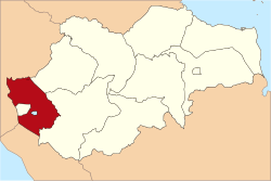
Kerinci is a regency (kabupaten) in Jambi province, on the island of Sumatra, Indonesia. The regency has an area of 3,448.90 km2 (1,331.63 sq mi). Kerinci Regency had a population of 229,495 at the 2010 Census, 234,912 at the 2015 Census and 250,259 at the 2020 Census.[2] The regency seat is at Sungai Penuh (also called Siulak), but this city is now independent and not a part of the regency. Kerinci is located 50 km (31 mi) from Jambi City, the capital of Jambi Province.
Administrative districts[]
At the 2010 Census there were twelve districts (kecamatan), but four more were added in 2013 and another two in 2020. The eighteen districts currently forming the Regency are listed below with their areas and their populations at the 2010 Census and the 2020 Census.[3] The table also includes the locations of the district administrative centres, and the number of villages (rural desa and urban kelurahan) in each district.
| Name | Area in sq.km. |
Population Census 2010 |
Population Census 2020 |
Admin centre |
No. of villages |
|---|---|---|---|---|---|
| Gunung Raya | 389.26 | 13,928 | 8,415 | Lempur Tengah | 12 |
| Bukit Kerman | 213.69 | (a) | 12,369 | Pondok | 15 |
| Batang Meringin | 507.65 | 16,887 | 11,859 | Tamiai | 9 |
| Keliling Danau | 303.76 | 21,969 | 25,454 | Jujun | 18 |
| Danau Kerinci Barat (West Danau Kerinci) |
59.94 | (b) | (b) | Serumpun Pauh | 14 |
| Danau Kerinci | 220.92 | 15,743 | 17,856 | Sanggaran Agung | 13 |
| Tanah Cogok | 14.46 | (b) | (b) | Koto Tuo Ujung Pasir | 12 |
| Sitinjau Laut | 52.24 | 13,943 | 14,611 | Hiang | 14 |
| Air Hangat | 211.35 | 19,456 | 11,474 | Semurup | 16 |
| Air Hangat Timur (East Air Hangat) |
181.43 | 17,459 | 19,556 | Sungai Tutung | 25 |
| Depati VII (Depati Tujuh) |
27.71 | 14,423 | 16,790 | Koto Tuo | 20 |
| Air Hangat Barat (West Air Hangat) |
14.13 | (a) | 9,906 | Koto Cayo | 12 |
| Gunung Kerinci | 344.99 | 11,601 | 12,760 | Siulak Deras | 16 |
| Siulak | 142.78 | 30,742 | 22,884 | Dusun Baru | 26 |
| Siulak Mukai | 275.47 | (a) | 11,139 | Mukai Pintu | 14 |
| Kayu Aro | 114.66 | 39,308 | 19,754 | Tanjung Bungo | 21 |
| Gunung Tujuh | 166.59 | 14,036 | 14,950 | Pelompek | 13 |
| Kayu Aro Barat (West Kyu Aro) |
207.84 | (a) | 20,482 | Bedeng Dua | 17 |
| Total Regency | 3,448.90 | 229,495 | 250,259 | Siulak | 287 |
Note: (a) The 2010 population of these new districts are included with that of the existing districts from which they were cut out in 2013. (a) The 2010 and 2020 populations of these new districts are included with that of the existing districts from which they were cut out in 2020.
Mount Seven Lake[]
Mount Seven Lake is the highest caldera in Southeast Asia 1,950 m (6,400 ft) at above mean sea level, with a lake area of 960 hectares (2,400 acres). The mount is called Mount Seven because there are seven summits. Mount Seven is located in Kerinci Seblat National Park. The lake has a white sandy beach and Mount Seven Waterfall.[4]
See also[]
References[]
- ^ Badan Pusat Statistik, Jakarta, 2021.
- ^ Badan Pusat Statistik, Jakarta, 2021.
- ^ Badan Pusat Statistik, Jakarta, 2021.
- ^ "Danau Gunung Tujuh: Danau Para Dewa yang Menyimpan Pesona Sekaligus Misteri". Archived from the original on November 29, 2014. Retrieved November 22, 2014.
| Authority control |
|
|---|
Coordinates: 2°05′02″S 101°28′48″E / 2.08389°S 101.48000°E

This Jambi location article is a stub. You can help Wikipedia by . |
- Regencies of Jambi
- Sumatra geography stubs