Merangin Regency
Merangin Regency
Kabupaten Merangin | |
|---|---|
 Coat of arms | |
 | |
| Country | Indonesia |
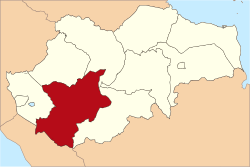
| Province | Jambi |
| Regency seat | Bangko |
| Area | |
| • Total | 7,668.61 km2 (2,960.87 sq mi) |
| Population (2021 Census)[1] | |
| • Total | 357,315 |
| • Density | 47/km2 (120/sq mi) |
| Time zone | UTC+7 (WIB) |
| Website | meranginkab.go.id |
Merangin is a regency (kabupaten) of Jambi Province on the island of Sumatra, Indonesia. The regency covers an area of 7,668.61 km2, and had a population of 333,206 at the 2010 census[2] and 354,052 at the 2020 census, comprising 180,357 male and 173,695 female.[3]
Administrative districts[]
Merangin Regency is divided into twenty-four districts (kecamatan), tabulated below with their areas and their populations at the 2010 census[4] and the 2020 census.[5] The table also includes the locations of the district administrative centres, the number of administrative villages (205 rural desa and 10 urban kelurahan in total) in each district, and its post code.
| District | Area in km2 |
Population 2010 Census |
Population 2020 Census |
Admin centre |
Number of villages |
Post code |
|---|---|---|---|---|---|---|
| Jangkat | 967.23 | 8,932 | 9,420 | Muara Madras | 11 | 37372 |
| Sungai Tenang (Jangkat Timur) |
593.46 | 9,005 | 9,409 | Rantau Suli | 14 | 37374 |
| Muara Siau | 655.06 | 9,327 | 10,063 | Pasar Muara Siau | 17 | 37370 |
| Lembah Masurai | 688.99 | 19,522 | 13,875 | Pasar Masurai | 15 | 37373 |
| Tiang Pumpung | 274.86 | 4,586 | 4,684 | Sekancing | 6 | 37371 |
| Pamenang | 346.54 | 30,362 | 33,476 | Pamenang | 14 | 37352 |
| Pamenang Barat (West Pamenang) |
199.55 | 15,737 | 17,294 | Simpang Limbur Merangin |
8 | 37318 |
| Renah Pamenang | 107.58 | 13,439 | 14,416 | Meranti | 4 | 37351 |
| Pamenang Selatan (South Pamenang) |
167.47 | 9,612 | 10,430 | Tambang Emas | 4 | 37319 |
| Bangko | 168.39 | 45,557 | 48,857 | Pasar Atas Bangko | 8 | 37311 -37314 |
| Bangko Barat (West Bangko) |
196.47 | 10,607 | 10,985 | Pulau Rengas Ulu | 6 | 37315 |
| Nalo Tantan | 206.58 | 11,674 | 16,988 | Lubuk Gaung | 7 | 37317 |
| Batang Masumai | 111.34 | 9,563 | 10,702 | Sungai Ulak | 10 | 37316 |
| Sungai Manau | 295.50 | 9,577 | 10,216 | Sungai Manau | 10 | 37363 |
| Renah Pembarap | 272.86 | 11,623 | 12,987 | Simpang Parit | 12 | 37362 |
| Pangkalan Jambu | 427.05 | 6,142 | 6,409 | Sungai Jering | 8 | 37361 |
| Tabir | 333.33 | 27,602 | 28,594 | Pasar Rantau Panjang | 11 | 37350 |
| Tabir Ulu | 219.64 | 8,411 | 8,144 | Muara Jernih | 6 | 37356 |
| Tabir Selatan (South Tabir) |
196.25 | 26,397 | 29,313 | Rawa Jaya | 8 | 37354 |
| Tabir Ilir | 158.92 | 9,623 | 8,861 | Rantau Limau Manis | 7 | 37358 |
| Tabir Timur (East Tabit) |
108.75 | 7,381 | 7,908 | Sungai Bulian | 4 | 37355 |
| Tabir Lintas | 115.38 | 7,375 | 8,112 | Mensango | 5 | 37357 |
| Margo Tabir | 128.30 | 12,941 | 13,604 | Tanjung Rejo | 6 | 37359 |
| Tabir Barat (West Tabir) |
739.50 | 8,211 | 9,405 | Muara Kibul | 14 | 37353 |
| Totals | 7,679.00 | 333,206 | 354,052 | Bangko | 215 |
However, the last-mentioned eight districts, comprising the northern third of Merangin Regency, are in the process of being separated out to form a new Regency - Kabupaten Tabir Raya; these eight districts cover 2,000.07 km2 and had an estimated combined population of 113,841 at the 2020 census.[6]
Merangin Geopark[]
Merangin Geopark has been proposed to UNESCO to be a World's Heritage Merangin Geopark and UNESCO team has visited Merangin Geopark. The geopark has Araucarioxylon fossil tree complete with the root of 300 million years, the oldest in Asia. Today the ancient Merangin River is usually used for white water sports.[7]
References[]
- ^ Badan Pusat Statistik, Jakarta, 2021.
- ^ Biro Pusat Statistik, Jakarta, 2011.
- ^ Badan Pusat Statistik, Jakarta, 2021.
- ^ Biro Pusat Statistik, Jakarta, 2011.
- ^ Badan Pusat Statistik, Jakarta, 2021.
- ^ Badan Pusat Statistik, Jakarta, 2021.
- ^ Deddy (November 20, 2014). "Warga Jepang Buru Batuan Purba Geopark".
External links[]
Coordinates: 2°12′10″S 102°03′14″E / 2.20278°S 102.05389°E

This Jambi location article is a stub. You can help Wikipedia by . |
- Regencies of Jambi
- Sumatra geography stubs