Kfarhata Zgharta
Kfarhata
كفرحاتا | |
|---|---|
City | |
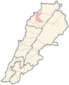
 Kfarhata Location within Lebanon | |
| Coordinates: 34°22′58″N 35°53′51″E / 34.38278°N 35.89750°ECoordinates: 34°22′58″N 35°53′51″E / 34.38278°N 35.89750°E | |
| Country | |
| Governorate | North Governorate |
| District | Zgharta District |
| Elevation | 170 m (560 ft) |
| Time zone | UTC+2 (EET) |
| • Summer (DST) | UTC+3 (EEST) |
| Dialing code | +961 |

Kfarhata ( known also as Kfar Hata, Kafrhata, Arabic: كفرحاتا ) is a village located in the Zgharta District in the North Governorate of Lebanon.[1] It is a mixed Maronite Christian and Sunni Muslim community.[2]
It is home for the El Chemor family, once rulers of Zgharta Zawiyeh in the Ottomans era.
References[]
- ^ Kfar Hata (Zgharta), Localiban
- ^ "Municipal and ikhtiyariah elections in Northern Lebanon" (PDF). The Monthly. March 2010. p. 23. Archived from the original on 3 June 2016. Retrieved 25 October 2016.CS1 maint: bot: original URL status unknown (link)
External links[]
Capital: Zgharta | ||
| Towns and villages |
|  |
| Notable landmarks |
| |
| History | ||
| Notable people |
| |
Categories:
- Zgharta District
- Populated places in the North Governorate
- Sunni Muslim communities in Lebanon
- Maronite Christian communities in Lebanon