Khao Suan Kwang District
Khao Suan Kwang
เขาสวนกวาง | |
|---|---|
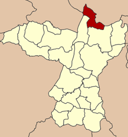 District location in Khon Kaen Province | |
| Coordinates: 16°51′31″N 102°51′42″E / 16.85861°N 102.86167°ECoordinates: 16°51′31″N 102°51′42″E / 16.85861°N 102.86167°E | |
| Country | Thailand |
| Province | Khon Kaen |
| Seat | Kham Muang |
| Area | |
| • Total | 329.9 km2 (127.4 sq mi) |
| Population (2005) | |
| • Total | 37,169 |
| • Density | 122.7/km2 (318/sq mi) |
| Time zone | UTC+7 (ICT) |
| Postal code | 40280 |
| Geocode | 4019 |

Khao Suan Kwang (Thai: เขาสวนกวาง, pronounced [kʰǎw sǔə̯n kwāːŋ]) is a district (amphoe) of Khon Kaen Province, northeastern Thailand.
History[]
The minor district (king amphoe) Khao Suan Kwang was established in 1978 by splitting it from Nam Phong District. It was upgraded to a full district on 16 March 1985.[1][2]
Geography[]
Neighboring districts are (from the south clockwise): Nam Phong and Ubolratana of Khon Kaen Province; Non Sang of Nong Bua Lamphu Province; Nong Wua So, Nong Saeng, and Non Sa-at of Udon Thani Province.
Administration[]
The district is divided into five subdistricts (tambons), which are further subdivided into 56 villages (mubans). Khao Suan Kwang is a township (thesaban tambon) which covers parts of tambons Khao Suan Kwang and Kham Muang. There are a further five tambon administrative organizations (TAO).
| No. | Name | Thai name | Villages | Pop. | |
|---|---|---|---|---|---|
| 1. | Khao Suan Kwang | เขาสวนกวาง | 11 | 8,849 | |
| 2. | Dong Mueang Aem | ดงเมืองแอม | 15 | 8,838 | |
| 3. | Na Ngio | นางิ้ว | 7 | 5,297 | |
| 4. | Non Sombun | โนนสมบูรณ์ | 10 | 5,772 | |
| 5. | Kham Muang | คำม่วง | 13 | 8,413 |
References[]
- ^ "History of Khao Suan Kwang at cddweb.cdd.go.th". Archived from the original on 2007-12-15. Retrieved 2007-01-06.
- ^ พระราชกฤษฎีกาตั้งอำเภอเขาสวนกวาง อำเภอแปลงยาว อำเภอบ่อทอง อำเภอปะคำ และอำเภอบ้านฉาง พ.ศ. ๒๕๒๘ (PDF). Royal Gazette (in Thai). 102 (33 ก special): 7–9. March 15, 1985.
External links[]
- Amphoe of Khon Kaen Province