Khlung district
(Redirected from )
This article does not cite any sources. (July 2017) |
Khlung
ขลุง | |
|---|---|
 Waterfall, Namtok Phlio National Park | |
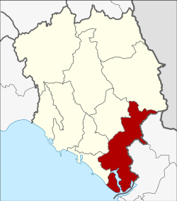 District location in Chanthaburi province | |
| Coordinates: 12°27′17″N 102°13′17″E / 12.45472°N 102.22139°ECoordinates: 12°27′17″N 102°13′17″E / 12.45472°N 102.22139°E | |
| Country | Thailand |
| Province | Chanthaburi |
| Seat | Khlung |
| Area | |
| • Total | 756.038 km2 (291.908 sq mi) |
| Population (2005) | |
| • Total | 55,044 |
| • Density | 72.8/km2 (189/sq mi) |
| Time zone | UTC+7 (ICT) |
| Postal code | 22110 |
| Geocode | 2202 |

Khlung (Thai: ขลุง, pronounced [kʰlǔŋ]) is the southernmost district (amphoe) of Chanthaburi province, eastern Thailand.
Geography[]
Neighboring districts are (from the northwest clockwise) , Mueang Chanthaburi, Makham, Pong Nam Ron of Chanthaburi Province, Bo Rai, Khao Saming, and Laem Ngop of Trat province. To the southeast is the Gulf of Thailand.
Administration[]
The district is divided into 12 sub-districts (tambons), which are further subdivided into 90 villages (mubans). Khlung is a town (thesaban mueang) which covers tambon Khlung. There are a further 11 tambon administrative organizations (TAO).
| No. | Name | Thai name | Villages | Pop. | |
|---|---|---|---|---|---|
| 1. | Khlung | ขลุง | - | 11,259 | |
| 2. | Bo | บ่อ | 10 | 6,715 | |
| 3. | Kwian Hak | เกวียนหัก | 10 | 4,400 | |
| 4. | Tapon | ตะปอน | 6 | 3,274 | |
| 5. | Bang Chan | บางชัน | 6 | 3,735 | |
| 6. | Wan Yao | วันยาว | 8 | 5,346 | |
| 7. | Sueng | ซึ้ง | 11 | 4,830 | |
| 8. | Map Phai | มาบไพ | 6 | 2,350 | |
| 9. | Wang Sappharot | วังสรรพรส | 9 | 2,859 | |
| 10. | Trok Nong | ตรอกนอง | 6 | 2,358 | |
| 11. | Tok Phrom | ตกพรม | 11 | 3,844 | |
| 12. | Bo Wen | บ่อเวฬุ | 7 | 4,074 |
External links[]
This Chanthaburi Province location article is a stub. You can help Wikipedia by . |
Categories:
- Districts of Chanthaburi province
- Eastern Thailand geography stubs