Khwahan, Afghanistan
Khawan
خواهان Khwāhān | |
|---|---|
Town | |
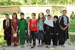 Young Khwahan's girls gather at the medical facility in Khwahan, Badakhshan Province, on 3 June 2012. | |
 Khawan Location of Khwahan in Afghanistan | |
| Coordinates: 37°53′19″N 70°13′10″E / 37.88861°N 70.21944°ECoordinates: 37°53′19″N 70°13′10″E / 37.88861°N 70.21944°E | |
| Country | |
| Province | Badakhshan |
| District | Khwahan |
| Elevation | 3,412 ft (1,040 m) |
| Time zone | +4.30 |
| • Summer (DST) | +4.30 |

Khwahan (Persian: خواهان)/(Tajik: Хоҳон) is a town (and a fort) and the capital of Khwahan District, in Badakhshan Province in north-eastern Afghanistan.[1] It is located on the left bank of the Panj River, sub-regions of Darwaz.[2]


History[]
After Alexander the Great overthrew the Persians, the area came under the rule of [3] the Greco-Bactrian king Euthydemus I and his son Demetrius I[4]
The village has a fort called Qala Khwahan. The fort is made of mud, in the shape of a square with three bastions on each face, with a capacity of 500 to 600 individuals. It is similar to most other forts in the area. For about two miles in each direction is cultivated land.[2]
The village contained roughly 160 houses around the turn of the 20th century.[2]
The inhabitants of this area speak Dari Persian and are Sunni Muslims; and engage in agriculture. They grow Buckwheat, red and white barley, sesame, zucchini, corn, mung beans, peas, beans, potatoes.
Geography[]
The area is mountainous with Kuh-e Kallat a prominent mountain in the district. This peak is 4090 meters high above sea level. The town sits on the Panj River and is one of very few Afghan towns with Tajikistan to its south. Road access is to Kulob, Tadjikistan.
References[]
- ^ "NGA GeoName Database". National Geospatial Intelligence Agency. Archived from the original on 2008-05-22. Retrieved 2008-05-27.
- ^ Jump up to: a b c Adamec, Ludwig W., ed. (1972). Historical and Political Gazetteer of Afghanistan. 1. Graz, Austria: Akadamische Druck-u. Verlangsanstalt. pp. 107–108.
- ^ Shane Wallace Greek Culture in Afghanistan and India: Old Evidence and New Discoveries p.206
- ^ Osmund Bopearachchi, Some Observations on the Chronology of the Early Kushans, p.48
External links[]

| show Authority control |
|---|
This Badakhshan Province, Afghanistan location article is a stub. You can help Wikipedia by . |
- Populated places in Khwahan District
- Badakhshan Province geography stubs