Kimjongsuk County
Kim Jong-suk County
김정숙군 | |
|---|---|
| Korean transcription(s) | |
| • Chosŏn'gŭl | 김정숙군 |
| • Hanja | 金貞淑郡 |
| • McCune-Reischauer | Kimjŏngsuk-kun |
| • Revised Romanization | Gimjeongsuk-gun |
 Map of Ryanggang showing the location of Kimjongsuk | |
| Country | North Korea |
| Province | Ryanggang |
| Administrative divisions | 1 ŭp, 2 workers' districts, 22 ri |
| Area | |
| • Total | 1,228 km2 (474 sq mi) |
| Population (2008[1]) | |
| • Total | 42,618 |
| • Density | 35/km2 (90/sq mi) |

Kimjŏngsuk County is a kun, or county, in Ryanggang province, North Korea, along the Yalu River. Originally part of Samsu, the county was made a separate entity in 1952. Formerly known as Sinpa, it was named in 1981 after Kim Jong-suk, the mother of Kim Jong-il.
The Sinpa Revolutionary Site there is associated with Kim Jong-suk's underground political activities there during the anti-Japanese struggle.[2]
Geography[]
Kimjŏngsuk lies in the northern portion of the Kaema Plateau, and slopes downward toward the north. The flows through the county, which is traversed by the and . The highest point is itself, 2185 m. Some 92% of the county's area is forestland. The chief rivers are the Yalu and the Changjin. The climate varies, with extremely cold temperatures prevailing in the south, and 3-3.5 ℃ warmer temperatures along the Yalu in the north.
Administrative divisions[]
Kimjŏngsuk county is divided into 1 ŭp (town), 2 rodongjagu (workers' districts) and 22 ri (villages):
|
|
Economy[]
The chief local industry is logging; there is little agriculture, except for some rice cultivation along the Yalu. A certain amount of wheat, maize, soybeans, and potatoes are also produced. There are local deposits of molybdenum, gold, copper, silver, lead, zinc and tungsten. Honeybees and other livestock are also raised. Hydropower is abundant. Food processing dominates local manufacturing.
Transportation[]
The county is served by both road and rail, with the Pukbunaeryuk Line of the Korean State Railway passing through the county.
See also[]
References[]
- ^ North Korea: Administrative Division
- ^ "Sinpha Revolutionary Site". KCNA. 10 October 2014. Archived from the original on 13 October 2014.
External links[]
- (in Korean) In Korean language online encyclopedias:
| Capital | 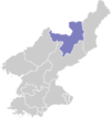 | |
|---|---|---|
| Cities | ||
| Counties | ||
Coordinates: 41°24′28.8″N 127°45′54″E / 41.408000°N 127.76500°E

- Counties of Ryanggang