Pungso County
Pungsŏ County
풍서군 | |
|---|---|
| Korean transcription(s) | |
| • Chosŏn'gŭl | 풍서군 |
| • Hancha | 豊西郡 |
| • McCune-Reischauer | P'ungsŏ-gun |
| • Revised Romanization | Pungseo-gun |
 Map of Ryanggang showing the location of Pungso | |
| Country | North Korea |
| Province | Ryanggang |
| Administrative divisions | 1 ŭp, 3 workers' districts, 17 ri |
| Area | |
| • Total | 1,812 km2 (700 sq mi) |
| Population (2008 census) | |
| • Total | 44,112 |
| • Density | 24/km2 (63/sq mi) |
P'ungsŏ County is a kun, or county, in Ryanggang province, North Korea. It was formed after the division of Korea from portions of Kimhyŏnggwŏn (then P'ungsan) and Kapsan counties.
Geography[]
Lying atop the southern portion of the Kaema Plateau, P'ungsŏ is heavily mountainous. In general, the mountains are higher in the northwest and lower toward the southeast. They include the ; the highest point is itself. The chief rivers are the and the (능귀강). , an artificial reservoir, lies in the middle of the county. Some 91% of P'ungsŏ's area is covered with forestland.
Administrative divisions[]
P'ungsŏ county is divided into 1 ŭp (town), 3 rodongjagu (workers' districts) and 17 ri (villages):
|
|
Economy[]
Logging is the chief industry in P'ungsŏ. There is little agriculture, due to the rugged terrain. However, some amounts of maize, potatoes, and wheat are produced on dry-field farms; livestock are also raised. The county is known for the production of bracken fern. The county is home to deposits of gold, lead and zinc.
Transportation[]
The county is served by road, but not by rail. The Nŭnggwi River and P'ungsŏ Lake are used to transport raw lumber downstream.
See also[]
References[]
External links[]
- (in Korean) In Korean language online encyclopedias:
| Capital | 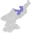 | |
|---|---|---|
| Cities | ||
| Counties | ||
- Counties of Ryanggang