King Island Council
| King Island Council Tasmania | |||||||||||||||
|---|---|---|---|---|---|---|---|---|---|---|---|---|---|---|---|
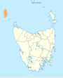
 Map showing the King Island local government area. | |||||||||||||||
| Coordinates | 39°51′49″S 143°59′06″E / 39.8637°S 143.9851°ECoordinates: 39°51′49″S 143°59′06″E / 39.8637°S 143.9851°E | ||||||||||||||
| Population | 1,601 (2018)[1] | ||||||||||||||
| • Density | 1.4608/km2 (3.7834/sq mi) | ||||||||||||||
| Established | 1 January 1907[2] | ||||||||||||||
| Area | 1,096 km2 (423.2 sq mi)[1] | ||||||||||||||
| Mayor | |||||||||||||||
| Council seat | Currie | ||||||||||||||
| Region | King Island | ||||||||||||||
| State electorate(s) | Braddon | ||||||||||||||
| Federal division(s) | Braddon | ||||||||||||||
| Website | King Island Council | ||||||||||||||
| |||||||||||||||

King Island Council is a local government body in Tasmania, encompassing King Island and the adjacent minor islands within Bass Strait, in the north-west of the state. The King Island local government area is classified as rural and has a population of 1,601,[1] with Currie as the main town and administrative centre.
History and attributes[]
The King Island municipality was established on 1 January 1907[2] King Island is classified as rural, agricultural and small (RAS) under the Australian Classification of Local Governments.[3]
Localities[]
- Bungaree
- Currie
- Egg Lagoon
- Grassy
- Loorana
- Lymwood
- Naracoopa
- Nugara
- Pearshape
- Pegarah
- Reekara
- Sea Elephant
- Surprise Bay
- Wickham
- Yambacoona
- Yarra Creek
See also[]
- List of local government areas of Tasmania
References[]
- ^ a b c "3218.0 – Regional Population Growth, Australia, 2017-18: Population Estimates by Local Government Area (ASGS 2018), 2017 to 2018". Australian Bureau of Statistics. Australian Bureau of Statistics. 27 March 2019. Retrieved 25 October 2019. Estimated resident population, 30 June 2018.
- ^ a b "Agency Details: King Island Municipal Council". search.archives.tas.gov.au. Tasmanian Government. Retrieved 11 June 2018.
- ^ "Local government national report 2014-2015". regional.gov.au. Australian Government. Retrieved 8 June 2018.
External links[]
Categories:
- Local government areas of Tasmania
- King Island (Tasmania)