Kirkstall railway station
Kirkstall | |
|---|---|
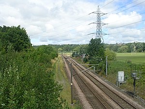 Last location of the station north of Kirkstall Bridge (2011) | |
| Location | Kirkstall, City of Leeds England |
| Coordinates | 53°48′54″N 1°36′26″W / 53.8151°N 1.6073°WCoordinates: 53°48′54″N 1°36′26″W / 53.8151°N 1.6073°W |
| Grid reference | SE258356 |
| Platforms | 2 |
| Other information | |
| Status | Disused |
| History | |
| Original company | Leeds and Bradford Railway |
| Pre-grouping | Midland Railway |
| Post-grouping | London, Midland and Scottish Railway |
| Key dates | |
| 1846 | Opened |
| 1906 | Relocated |
| 22 March 1965 | Closed |

Kirkstall was a railway station in Kirkstall, City of Leeds, West Yorkshire. It was located between Kirkstall Forge and Armley Canal Road on the right bank of the River Aire.
History[]

Original location of the station south of Kirkstall Bridge
The station was opened by the Midland Railway in 1860 and closed in March 1965 as part of the Beeching cuts.[1] Originally located south of Kirkstall Bridge next to today's Wyther Lane,[2] it had been moved north of it by 1906.[3] It was demolished after closure and no trace now remains.
| Preceding station | Historical railways | Following station | ||
|---|---|---|---|---|
| Newlay and Horsforth | Midland Railway Leeds and Bradford Railway |
Armley Canal Road | ||
References[]
- ^ John Whitaker. "List of West Yorkshire passenger stations". Lost Railways West Yorkshire. Retrieved 14 March 2018.
- ^ Yorkshire 202 (includes: Aireborough; Horsforth; Pudsey.) (Map). OS Six-inch England and Wales, 1842-1952. Ordnance Survey. 1851. Retrieved 14 March 2018.
- ^ Yorkshire CCII.SE (includes: Horsforth; Leeds.) (Map). OS Six-inch England and Wales, 1842-1952. Ordnance Survey. 1909. Retrieved 14 March 2018.
This article on a railway station in Yorkshire and the Humber is a stub. You can help Wikipedia by . |
Categories:
- Disused railway stations in Leeds
- Railway stations in Great Britain opened in 1846
- Railway stations in Great Britain closed in 1965
- Beeching closures in England
- Former Midland Railway stations
- 1847 establishments in England
- Yorkshire and the Humber railway station stubs