Kodori (river)
| Kodori | |
|---|---|
 | |
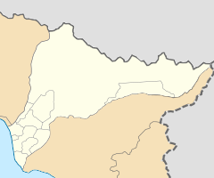
 Kodori river (in red) on the map of Georgia. | |
 | |
| Location | |
| Country | Georgia/Abkhazia[1] |
| Physical characteristics | |
| Source | Kelasuri First / Kelasuri Second |
| • location | Main Caucasian Range Caucasus Major |
| • elevation | 1,380 m (4,530 ft) |
| Mouth | Georgia/Abkhazia[1] |
• location | Black Sea |
• coordinates | 42°49′14″N 41°07′55″E / 42.82056°N 41.13194°ECoordinates: 42°49′14″N 41°07′55″E / 42.82056°N 41.13194°E |
• elevation | 0 ft (0 m) |
| Length | 105 km (65 mi) |
| Basin size | 2,051 square kilometres (792 sq mi) |
| Discharge | |
| • average | 144 m3/s (5,100 cu ft/s) |


The Kodori (Georgian: კოდორი; Abkhazian: Кәыдры, romanized: Kwydry) is one of the two largest rivers of Abkhazia,[1] along with the Bzyb. It is formed by the joining of the rivers Sakeni and . The Kodori is first among Abkhazia's rivers with respect to average annual discharge at 144 cubic metres per second (5,100 cu ft/s) and drainage basin area at 2,051 square kilometres (792 sq mi). It is second after the Bzyb with respect to length at 105 kilometres (65 mi) when combined with the Sakeni.[2]
See also[]
- Kodori Valley for the valley through which the Kodori flows.
References[]
| Wikimedia Commons has media related to Kodori River. |
- ^ a b c Abkhazia is the subject of a territorial dispute between the Republic of Abkhazia and Georgia. The Republic of Abkhazia unilaterally declared independence on 23 July 1992, but Georgia continues to claim it as part of its own sovereign territory and designates it as a territory occupied by Russia. Abkhazia has received formal recognition as an independent state from 7 out of 193 United Nations member states, 1 of which has subsequently withdrawn its recognition.
- ^ Dbar, Roman (1999). "Geography & The Environment". In George Hewitt (ed.). The Abkhazians - a handbook. Caucasus World; Peoples of the Caucasus & the Black Sea. Richmond, Surrey: Curzon. ISBN 0-7007-0643-7.
This Abkhazia location article is a stub. You can help Wikipedia by . |
Categories:
- Caucasus
- Rivers of Abkhazia
- Rivers of Georgia (country)
- Tributaries of the Black Sea
- Asia river stubs
- Europe river stubs
- Georgia (country) geography stubs
- Abkhazia stubs