Kodyma (river)
| Kodyma, Кодима | |
|---|---|
 | |
| Location | |
| Country | Ukraine |
| Physical characteristics | |
| Source | |
| • elevation | 165 m (541 ft) |
| Mouth | Southern Buh |
• coordinates | 48°00′25″N 30°48′33″E / 48.0070°N 30.8093°ECoordinates: 48°00′25″N 30°48′33″E / 48.0070°N 30.8093°E |
| Length | 149 km (93 mi) |
| Basin size | 2,470 km2 (950 sq mi) |
| Basin features | |
| Progression | Southern Bug→ Dnieper–Bug estuary→ Black Sea |

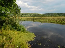
Kodyma (Ukrainian: Кодима) is a right tributary of the Southern Buh river of Ukraine. Originating from springs in a boggy valley near the village of Budei (uk:Будеї), Kodymsky Raion, Odessa Oblast, it flows within the Odessa Oblast and Mykolaiv Oblast and joins Southern Buh about 199 km away from its mouth, near Pervomaisk, Mykolaiv Oblast.
Settlements by the river include Balta town, Holma village (uk:Гольма), ("Bobrik the First", uk:Бобрик Перший), and Kryve Ozero urban-type settlement ("Crooked Lake").
Notes and references[]
| Authority control |
|
|---|
Categories:
- Tributaries of the Southern Bug
- Rivers of Odessa Oblast
- Ottoman Empire–Polish–Lithuanian Commonwealth border
- Ukraine river stubs