Konkyan Township
Konkyan | |
|---|---|
Township | |
 Location in Laukkaing district (Kokang SAZ) | |
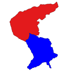
 Konkyan Location in Burma | |
| Coordinates: 23°49′00″N 98°32′00″E / 23.81667°N 98.53333°ECoordinates: 23°49′00″N 98°32′00″E / 23.81667°N 98.53333°E | |
| Country | |
| State | Shan State |
| Self-administered zone | Kokang |
| Elevation | 1,593 m (5,226 ft) |
| Time zone | UTC+6.30 (MST) |

Konkyan Township or Kongyan Township (Burmese: ကုန်းကြမ်းမြို့နယ်) is a township located within Laukkaing District, Shan State, Myanmar. It is also part of the Kokang Self-Administered Zone. The capital town is Konkyan.
Geography[]
It is sharing a border with Laukkaing Township. It is situated at 1,593 metres (5,226 ft) above sea level. The remaining area is mainly mountainous.[2]
Rubber, lychee, mango, walnut and pear are grown in this area as poppy substitutes. Sugarcane, pineapple, corn, buckwheat, soybean and various vegetables are also grown.
Further reading[]
- Topo Map of Kokang Self-Administered Zone - Mimu
- Shan (North) State, Myanmar - Mimu
- Konkyan Township - Shan State - Mimu
References[]
- ^ GoogleEarth
- ^ MG Archived 2011-10-02 at the Wayback Machine
This Shan State location article is a stub. You can help Wikipedia by . |


Categories:
- Townships of Shan State
- Shan State geography stubs