Kornicker Glacier
| Kornicker Glacier | |
|---|---|
 Location of Sentinel Range in Western Antarctica | |
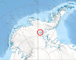
 Location of Kornicker Glacier in Antarctica | |
| Type | tributary |
| Location | Ellsworth Land |
| Coordinates |  78°43′00″S 84°35′00″W / 78.71667°S 84.58333°W / -78.71667; -84.58333 78°43′00″S 84°35′00″W / 78.71667°S 84.58333°W / -78.71667; -84.58333 |
| Thickness | unknown |
| Terminus | Thomas Glacier |
| Status | unknown |

Kornicker Glacier ( WikiMiniAtlas78°43′S 84°35′W / 78.717°S 84.583°W / -78.717; -84.583) is a glacier draining northeastwards from the cirque bounded by Mount Liptak, Mount Southwick, Mount Milton and Mount Mullen in the southern Sentinel Range of the Ellsworth Mountains in Antarctica. The glacier flows along the northwestern side of Petvar Heights and merges with the terminus of the southeast-flowing Thomas Glacier as both glaciers emerge from the range.
Kornicker Glacier was named by the Advisory Committee on Antarctic Names (2006) after , a research zoologist at the Department of Invertebrate Zoology (Crustacea), National Museum of Natural History, Smithsonian Institution, 1964–2006, and a member of the Board of Associated Editors, Antarctic Research Series, American Geophysical Union, 1978–90.[1]
Contents
See also[]
- List of glaciers in the Antarctic
- Glaciology
Maps[]
- Vinson Massif. Scale 1:250 000 topographic map. Reston, Virginia: US Geological Survey, 1988.
- Antarctic Digital Database (ADD). Scale 1:250000 topographic map of Antarctica. Scientific Committee on Antarctic Research (SCAR). Since 1993, regularly updated.
References[]
- ^ "Kornicker Glacier". Geographic Names Information System. United States Geological Survey. Retrieved 2013-05-14.
 This article incorporates public domain material from the United States Geological Survey document: "Kornicker Glacier". (content from the Geographic Names Information System)
External links[]
Glaciers | |||||||
|---|---|---|---|---|---|---|---|
| Types |
| ||||||
| Anatomy |
| ||||||
| Processes |
| ||||||
| Measurements |
| ||||||
| Volcanic relations | |||||||
| Landforms |
| ||||||
| |||||||
Glaciers in the Antarctic | |
|---|---|
|
Glaciers of Ellsworth Land | |
|---|---|
|
This article about a glacier in Ellsworth Land is a stub. You can help Wikipedia by . |
- v
- t
- Glaciers of Ellsworth Land
- Ellsworth Land glacier stubs
- Coordinates on Wikidata
- Wikipedia articles incorporating text from the USGS Geographic Names Information System
- All stub articles