Korokoro, New Zealand
Korokoro | |
|---|---|
Suburb of Lower Hutt City | |
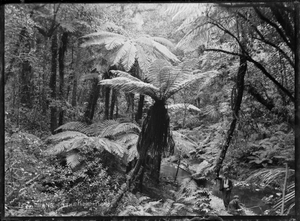 Native bush with tree ferns, a stream, and two men in right foreground, at Korokoro | |
 | |
| Country | New Zealand |
| City | Lower Hutt City |
| Electoral ward | Harbour |
| Established | 1900s |
| Area | |
| • Land | 185 ha (457 acres) |
| Population (2020[1]) | |
| • Total | 1,600 |
| Maungaraki | ||
|
|
Alicetown, Ava | |
| Horokiwi | Petone |

Korokoro, a suburb of Lower Hutt City, lies in the south of the North Island of New Zealand. The suburb occupies part of the western hills of the Hutt Valley; its eastern slopes overlook Petone and the Wellington harbour.
Korokoro was established in the 1900s by the Liberal government (in office 1891-1912), and remained a relatively small settlement until the Lower Hutt City Council developed the area for private housing in the 1960s.[2][failed verification]. Before 1989, Korokoro formed part of the Petone Borough,[3] which amalgamated with Lower Hutt City in that year.[4]
Korokoro has a full primary school established in 1904 called Korokoro School with over 180 pupils attend. The school has eight classrooms and is decile 10.[5]
Demographics[]
Korokoro statistical area covers 1.85 km2 (0.71 sq mi).[6] It had an estimated population of 1,590 as of June 2021,[7] with a population density of 859 people per km2.
| Year | Pop. | ±% p.a. |
|---|---|---|
| 2006 | 1,284 | — |
| 2013 | 1,329 | +0.49% |
| 2018 | 1,482 | +2.20% |
| Source: [8] | ||
Korokoro had a population of 1,482 at the 2018 New Zealand census, an increase of 153 people (11.5%) since the 2013 census, and an increase of 198 people (15.4%) since the 2006 census. There were 540 households. There were 744 males and 741 females, giving a sex ratio of 1.0 males per female. The median age was 37.9 years (compared with 37.4 years nationally), with 315 people (21.3%) aged under 15 years, 225 (15.2%) aged 15 to 29, 795 (53.6%) aged 30 to 64, and 147 (9.9%) aged 65 or older.
Ethnicities were 85.6% European/Pākehā, 10.9% Māori, 2.0% Pacific peoples, 10.9% Asian, and 3.0% other ethnicities (totals add to more than 100% since people could identify with multiple ethnicities).
The proportion of people born overseas was 24.3%, compared with 27.1% nationally.
Although some people objected to giving their religion, 58.5% had no religion, 30.2% were Christian, 1.2% were Hindu, 0.4% were Muslim, 0.6% were Buddhist and 2.0% had other religions.
Of those at least 15 years old, 501 (42.9%) people had a bachelor or higher degree, and 87 (7.5%) people had no formal qualifications. The median income was $52,700, compared with $31,800 nationally. The employment status of those at least 15 was that 729 (62.5%) people were employed full-time, 150 (12.9%) were part-time, and 45 (3.9%) were unemployed.[8]
Education[]
Korokoro School is a co-educational state primary school for Year 1 to 8 students,[9][10] with a roll of 214 as of November 2021.[11]
References[]
- ^ "Subnational population estimates". NZ.Stat. Statistics New Zealand. Retrieved 9 March 2021.
- ^ Te Ara: Encyclopaedia of New Zealand - Hutt Valley - central and west Retrieved: 24 January 2009
- ^ "The Petone Chronicle". May 2014. Retrieved 10 May 2018.
- ^
"Our history". Hutt City: Te Awa Kairangi. Hutt City Council. Lower Hutt City. 29 September 2017. Retrieved 10 May 2018.
1989 Amalgamation of Lower Hutt, Petone, Wainuiomata and Eastbourne into Lower Hutt City
- ^ Korokoro school website Retrieved: 6 April 2012
- ^ "ArcGIS Web Application". statsnz.maps.arcgis.com. Retrieved 7 June 2021.
- ^ "Population estimate tables - NZ.Stat". Statistics New Zealand. Retrieved 22 October 2021.
- ^ a b "Statistical area 1 dataset for 2018 Census". Statistics New Zealand. March 2020. Korokoro (243300). 2018 Census place summary: Korokoro
- ^ "Korokoro School Official School Website". korokoro.school.nz.
- ^ "Korokoro School Education Review Office Report". ero.govt.nz. Education Review Office.
- ^ "Korokoro School Ministry of Education School Profile". educationcounts.govt.nz. Ministry of Education.

- Suburbs of Lower Hutt