Korunye, South Australia
| Korunye South Australia | |||||||||||||||
|---|---|---|---|---|---|---|---|---|---|---|---|---|---|---|---|
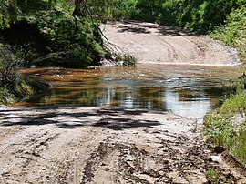 Ford through the River Light on Wasley Road, Korunye | |||||||||||||||
 Korunye | |||||||||||||||
| Coordinates | 34°30′45″S 138°30′37″E / 34.512380°S 138.510220°ECoordinates: 34°30′45″S 138°30′37″E / 34.512380°S 138.510220°E | ||||||||||||||
| Postcode(s) | 5502 | ||||||||||||||
| LGA(s) | Adelaide Plains Council | ||||||||||||||
| Region | Light | ||||||||||||||
| County | Gawler | ||||||||||||||
| State electorate(s) | Goyder | ||||||||||||||
| Federal division(s) | Grey | ||||||||||||||
| |||||||||||||||

Korunye is a locality in South Australia beside the Adelaide-Crystal Brook rail line between Two Wells and Mallala.[1][2] The name derived is from that of the historic railway siding, Korunye Railway Station, within the locality.[1] South Australian historian Geoffrey Manning states that Korunye is from an indigenous word meaning "rainbow".[3]
References[]
- ^ a b "Search for 'Korunye, LOCB'". Government of South Australia. SA0037718. Retrieved 16 June 2017.[permanent dead link]
- ^ "2905.0 - Statistical Geography: Volume 2 -- Census Geographic Areas, Australia, 2006". Australian Bureau of Statistics. Retrieved 8 December 2009.
- ^ "Place Names: Korunye". Manning Index of South Australian History. State Library of South Australia. Retrieved 16 June 2017.
Aboriginal for 'rainbow'. Its earlier name was 'Paddy's Station'.
This South Australia geography article is a stub. You can help Wikipedia by . |
Categories:
- Towns in South Australia
- South Australia geography stubs