Kranichfeld
Kranichfeld | |
|---|---|
 Coat of arms | |
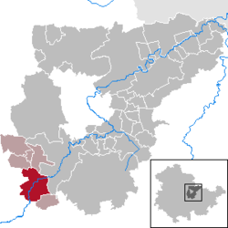
show Location of Kranichfeld within Weimarer Land district | |
 Kranichfeld | |
| Coordinates: 50°51′0″N 11°12′0″E / 50.85000°N 11.20000°ECoordinates: 50°51′0″N 11°12′0″E / 50.85000°N 11.20000°E | |
| Country | Germany |
| State | Thuringia |
| District | Weimarer Land |
| Municipal assoc. | Kranichfeld |
| Subdivisions | 3 |
| Government | |
| • Mayor (2016–22) | Enno Dörnfeld[1] (CDU) |
| Area | |
| • Total | 23.08 km2 (8.91 sq mi) |
| Elevation | 301 m (988 ft) |
| Population (2020-12-31)[2] | |
| • Total | 3,340 |
| • Density | 140/km2 (370/sq mi) |
| Time zone | UTC+01:00 (CET) |
| • Summer (DST) | UTC+02:00 (CEST) |
| Postal codes | 99446–99448 |
| Dialling codes | 036450 |
| Vehicle registration | AP |
| Website | www.kranichfeld.de |


Kranichfeld is a town in the Weimarer Land district, in Thuringia. It is situated on the river Ilm, 18 km southeast of Erfurt, and 16 km southwest of Weimar.
History[]
Within the German Empire (1871-1918), Kranichfeld was part of the Grand Duchy of Saxe-Weimar-Eisenach.
References[]
- ^ Gewählte Bürgermeister - aktuelle Landesübersicht, Freistaat Thüringen, accessed 14 July 2021.
- ^ "Bevölkerung der Gemeinden, erfüllenden Gemeinden und Verwaltungsgemeinschaften in Thüringen Gebietsstand: 31.12.2020". Thüringer Landesamt für Statistik (in German). June 2021.
| show Towns and municipalities in Weimarer Land |
|---|
| show Authority control |
|---|
This Weimarer Land location article is a stub. You can help Wikipedia by . |
Categories:
- Towns in Thuringia
- Weimarer Land
- Grand Duchy of Saxe-Weimar-Eisenach
- Bezirk Erfurt
- Weimarer Land geography stubs