Schmiedehausen
Schmiedehausen | |
|---|---|
 Coat of arms | |
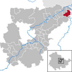
show Location of Schmiedehausen within Weimarer Land district | |
 Schmiedehausen | |
| Coordinates: 51°4′7″N 11°39′52″E / 51.06861°N 11.66444°ECoordinates: 51°4′7″N 11°39′52″E / 51.06861°N 11.66444°E | |
| Country | Germany |
| State | Thuringia |
| District | Weimarer Land |
| Municipal assoc. | Bad Sulza |
| Government | |
| • Mayor (2016–22) | Bernd Otterstein[1] |
| Area | |
| • Total | 10.37 km2 (4.00 sq mi) |
| Elevation | 225 m (738 ft) |
| Population (2020-12-31)[2] | |
| • Total | 363 |
| • Density | 35/km2 (91/sq mi) |
| Time zone | UTC+01:00 (CET) |
| • Summer (DST) | UTC+02:00 (CEST) |
| Postal codes | 99518 |
| Dialling codes | 036421 |
| Vehicle registration | AP |
| Website | www.bad-sulza.de |


Schmiedehausen is a municipality in the Weimarer Land district of Thuringia, Germany. Schmiedehausen is located in the extreme northeastern corner of the Saale-Ilm-limestone slab and is easily accessible by road via Camburg and Bad Sulza. The district of the town is developed for agricultural purposes. The wooded hills of the Ilm valley start at Bergsulza.
References[]
- ^ Gewählte Bürgermeister - aktuelle Landesübersicht, Freistaat Thüringen, accessed 13 July 2021.
- ^ "Bevölkerung der Gemeinden, erfüllenden Gemeinden und Verwaltungsgemeinschaften in Thüringen Gebietsstand: 31.12.2020". Thüringer Landesamt für Statistik (in German). June 2021.
| show Towns and municipalities in Weimarer Land |
|---|
| Authority control |
|---|
This Weimarer Land location article is a stub. You can help Wikipedia by . |
Categories:
- Municipalities in Thuringia
- Weimarer Land
- Duchy of Saxe-Meiningen
- Bezirk Erfurt
- Weimarer Land geography stubs