Kreuzau
Kreuzau | |
|---|---|
 Coat of arms | |
show Location of Kreuzau within Düren district | |
 Kreuzau | |
| Coordinates: 50°45′00″N 06°28′59″E / 50.75000°N 6.48306°ECoordinates: 50°45′00″N 06°28′59″E / 50.75000°N 6.48306°E | |
| Country | Germany |
| State | North Rhine-Westphalia |
| Admin. region | Köln |
| District | Düren |
| Government | |
| • Mayor (2020–25) | Ingo Eßer[1] (CDU) |
| Area | |
| • Total | 41.77 km2 (16.13 sq mi) |
| Highest elevation | 360 m (1,180 ft) |
| Lowest elevation | 142 m (466 ft) |
| Population (2020-12-31)[2] | |
| • Total | 17,422 |
| • Density | 420/km2 (1,100/sq mi) |
| Time zone | UTC+01:00 (CET) |
| • Summer (DST) | UTC+02:00 (CEST) |
| Postal codes | 52372 |
| Dialling codes | 02422, 02427, 02421 |
| Vehicle registration | DN |
| Website | www.kreuzau.de |
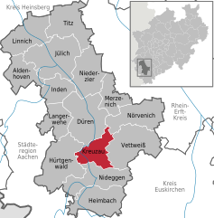


Kreuzau is a municipality in the district of Düren in the state of North Rhine-Westphalia, Germany. It is located on the river Rur, approx. 5 km south of Düren.
Geography[]
Neighbouring communities[]
Kreuzau is surrounded by the following settlements, listed clockwise beginning in the north: the county town of Düren and the municipalities of Nörvenich, Vettweiß, Nideggen and Hürtgenwald, all in the county of Düren.
Municipal subdivisions[]
The municipality Kreuzau includes the following civil parishes (Ortsteil):
- Drove
- Kreuzau (incl. ) with 5,150 inhabitants on 31 October 2015
- (incl. )
- (incl. )
- (incl. and )
In addition there was the now extinct village of .
Twin towns[]
Kreuzau is twinned with:
 Obervellach, Austria
 Plancoët, France
References[]
- ^ Wahlergebnisse in NRW Kommunalwahlen 2020, Land Nordrhein-Westfalen, accessed 19 June 2021.
- ^ "Bevölkerung der Gemeinden Nordrhein-Westfalens am 31. Dezember 2020" (in German). Landesbetrieb Information und Technik NRW. Retrieved 21 June 2021.
| Wikimedia Commons has media related to Kreuzau. |
| show Towns and municipalities in Düren (district) |
|---|
| show Authority control |
|---|
This Düren district location article is a stub. You can help Wikipedia by . |
Categories:
- Municipalities in North Rhine-Westphalia
- Düren (district)
- Cologne region geography stubs