Kriváň (village)
Kriváň | |
|---|---|
Municipality | |
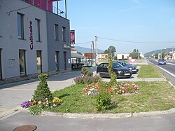 View on the village center | |
 Kriváň Location of Kriváň in the Banská Bystrica Region | |
| Coordinates: 48°31′50″N 19°26′50″E / 48.53056°N 19.44722°ECoordinates: 48°31′50″N 19°26′50″E / 48.53056°N 19.44722°E | |
| Country | |
| Region | Banská Bystrica |
| District | Detva |
| Government | |
| • Mayor | Imrich Paľko |
| Area | |
| • Total | 9.109773 km2 (3.517303 sq mi) |
| Elevation | 395 m (1,296 ft) |
| Population (31 December 2010) | |
| • Total | 1,889 |
| • Density | 210/km2 (540/sq mi) |
| Time zone | UTC+1 (CET) |
| • Summer (DST) | UTC+2 (CEST) |
| Postal code | 962 04 |
| Area code(s) | 421-45 |
| Car plate | DT |
| Website | www |


Kriváň is a village and municipality in Detva District, in the Banská Bystrica Region of central Slovakia.[1] It lies on the road track I/50, approximately in the halfway between Bratislava and Košice. The village had been established in 1955.
References[]
- ^ Ústredný portál verejnej správy Slovenskej republiky. "Obec Kriváň". Ministry of Finance of the Slovak Republic. Retrieved 2012-08-20.
External links[]
 Media related to Kriváň (village) at Wikimedia Commons
- Official website

- https://web.archive.org/web/20150610204905/http://krivan.e-obce.sk/
| hide Municipalities of Detva District | ||
|---|---|---|
This Banská Bystrica Region geography article is a stub. You can help Wikipedia by . |
Categories:
- Villages and municipalities in Detva District
- Banská Bystrica Region geography stubs