Kuboes
Kuboes | |
|---|---|
 Old mission church in Kuboes | |
 Kuboes | |
| Coordinates: 28°26′49.2″S 16°59′20.76″E / 28.447000°S 16.9891000°ECoordinates: 28°26′49.2″S 16°59′20.76″E / 28.447000°S 16.9891000°E | |
| Country | South Africa |
| Province | Northern Cape |
| District | Namakwa |
| Municipality | Richtersveld |
| Area | |
| • Total | 0.88 km2 (0.34 sq mi) |
| Population (2011)[1] | |
| • Total | 948 |
| • Density | 1,100/km2 (2,800/sq mi) |
| Racial makeup (2011) | |
| • Black African | 0.6% |
| • Coloured | 95.5% |
| • Indian/Asian | 0.2% |
| • Other | 3.7% |
| First languages (2011) | |
| • Afrikaans | 96.5% |
| • English | 1.3% |
| • Other | 2.2% |
| Time zone | UTC+2 (SAST) |
| PO box | 8292 |
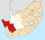
Kuboes is a town in Richtersveld Local Municipality in the Northern Cape province of South Africa.
Kuboes was one of the first permanent settlements on the Richtersveld. The town grew around a Rhenish mission set up by revered Johan Hein, who began to preach to the nomadic population of the surrounding areas in 1844. A church was built in 1893, and eventually the itinerant population decided to set up in Kuboes itself.[2]
Kuboes is a centre of Nama culture, and the local school is claimed to be the only school in the world that teaches the Nama language.[2]
References[]
Categories:
- Northern Cape geography stubs
- Populated places in the Richtersveld Local Municipality


