Kwun Tong Road
This article needs additional citations for verification. (September 2014) |
Kwun Tong Road (Chinese: 觀塘道) is a major thoroughfare in Kwun Tong District, New Kowloon, Hong Kong.
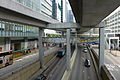
 Kwun Tong Road near Kai Yip Estate | |||
| Native name | 觀塘道 (Chinese) | ||
|---|---|---|---|
| Part of | Route 7 | ||
| Location | New Kowloon, Hong Kong | ||
| From | Clear Water Bay Road, Prince Edward Road East, Lung Cheung Road | ||
| Major junctions | Ngau Tau Kok Road, Hip Wo Street, Hoi Yuen Road, Wai Yip Street, Hong Ning Road | ||
| To | Lei Yue Mun Road, Tsui Ping Road | ||
Location[]
Kwun Tong Road starts at the junction with Prince Edward Road East, Clear Water Bay Road and Lung Cheung Road in Ngau Chi Wan. It runs along the coast of Kwun Tong before reclamation, spans south in Ngau Tau Kok and Kwun Tong, and ends at a junction with , where it is succeeded by Lei Yue Mun Road. Kwun Tong Road is a section of Route 7.
Kwun Tong Road runs through the areas around Kwun Tong Bypass, Kai Yip Estate, the ex-premise of St. Joseph's Anglo-Chinese School, Kowloon Bay station, Lower Ngau Tau Kok Estate, , Ngau Tau Kok station, Millennium City, apm Millennium City 5 shopping mall, the roundabout with and Hoi Yuen Road beneath Kwun Tong station of MTR, and Bus Terminus.
History[]
When Kwun Tong station was being built in 1979, a road tunnel known as the Kwun Tong Road Underpass was dug beneath the station to give a bypass for traffic. Having traffic on the main route diverted into the tunnel, the roundabout functions efficiently. Nevertheless, as road transport in the region becomes saturated, the roundabout still occasionally has traffic congestions.
Features[]
Remaining buildings of the former RAF Kai Tak are located along Kwun Tong Road. With 6 lanes on either side, it is the widest road in urban Hong Kong second widest road in the entire region, only surpassed by Cheung Tsing Highway. A section of Kwun Tong line is elevated along Kwun Tong Road.
Gallery[]

Kwun Tong Road as of 1945 with Lion Rock in the background

Kwun Tong Road near Kowloon Bay
Kwun Tong Road near apm


References[]
| Wikimedia Commons has media related to Kwun Tong Road. |
| Preceded by |
Hong Kong Route 7 Kwun Tong Road |
Succeeded by Lung Cheung Road |
| Kowloon City | |
|---|---|
| Kwun Tong | |
| Sham Shui Po | |
| Wong Tai Sin | |
| Yau Tsim Mong | |
| |
Coordinates: 22°19′18.7″N 114°12′52.2″E / 22.321861°N 114.214500°E

This Hong Kong road article is a stub. You can help Wikipedia by . |
This New Kowloon location article is a stub. You can help Wikipedia by . |
- Kwun Tong
- Roads in Hong Kong
- Route 7 (Hong Kong)
- Hong Kong road stubs
- New Kowloon geography stubs