La Côte-de-Beaupré Regional County Municipality
La Côte-de-Beaupré | |
|---|---|
 | |
| Coordinates: 47°03′N 70°54′W / 47.050°N 70.900°WCoordinates: 47°03′N 70°54′W / 47.050°N 70.900°W[1] | |
| Country | |
| Province | |
| Region | Capitale-Nationale |
| Effective | January 1, 1982 |
| County seat | Château-Richer |
| Government | |
| • Type | Prefecture |
| • Prefect | Pierre Lefrançois |
| Area | |
| • Total | 5,027.80 km2 (1,941.24 sq mi) |
| • Land | 4,865.97 km2 (1,878.76 sq mi) |
| Population (2016)[3] | |
| • Total | 28,199 |
| • Density | 5.8/km2 (15/sq mi) |
| • Change 2011-2016 | |
| • Dwellings | 14,244 |
| Time zone | UTC−5 (EST) |
| • Summer (DST) | UTC−4 (EDT) |
| Area code(s) | 418 and 581 |
| Website | www.mrc cotedebeaupre.com |
| [4] | |

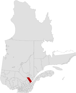
La Côte-de-Beaupré is a regional county municipality in the Capitale-Nationale region of Quebec, Canada. The seat is Château-Richer. Its most populous community is the municipality of Boischatel.
Subdivisions[]
There are 11 subdivisions within the RCM:[2]
|
|
|
|
Transportation[]
Access Routes[]
Highways and numbered routes that run through the municipality, including external routes that start or finish at the county border:[5]
|
|
|
See also[]
References[]
- ^ Reference number 141100 of the Commission de toponymie du Québec (in French)
- ^ Jump up to: a b c Geographic code 210 in the official Répertoire des municipalités (in French)
- ^ Jump up to: a b "Census Profile, 2016 Census: La Côte-de-Beaupré, Municipalité régionale de comté [Census division], Quebec". Statistics Canada. Retrieved December 10, 2019.
- ^ "(Code 2421) Census Profile". 2011 census. Statistics Canada. 2012.
- ^ Official Transport Quebec Road Map
- La Côte-de-Beaupré Regional County Municipality Statistics Canada
| show Adjacent Counties & Equivalent Territories |
|---|
| show Authority control |
|---|
This Quebec location article is a stub. You can help Wikipedia by . |
Categories:
- La Côte-de-Beaupré Regional County Municipality
- Quebec geography stubs