Pont-Rouge
Pont-Rouge | |
|---|---|
City | |
 | |
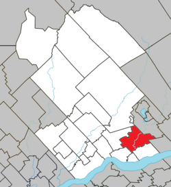 Location within Portneuf RCM. | |
 Pont-Rouge Location in central Quebec. | |
| Coordinates: 46°45′N 71°42′W / 46.750°N 71.700°WCoordinates: 46°45′N 71°42′W / 46.750°N 71.700°W[1] | |
| Country | |
| Province | |
| Region | Capitale-Nationale |
| RCM | Portneuf |
| Constituted | January 3, 1996 |
| Government | |
| • Mayor | Ghislain Langlais |
| • Federal riding | Portneuf—Jacques-Cartier |
| • Prov. riding | Portneuf |
| Area | |
| • Total | 123.40 km2 (47.65 sq mi) |
| • Land | 121.23 km2 (46.81 sq mi) |
| Population (2011)[3] | |
| • Total | 8,723 |
| • Density | 72.0/km2 (186/sq mi) |
| • Pop 2006-2011 | |
| • Dwellings | 3,617 |
| Time zone | UTC−5 (EST) |
| • Summer (DST) | UTC−4 (EDT) |
| Postal code(s) | G3H |
| Area code(s) | 418 and 581 |
| Highways | |
| Website | www.ville. pontrouge.qc.ca |

Pont-Rouge is a city along the Jacques-Cartier River in southern Quebec, Canada. In the Canada 2011 Census the population was 8,723 inhabitants.[4]
History[]
The first efforts to colonise the area came around 1769.
On April 15, 1867, the archbishop of Quebec, Charles-François Baillargeon, founded the parish of Sainte-Jeanne-de-Neuville from portions of Cap-Santé, Saint-Basile, and Neuville. After the separation of the parish in two in 1911 (the village of Pont-Rouge and the parish of Sainte-Jeanne-de-Pont-Rouge), the new City of Pont-Rouge was established when these two municipalities merged on January 3, 1996.
Transportation had considerable influence on the development of the parish, mainly the two bridges and the construction of the Canadian Pacific Railway bridge in 1874. The Royal Bridge (now called Pont Déry), was reconstructed several times because of the weakness of the centre of the bridge. This bridge served its purpose for the transportation of heavy loads and mail between Quebec and Montreal. The bridge was a toll bridge, and the money served the construction of a second bridge le pont Rouge, which was free. It united the western part to the eastern part of Dupont Street, named in honour of Father Charles-François Dupont, who was priest there from 1917 to 1933. A newer bridge has now replaced this bridge as of 2009.
Demographics[]

Population trend:[5]
- Population in 2016: 9240
- Population in 2011: 8723 (2006 to 2011 population change: 16.0%)
- Population in 2006: 7518
- Population in 2001: 7146
- Population in 1996:
- Sainte-Jeanne-de-Pont-Rouge (municipality): 2145
- Pont-Rouge (village): 4676
- Population in 1991:
- Sainte-Jeanne-de-Pont-Rouge (municipality): 1966
- Pont-Rouge (village): 4133
Private dwellings occupied by usual residents: 3471 (total dwellings: 3617)
Mother tongue:
- English as first language: 0.7%
- French as first language: 98.2%
- English and French as first language: 0%
- Other as first language: 1.1%
Administration[]
| Period | Name | |
|---|---|---|
| 2013 | Ghislain Langlais | |
| 2005 | 2013 | Claude Bégin |
| 1996 | 2005 | Paul-Eugène Parent |
| 1973 | 1996 | Marcel Bédard |
| 1967 | 1973 | Albert Picher |
| 1965 | 1967 | Louis Piché |
| 1964 | 1965 | Léopold Bussières |
| 1961 | 1964 | Clément Vaugeois |
| 1941 | 1961 | Joseph-Alfred Leclerc |
| 1929 | 1941 | Edward Hamel |
| 1925 | 1929 | Joseph Arthus Bussières |
| 1921 | 1925 | Edward Hamel |
| 1919 | 1921 | Arthur Galarneau |
| 1917 | 1919 | Thomas Savary |
| 1916 | 1917 | Louis-Georges Bussières |
| 1915 | 1916 | Napoleon Larue |
| 1911 | 1915 | Arthur Galarneau |
References[]
- ^ Reference number 313056 of the Commission de toponymie du Québec (in French)
- ^ Jump up to: a b Geographic code 34017 in the official Répertoire des municipalités (in French)
- ^ Jump up to: a b Statistics Canada (February 10, 2011). "2011 Community profiles - Pont-Rouge". Retrieved 2011-02-15.
- ^ "Census subdivision of Pont-Rouge, V (Quebec) - Census Subdivisions - Focus on Geography Series - Census 2011". 2012-02-08.
- ^ Statistics Canada: 1996, 2001, 2006, 2011census
External links[]
| Wikimedia Commons has media related to Pont-Rouge. |
| show Adjacent Municipal Subdivisions |
|---|
| hide | |
|---|---|
| Cities & towns | |
| Municipalities | |
| Parishes | |
| Unorganized territories | |
| |
| show Authority control |
|---|
- Cities and towns in Quebec
- Incorporated places in Capitale-Nationale