La Glacerie
La Glacerie | |
|---|---|
Part of Cherbourg-en-Cotentin | |
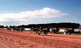 The racecourse | |
show Location of La Glacerie | |
 La Glacerie | |
| Coordinates: 49°36′39″N 1°36′03″W / 49.6108°N 1.6008°WCoordinates: 49°36′39″N 1°36′03″W / 49.6108°N 1.6008°W | |
| Country | France |
| Region | Normandy |
| Department | Manche |
| Arrondissement | Cherbourg |
| Canton | Cherbourg-Octeville-2 |
| Commune | Cherbourg-en-Cotentin |
| Area 1 | 18.7 km2 (7.2 sq mi) |
| Population (2017)[1] | 6,142 |
| • Density | 330/km2 (850/sq mi) |
| Time zone | UTC+01:00 (CET) |
| • Summer (DST) | UTC+02:00 (CEST) |
| Postal code | 50470 |
| Elevation | 5–178 m (16–584 ft) (avg. 110 m or 360 ft) |
| 1 French Land Register data, which excludes lakes, ponds, glaciers > 1 km2 (0.386 sq mi or 247 acres) and river estuaries. | |


La Glacerie (French pronunciation: [la ɡlas(ə)ʁi]) is a former commune in the Manche department in north-western France. On 1 January 2016, it was merged into the new commune of Cherbourg-en-Cotentin.[2]
Heraldry[]
 |
The arms of La Glacerie are blazoned : Azure, a chevron argent charged near the point with a rose gules, between 2 plates fimbriated Or (mirrors) and a belltower argent issuant from a barrulet gules, in chief a fleur de lys Or.
|
See also[]
- Communes of the Manche department
References[]
- ^ Téléchargement du fichier d'ensemble des populations légales en 2017, INSEE
- ^ Arrêté préfectoral 1 December 2015 (in French)
| Wikimedia Commons has media related to La Glacerie. |
This Manche geographical article is a stub. You can help Wikipedia by . |
Categories:
- Former communes of Manche
- Manche geography stubs