La Rédemption, Quebec
La Rédemption | |
|---|---|
Parish municipality | |
 | |
 Location within La Mitis RCM | |
 La Rédemption Location in eastern Quebec | |
| Coordinates: 48°27′N 67°53′W / 48.45°N 67.88°WCoordinates: 48°27′N 67°53′W / 48.45°N 67.88°W[1] | |
| Country | |
| Province | |
| Region | Bas-Saint-Laurent |
| RCM | La Mitis |
| Constituted | January 1, 1956 |
| Government | |
| • Mayor | Isabelle Dupont |
| • Federal riding | Haute-Gaspésie—La Mitis—Matane—Matapédia |
| • Prov. riding | Matane-Matapédia |
| Area | |
| • Total | 117.50 km2 (45.37 sq mi) |
| • Land | 117.66 km2 (45.43 sq mi) |
| There is an apparent contradiction between two authoritative sources | |
| Population | |
| • Total | 488 |
| • Density | 4.1/km2 (11/sq mi) |
| • Pop 2006-2011 | |
| • Dwellings | 220 |
| Time zone | UTC−5 (EST) |
| • Summer (DST) | UTC−4 (EDT) |
| Postal code(s) | G0J 1P0 |
| Area code(s) | 418 and 581 |
| Highways | No major routes |
| Website | www.municipalite. laredemption.qc.ca |

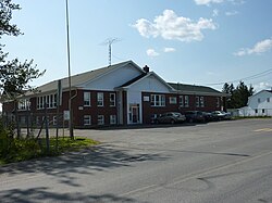
La Rédemption is a parish municipality in Quebec, Canada.
See also[]
References[]
- ^ Reference number 34319 of the Commission de toponymie du Québec (in French)
- ^ Jump up to: a b Geographic code 09005 in the official Répertoire des municipalités (in French)
- ^ Jump up to: a b "(Code 2409005) Census Profile". 2011 census. Statistics Canada. 2012.
External links[]
 Media related to La Rédemption at Wikimedia Commons
| show Adjacent Municipal Subdivisions |
|---|
| hide | |
|---|---|
| Cities & Towns | |
| Municipalities | |
| Parishes |
|
| Villages | |
| Unorganized territories | |
| |
| Authority control |
|
|---|
This Bas-Saint-Laurent location article is a stub. You can help Wikipedia by . |
Categories:
- Parish municipalities in Quebec
- Incorporated places in Bas-Saint-Laurent
- Bas-Saint-Laurent geography stubs