La Ronde-Haye
La Ronde-Haye | |
|---|---|
Part of Saint-Sauveur-Villages | |
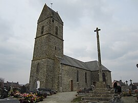 The church of Notre-Dame | |
show Location of La Ronde-Haye | |
 La Ronde-Haye | |
| Coordinates: 49°07′38″N 1°26′24″W / 49.1272°N 1.44°WCoordinates: 49°07′38″N 1°26′24″W / 49.1272°N 1.44°W | |
| Country | France |
| Region | Normandy |
| Department | Manche |
| Arrondissement | Coutances |
| Canton | Agon-Coutainville |
| Commune | Saint-Sauveur-Villages |
| Area 1 | 6.67 km2 (2.58 sq mi) |
| Population (2017)[1] | 353 |
| • Density | 53/km2 (140/sq mi) |
| Time zone | UTC+01:00 (CET) |
| • Summer (DST) | UTC+02:00 (CEST) |
| Postal code | 50490 |
| Elevation | 33–93 m (108–305 ft) (avg. 58 m or 190 ft) |
| 1 French Land Register data, which excludes lakes, ponds, glaciers > 1 km2 (0.386 sq mi or 247 acres) and river estuaries. | |


La Ronde-Haye is a former commune in the Manche department in Normandy in north-western France. On 1 January 2019, it was merged into the new commune Saint-Sauveur-Villages.[2]
See also[]
- Communes of the Manche department
References[]
- ^ Téléchargement du fichier d'ensemble des populations légales en 2017, INSEE
- ^ Arrêté préfectoral 26 December 2018 (in French)
| Wikimedia Commons has media related to La Ronde-Haye. |
This Manche geographical article is a stub. You can help Wikipedia by . |
Categories:
- Former communes of Manche
- Manche geography stubs