La Torre
This article does not cite any sources. (October 2012) |
La Torre | |
|---|---|
 Winter panorama from the north | |
| Nickname(s): La Torre del Valle de Amblés | |
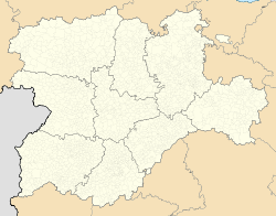
 Extension of the municipal term within the province of Ávila | |
 La Torre Location in Spain. | |
| Coordinates: 40°35′21″N 4°57′55″W / 40.58917°N 4.96528°WCoordinates: 40°35′21″N 4°57′55″W / 40.58917°N 4.96528°W | |
| Country | |
| Autonomous community | |
| Province | |
| Government | |
| • Mayor | Bernardino Angel Jiménez Galán, PP |
| Area | |
| • Total | 58 km2 (22 sq mi) |
| Elevation | 1,130 m (3,710 ft) |
| Population (2018)[1] | |
| • Total | 239 |
| • Density | 4.1/km2 (11/sq mi) |
| Time zone | UTC+1 (CET) |
| • Summer (DST) | UTC+2 (CEST) |
| Website | Official website |

La Torre is a municipality composed of the following districts, Balbarda, Blacha, Guareña, Oco and Sanchicorto located in the province of Ávila, Castile and León, Spain. According to the 2004 census (INE), the municipality has a population of 357 inhabitants.
References[]
- ^ Municipal Register of Spain 2018. National Statistics Institute.
This article about a location in the province of Ávila, Spain, is a stub. You can help Wikipedia by . |
Categories:
- Municipalities in the Province of Ávila
- Province of Ávila geography stubs