Peñalba de Ávila
This article needs additional citations for verification. (June 2014) |
Peñalba de Ávila | |
|---|---|
 View of Peñalba de Ávila from the north | |
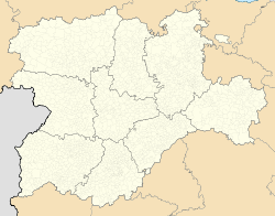 Peñalba de Ávila Location in Spain. | |
| Coordinates: 40°46′19″N 4°44′46″W / 40.77194°N 4.74611°W | |
| Country | |
| Autonomous community | |
| Province | |
| Municipality | Peñalba de Ávila |
| Area | |
| • Total | 23 km2 (9 sq mi) |
| Population (2018)[1] | |
| • Total | 113 |
| • Density | 4.9/km2 (13/sq mi) |
| Time zone | UTC+1 (CET) |
| • Summer (DST) | UTC+2 (CEST) |
| Website | Official website |


Peñalba de Ávila is a municipality located in the province of Ávila, Castile and León, Spain. According to the 2010 census (INE), the municipality has a population of 123 inhabitants.
Peñalba de Ávila is 17 kilometers away from Madrid. It comprises 23 kilometers of surface area and its altitude is 1073 meters above sea level.[2]
Population[]
The population of Peñalba de Ávila has shown a steady decline since 1900. The largest population in the municipality was in 1910 when the population was 354 inhabitants.[2]
The population as of 2010 was 123 people: 71 men and 52 women.[2]
Cityscape[]
The streets and buildings of Peñalba de Ávila.

A street of Peñalba de Ávila
References[]
- ^ Municipal Register of Spain 2018. National Statistics Institute.
- ^ a b c "Ayuntamiento de Peñalba de Ávila - Datos de Población". Ayuntamiento de Peñalba de Ávila. Peñalba de Ávila. Retrieved 25 June 2014.
This article about a location in the province of Ávila, Spain, is a stub. You can help Wikipedia by . |
Categories:
- Municipalities in the Province of Ávila
- Province of Ávila geography stubs