Lady Evelyn-Smoothwater Provincial Park
| Lady Evelyn-Smoothwater Provincial Park | |
|---|---|
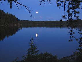 Moon over Florence Lake | |
 | |
| Location | Ontario, Canada |
| Nearest city | Temagami, Ontario |
| Coordinates | 47°14′N 80°16′W / 47.233°N 80.267°WCoordinates: 47°14′N 80°16′W / 47.233°N 80.267°W |
| Area | 724.00 km2 (279.54 sq mi) |
| Established | 1983 |
| Governing body | Ontario Parks |

Lady Evelyn-Smoothwater Provincial Park is a remote wilderness park in northeastern Ontario, Canada, near Lake Temagami. It is one of five provincial parks located in the Temagami area.[1]
This park encompasses Smoothwater Lake, , the Ishpatina Ridge (highest point in Ontario), Maple Mountain (highest vertical rise in Ontario), and most of the Lady Evelyn River. The park also includes many waterfalls, such as Helen Falls, the highest waterfall on the Lady Evelyn River.
Lady Evelyn-Smoothwater lies within the Eastern forest-boreal transition ecoregion.[2] It offers protection to some of the last remaining stands of old growth forest in Ontario, and is home to the endangered Aurora trout.[1]
As a wilderness park, few services are offered to visitors but it is ideal for backcountry canoeing, nature exploration, and wildlife viewing. The park hosts fire towers on top of Ishpatina Ridge and Maple Mountain, accessible by foot trails.[1]
History[]
Lady Evelyn River was established as a park in 1973. In 1983, the park was expanded to its present area of 72,000 hectares.[1]
The region has been home to the Teme-Augama Anishnabai for thousands of years; within the park, Maple Mountain (Chee-bay-jing) is traditional sacred site.
Throughout the park are remnants of logging activities from the early and mid-1900s.
See also[]
- List of Ontario parks
References[]
- ^ Jump up to: a b c d "Temagami Area Park Management Plan for Lady Evelyn-Smoothwater, Makobe-Grays River, Obabika River, Solace and Sturgeon River Provincial Parks". Government of Ontario. October 22, 2019. Retrieved February 20, 2021.
- ^ Olson, D. M, E. Dinerstein; et al. (2001). "Terrestrial Ecoregions of the World: A New Map of Life on Earth". BioScience. 51 (11): 933–938. doi:10.1641/0006-3568(2001)051[0933:TEOTWA]2.0.CO;2.CS1 maint: multiple names: authors list (link)
External links[]

This Ontario location article is a stub. You can help Wikipedia by . |
This Canadian protected area related article is a stub. You can help Wikipedia by . |
- IUCN Category Ib
- Provincial parks in Ontario
- Parks in Nipissing District
- Protected areas established in 1983
- 1983 establishments in Ontario
- Geography of Temagami
- Ontario geography stubs
- Canadian protected area stubs