Lagonegro
Lagonegro | |
|---|---|
| Comune di Lagonegro | |
 Coat of arms | |
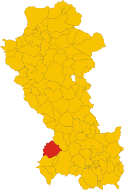 Lagonegro within the Province of Potenza | |
show Location of Lagonegro | |
 Lagonegro Location of Lagonegro in Italy | |
| Coordinates: 40°8′N 15°46′E / 40.133°N 15.767°ECoordinates: 40°8′N 15°46′E / 40.133°N 15.767°E | |
| Country | Italy |
| Region | Basilicata |
| Province | Potenza (PZ) |
| Frazioni | Casale Serino, Cervaro, Farno, Fecìla, Fortino, Malpignata, Pennarone, Strette |
| Government | |
| • Mayor | Maria Rita Cocciufa (commissar§) |
| Area | |
| • Total | 113.07 km2 (43.66 sq mi) |
| Elevation | 666 m (2,185 ft) |
| Population (31 December 2017)[3] | |
| • Total | 5,442 |
| • Density | 48/km2 (120/sq mi) |
| Demonym(s) | Lagonegresi |
| Time zone | UTC+1 (CET) |
| • Summer (DST) | UTC+2 (CEST) |
| Postal code | 85042 |
| Dialing code | 0973 |
| Patron saint | St. Nicholas of Bari |
| Saint day | 6 December |
| Website | Official website |


Lagonegro (Lucano: Launìvere) is a town and comune in the province of Potenza, in the Southern Italian region of Basilicata. It is part of the and has (2017) a population of 5,471.[3]
Geography[]
The municipality, located southwest of its province, near the borders of Basilicata with Cilento, a subregion of Campania, is bordered by the municipalities of Casalbuono, Casaletto Spartano, Lauria, Moliterno, Montesano sulla Marcellana, Nemoli, Rivello and Tortorella.[4] It counts the hamlets (frazioni) of Casale Serino, Cervaro, Farno, Fecìla, Fortino, Malpignata, Pennarone and Strette.
Transport[]
The town is served by two exits ("Lagonegro Nord" and "Lagonegro Sud") of the A2 motorway, linking Naples and Salerno to Cosenza, Lamezia and Reggio Calabria. is the terminus of 2 abandoned lines using two different gauges: the standard gauge line , and the narrow gauge line .[citation needed]
People[]
- Tiziana Alagia (b. 1973), long distance runner
- Giuseppe Mango (1954-2014), singer
See also[]
References[]
- ^ "Superficie di Comuni Province e Regioni italiane al 9 ottobre 2011". Istat. Retrieved 16 March 2019.
- ^ "Popolazione Residente al 1° Gennaio 2018". Istat. Retrieved 16 March 2019.
- ^ Jump up to: a b (in Italian) Source: Istat 2017
- ^ 40289 Lagonegro on OpenStreetMap
External links[]
| Wikimedia Commons has media related to Lagonegro. |
| show Authority control |
|---|
This Basilicata location article is a stub. You can help Wikipedia by . |
- Cities and towns in Basilicata
- Municipalities of the Province of Potenza
- Lagonegro
- Basilicata geography stubs