Lake Kilpisjärvi
| Lake Kilpisjärvi | |
|---|---|
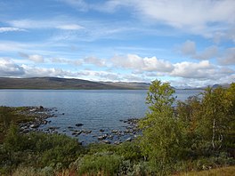 Kilpisjärvi seen from the Finnish side | |
 Lake Kilpisjärvi | |
| Location | Enontekiö, Finland / Kiruna, Sweden |
| Coordinates | 69°01′N 020°49′E / 69.017°N 20.817°ECoordinates: 69°01′N 020°49′E / 69.017°N 20.817°E |
| Primary outflows | Könkämäeno |
| Basin countries | Finland, Sweden |
| Surface area | 37.33 km2 (14.41 sq mi)[1] |
| Average depth | 19.5 m (64 ft)[2] |
| Max. depth | 57 m (187 ft)[2] |
| Water volume | 0.73 km3 (0.18 cu mi)[2] |
| Surface elevation | 472.8 m (1,551 ft)[1] |
| Frozen | 223 days[3] |
| Settlements | Kilpisjärvi |
| References | [1][2][3] |

Kilpisjärvi is a medium-sized lake located at the north-western tip of Finland and northernmost Sweden. Treriksröset, the point where the borders of Finland, Sweden and Norway join is located some 2.5 kilometres (1.6 mi) northwest from the lake.
The lake is divided into two parts, Kilpisjärvi (Northern Sami: Bajit Gilbbesjávri) and Alajärvi (Vuolit Gilbbesjávri).
Being located on the Scandinavian Mountains, the lake is surrounded by numerous fells, most notably Saana. The northern location and high elevation cause the lake to be frozen most of the year.[citation needed]
References[]
- ^ Jump up to: a b c Kilpisjärvi–Alajärvi in Järviwiki Web Service. Finnish Environment Institute. Retrieved 2014-03-21. (in English)
- ^ Jump up to: a b c d sv:Kilpisjärvi (sjö)
- ^ Jump up to: a b Suomen vesistöjen jääolot.pdf (in Finnish)
External links[]
![]() Media related to Lake Kilpisjärvi at Wikimedia Commons
Media related to Lake Kilpisjärvi at Wikimedia Commons
| Authority control |
|
|---|
This Lapland (Finland) location article is a stub. You can help Wikipedia by . |
This article about a location in Norrbotten County, Sweden is a stub. You can help Wikipedia by . |
- Torne river basin
- Lakes of Norrbotten County
- Finland–Sweden border
- International lakes of Europe
- Landforms of Lapland (Finland)
- Lakes of Enontekiö
- Lapland (Finland) geography stubs
- Norrbotten County geography stubs