Lake Petén Itzá
| Lake Petén Itza | |
|---|---|
 Lake view from the Northeastern shore | |
 Lake Petén Itza | |
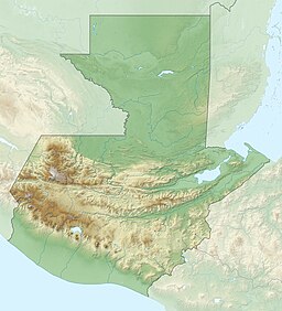
| Coordinates | 16°59′0″N 89°48′0″W / 16.98333°N 89.80000°WCoordinates: 16°59′0″N 89°48′0″W / 16.98333°N 89.80000°W |
| Primary inflows | , |
| Primary outflows | (subterranean) |
| Basin countries | Guatemala |
| Surface area | 99 km2 (38 sq mi)[1] |
| Max. depth | 160 m (520 ft) |
| Surface elevation | 110 m (360 ft) |
| Sections/sub-basins | Main north basin, shallow south basin |
| References | [1] |

Lake Petén Itzá (Lago Petén Itzá, Spanish pronunciation: [ˈlaɣo peˈten iˈtsa]) is a lake in the northern Petén Department in Guatemala. It is the third largest lake in Guatemala, after Lake Izabal and Lake Atitlán. It is located around 16°59′0″N 89°48′0″W / 16.98333°N 89.80000°W. It has an area of 99 km2 (38 sq mi), and is some 32 km (20 mi) long and 5 km (3.1 mi) wide. Its maximum depth is 160 m (520 ft). The lake area presents high levels of migration, due to the existence of natural resources such as wood, chewing gum, oil, and agricultural and pasture activities. Because of its archaeological richness, around 150,000 tourists pass through this region yearly. The city of Flores, the capital of the Petén Department, lies on an island near its southern shore.
Several streams flow into Lake Petén Itzá, but it has no surface outflow.[2] Although it loses water mostly by evaporation, it is not a salt lake.
Notable sites[]
There are at least 27 Maya sites around this lake and the archaeological remains of Tayasal, located across the lake on a peninsula close to the former Itza Maya capital, the last to be conquered in Mesoamerica in 1697.

Fauna[]
This lake has more than 100 important indigenous species such as the giant cichlid (Petenia splendida), crocodiles (Crocodylus moreletii and Crocodylus acutus), jaguars (Panthera onca), Pumas (Puma concolor), White-tailed deer (Odocoileus virginianus), red brocket (Mazama americana), and several bird species, including parrots, toucans, and macaws. On its northeast shore is the Cerro Cahui Protected Biotope, a natural reserve for butterflies is a 1,600-acre (6.5 km2) reserve is home to toucans, spider monkeys (Ateles geoffroyi), howler monkeys (Alouatta palliata, Alouatta pigra), and many other rain forest species.
Notes[]
- ^ Jump up to: a b INSIVUMEH. "Indice de lagos". Retrieved 13 July 2008.
- ^ Biogeography of the West Indies: Patterns and Perspectives (second ed.). p. 37.
| Wikimedia Commons has media related to Lago Petén Itzá. |
References[]
- Photos of the lake Peten Itzá
- Central Petén Maya Sites
- ETH Zurich Climate Geology Project: Lago Peten Itza
| hide Authority control | |
|---|---|
| General | |
| National libraries | |
- Geography of Mesoamerica
- Lakes of Guatemala
- Geography of the Petén Department