Lamae District
Lamae
ละแม | |
|---|---|
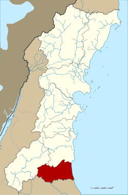 District location in Chumphon Province | |
| Coordinates: 9°46′6″N 99°5′30″E / 9.76833°N 99.09167°ECoordinates: 9°46′6″N 99°5′30″E / 9.76833°N 99.09167°E | |
| Country | Thailand |
| Province | Chumphon |
| Seat | Lamae |
| Area | |
| • Total | 259.0 km2 (100.0 sq mi) |
| Population (2005) | |
| • Total | 27,278 |
| • Density | 105.3/km2 (273/sq mi) |
| Time zone | UTC+7 (ICT) |
| Postal code | 86170 |
| Geocode | 8605 |

Lamae (Thai: ละแม, pronounced [lā.mɛ̄ː]) is a district (amphoe) in the southern part of Chumphon Province, southern Thailand.
Geography[]
Neighboring districts are (from the south clockwise) Tha Chana of Surat Thani Province, Phato and Lang Suan of Chumphon Province. To the east is the Gulf of Thailand.
History[]
The minor district (king amphoe) was created on 1 July 1971, when the three tambons, Lamae, Thung Luang, and Suan Taeng, were split off from Lang Suan District.[1] It was upgraded to a full district on 12 April 1977.[2]
Administration[]
The district is divided into four sub-districts (tambons), which are further subdivided into 47 villages (mubans). Lamae is a township (thesaban tambon) which covers parts of the same-named tambon. There are a further four tambon administrative organizations (TAO).
|

|
References[]
- ^ ประกาศกระทรวงมหาดไทย เรื่อง แบ่งท้องที่อำเภอหลังสวนตั้งเป็นกิ่งอำเภอละแม จังหวัดชุมพร (PDF). Royal Gazette (in Thai). 88 (39 ง): 1283. April 13, 1971.
- ^ พระราชกฤษฎีกาตั้งอำเภอปลายพระยา อำเภอห้วยเม็ก อำเภอละแม อำเภอแม่จริม อำเภอหนองกี่ อำเภอโคกปีบ อำเภอเกาะพะงัน อำเภอสนม อำเภอโซ่พิสัย อำเภอโนนสะอาด และอำเภอนาจะหลวย พ.ศ. ๒๕๒๐ (PDF). Royal Gazette (in Thai). 94 (31 ก): 326–330. April 12, 1977.
External links[]
This Chumphon Province location article is a stub. You can help Wikipedia by . |
- Amphoe of Chumphon Province
- Southern Thailand geography stubs