Lamandau Regency
Lamandau Regency
Kabupaten Lamandau | |
|---|---|
Regency | |
 Coat of arms | |
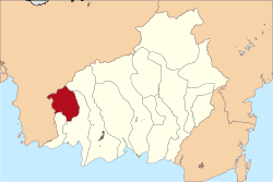 Location within Central Kalimantan | |
 Lamandau Regency Location in Kalimantan and Indonesia | |
| Coordinates: 1°50′18″S 111°17′13″E / 1.8383°S 111.2869°E | |
| Country | Indonesia |
| Region | Kalimantan |
| Province | Central Kalimantan |
| Capital | |
| Government | |
| • Regent | H. Hendra Lesmana |
| • Vice Regent | Riko Porwanto, S.STP. |
| Area | |
| • Total | 2,476.5 sq mi (6,414.0 km2) |
| Population (2020 Census)[1] | |
| • Total | 97,611 |
| • Density | 39/sq mi (15/km2) |
| Time zone | UTC+7 (IWST) |
| Area code | (+62) 532 |
| Website | lamandaukab |


Lamandau Regency (Indonesian: Kabupaten Lamandau) is one of the thirteen regencies which comprise the Central Kalimantan Province on the island of Kalimantan (Borneo), Indonesia. The town of is the capital of Lamandau Regency. The population of Lamandau Regency was 63,199 at the 2010 Census, and 97,611 at the 2020 Census.[2]
Administrative Districts[]
Lamandau Regency consists of eight districts (kecamatan), tabulated below with their areas and population totals from the 2010 Census[3] and the 2020 Census.[4] The table also includes the number of administrative villages (rural desa and urban kelurahan) in each district, and its postal codes.
| Name | Area in km2 |
Pop'n Census 2010[5] |
Pop'n Census 2020[6] |
No. of villages |
Post codes |
|---|---|---|---|---|---|
| Bulik | 665.55 | 21,989 | 38,041 | 14 | 74162 (a) |
| Sematu Jaya | 86.85 | 8,715 | 12,920 | 8 | 74165 |
| Menthobi Raya | 620.88 | 8,982 | 11,860 | 11 | 74164 |
| Bulit Timur (East Bulik) |
1,074.72 | 6,467 | 9,380 | 12 | 74163 |
| Lamandau (district) | 1,333.00 | 5,454 | 9,370 | 11 | 74660 |
| Belantikan Raya | 1,263.00 | 4,321 | 7,580 | 12 | 74663 |
| Delang | 685.00 | 4,866 | 5,760 | 11 | 74665 |
| Batangkawa | 685.00 | 2,405 | 2,700 | 9 | 74664 |
| Totals | 6,414.00 | 63,199 | 97,611 | 88 |
Note: (a) except the town of Nanga Bulik (with a post code of 74611) and the village of Kujan (with a post code of 74612).
Climate[]
Nanga Bulik has a tropical rainforest climate (Af) with heavy rainfall year-round.
| hideClimate data for Nanga Bulik | |||||||||||||
|---|---|---|---|---|---|---|---|---|---|---|---|---|---|
| Month | Jan | Feb | Mar | Apr | May | Jun | Jul | Aug | Sep | Oct | Nov | Dec | Year |
| Average high °C (°F) | 29.7 (85.5) |
30.1 (86.2) |
30.5 (86.9) |
31.1 (88.0) |
31.3 (88.3) |
31.1 (88.0) |
31.5 (88.7) |
31.7 (89.1) |
31.8 (89.2) |
31.5 (88.7) |
30.8 (87.4) |
30.2 (86.4) |
30.9 (87.7) |
| Daily mean °C (°F) | 26.1 (79.0) |
26.4 (79.5) |
26.5 (79.7) |
27.0 (80.6) |
27.1 (80.8) |
26.8 (80.2) |
26.9 (80.4) |
27.0 (80.6) |
27.1 (80.8) |
26.9 (80.4) |
26.7 (80.1) |
26.3 (79.3) |
26.7 (80.1) |
| Average low °C (°F) | 22.5 (72.5) |
22.7 (72.9) |
22.6 (72.7) |
22.9 (73.2) |
23.0 (73.4) |
22.6 (72.7) |
22.4 (72.3) |
22.4 (72.3) |
22.5 (72.5) |
22.4 (72.3) |
22.6 (72.7) |
22.5 (72.5) |
22.6 (72.7) |
| Average rainfall mm (inches) | 250 (9.8) |
241 (9.5) |
284 (11.2) |
294 (11.6) |
251 (9.9) |
198 (7.8) |
159 (6.3) |
144 (5.7) |
197 (7.8) |
252 (9.9) |
302 (11.9) |
307 (12.1) |
2,879 (113.5) |
| Source: Climate-Data.org[7] | |||||||||||||
References[]
- ^ Badan Pusat Statistik, Jakarta, 2021.
- ^ Badan Pusat Statistik, Jakarta, 2021.
- ^ Biro Pusat Statistik, Jakarta, 2011.
- ^ Badan Pusat Statistik, Jakarta, 2021.
- ^ Biro Pusat Statistik, Jakarta, 2011.
- ^ Badan Pusat Statistik, Jakarta, 2021.
- ^ "Climate: Nanga Bulik". Climate-Data.org. Retrieved 24 November 2020.
- Regencies of Central Kalimantan