Lamotte Township, Crawford County, Illinois
Lamotte Township | |
|---|---|
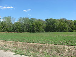 The Stoner Site, an important archaeological site in the township | |
 Location in Crawford County | |
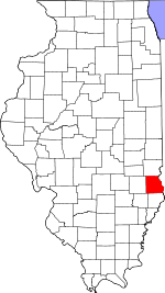 Crawford County's location in Illinois | |
| Coordinates: 39°00′53″N 87°37′12″W / 39.01472°N 87.62000°WCoordinates: 39°00′53″N 87°37′12″W / 39.01472°N 87.62000°W | |
| Country | United States |
| State | Illinois |
| County | Crawford |
| Established | November 5, 1867 |
| Area | |
| • Total | 51.41 sq mi (133.2 km2) |
| • Land | 50.81 sq mi (131.6 km2) |
| • Water | 0.59 sq mi (1.5 km2) 1.15% |
| Elevation | 440 ft (134 m) |
| Population (2010) | |
| • Estimate (2016)[1] | 1,971 |
| • Density | 40.3/sq mi (15.6/km2) |
| Time zone | UTC-6 (CST) |
| • Summer (DST) | UTC-5 (CDT) |
| ZIP codes | 62451, 62454 |
| FIPS code | 17-033-41833 |

Lamotte Township is one of ten townships in Crawford County, Illinois, USA. As of the 2010 census, its population was 2,046 and it contained 995 housing units.[2] Its name changed from Palestine Township sometime before 1921.
Geography[]
According to the 2010 census, the township has a total area of 51.41 square miles (133.2 km2), of which 50.81 square miles (131.6 km2) (or 98.83%) is land and 0.59 square miles (1.5 km2) (or 1.15%) is water.[2] The Wabash River defines its eastern border.
Cities, towns, villages[]
Unincorporated towns[]
(This list is based on USGS data and may include former settlements.)
Cemeteries[]
The township contains these seven cemeteries: Barbee, East Union, Green, Higgins, Kitchell, Neathery and Oak Grove.
Major highways[]
Airports and landing strips[]
- Robinson Municipal Airport
Landmarks[]
- Leaverton Park
Demographics[]
| Historical population | |||
|---|---|---|---|
| Census | Pop. | %± | |
| 2016 (est.) | 1,971 | [1] | |
| U.S. Decennial Census[3] | |||
School districts[]
- Hutsonville Community Unit School District 1
- Palestine Community Unit School District 3
- Robinson Community Unit School District 2
- Oblong Community Unit School District 4
Political districts[]
- Illinois' 15th congressional district
- State House District 109
- State Senate District 55
References[]
- "Lamotte Township, Crawford County, Illinois". Geographic Names Information System. United States Geological Survey. Retrieved 2010-01-10.
- United States Census Bureau 2007 TIGER/Line Shapefiles
- United States National Atlas
- ^ a b "Population and Housing Unit Estimates". Retrieved June 9, 2017.
- ^ a b "Population, Housing Units, Area, and Density: 2010 - County -- County Subdivision and Place -- 2010 Census Summary File 1". United States Census. Archived from the original on 2020-02-12. Retrieved 2013-05-28.
- ^ "Census of Population and Housing". Census.gov. Retrieved June 4, 2016.
External links[]
Places adjacent to Lamotte Township, Crawford County, Illinois | |
|---|---|
Municipalities and communities of Crawford County, Illinois, United States | ||
|---|---|---|
| City | ||
| Villages | ||
| Townships | ||
| CDPs | ||
| Other unincorporated communities | ||
| Ghost town | ||
| Footnotes | ‡This populated place also has portions in an adjacent county or counties | |
| ||
Categories:
- Townships in Crawford County, Illinois
- Townships in Illinois