Lamporecchio
Lamporecchio | |
|---|---|
| Comune di Lamporecchio | |
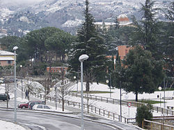 | |
show Location of Lamporecchio | |
 Lamporecchio Location of Lamporecchio in Italy | |
| Coordinates: 43°49′N 10°54′E / 43.817°N 10.900°ECoordinates: 43°49′N 10°54′E / 43.817°N 10.900°E | |
| Country | Italy |
| Region | Tuscany |
| Province | Province of Pistoia (PT) |
| Frazioni | Borgano, Cerbaia, Collececioli, Fornello, Mastromarco, Orbignano, Papone, Porciano, San Baronto, Spicchio, Papiano |
| Government | |
| • Mayor | Alessio Torrigiani (Democratic Party) |
| Area | |
| • Total | 22.25 km2 (8.59 sq mi) |
| Elevation | 56 m (184 ft) |
| Population (31 August 2017)[2] | |
| • Total | 7,524 |
| • Density | 340/km2 (880/sq mi) |
| Demonym(s) | Lamporecchiani |
| Time zone | UTC+1 (CET) |
| • Summer (DST) | UTC+2 (CEST) |
| Postal code | 51035 |
| Dialing code | 0573 |
| Patron saint | Saint Stephen |
| Saint day | 26 December |
| Website | Official website |


Lamporecchio (Italian pronunciation: [lampoˈrekkjo]) is a comune (municipality) in the Province of Pistoia in the Italian region Tuscany, located about 30 kilometres (19 mi) west of Florence and about 13 kilometres (8 mi) south of Pistoia, 15 kilometres (9 mi) east of Montecatini Terme, and 4 kilometres (2.5 mi) west of Vinci.
Lamporecchio is the birthplace of Francesco Berni, a poet. From here started its ascent as one of the most important noble families of Tuscany, the Rospigliosi, which later moved to Pistoia and Rome, reaching the papacy with Clement IX.
The town is known for the invention of brigidini, which are thin anise flavored wafers.
Lamporecchio borders the following municipalities: Cerreto Guidi, Larciano, Quarrata, Serravalle Pistoiese, Vinci.
A frazione of Lamporecchio, called San Baronto, was chosen to be a part of 2013 UCI Road World Championships road race.
External links[]
| Wikimedia Commons has media related to Lamporecchio. |
| show Authority control |
|---|
- ^ "Superficie di Comuni Province e Regioni italiane al 9 ottobre 2011". Istat. Retrieved 16 March 2019.
- ^ "Popolazione Residente al 1° Gennaio 2018". Istat. Retrieved 16 March 2019.
- Cities and towns in Tuscany
- Municipalities of the Province of Pistoia
- Tuscany geography stubs