Lancaster Canal
| Lancaster Canal | |
|---|---|
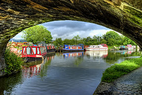 Cathouse Bridge (No. 64) over the navigable section of the canal in Garstang | |
| Specifications | |
| Maximum boat length | 70 ft 0 in (21.34 m) |
| Maximum boat beam | 14 ft 0 in (4.27 m) |
| Locks | 14 |
| Status | Navigable |
| Navigation authority | Canal and River Trust |
| History | |
| Original owner | Lancaster Canal Navigation Co |
| Principal engineer | John Rennie |
| Other engineer(s) | William Crossley |
| Date of act | 1792 |
| Date of first use | 1797 |
| Date completed | 1826 |
| Geography | |
| Start point | Preston |
| End point | Kendal |
| Branch(es) | Glasson Dock |
| Connects to | River Lune, Ribble Link |
Lancaster Canal | ||||||||||||||||||||||||||||||||||||||||||||||||||||||||||||||||||||||||||||||||||||||||||||||||||||||||||||||||||||||||||||||||||||||||||||||||||||||||||||||||||||||||||||||||||||||||||||||||||||||||||||||||||||||||||||||||||||||||||||||||||||||||||||||||||||||||||||||||||||||||||||||||||||||||||||||||||||||||||||||||||||||||||||||||||||||||||||||||||||||||||||||||||||||||||||||||||||||||||||||||||||||||||||||||||||||||||||||||||||||||||||||||||||||||||||||||||||||||||||||||||||||||||||||||||||||||||||||||||||||||||||||||||||||||||||||||||||||||||||||||||||||||||||||||
|---|---|---|---|---|---|---|---|---|---|---|---|---|---|---|---|---|---|---|---|---|---|---|---|---|---|---|---|---|---|---|---|---|---|---|---|---|---|---|---|---|---|---|---|---|---|---|---|---|---|---|---|---|---|---|---|---|---|---|---|---|---|---|---|---|---|---|---|---|---|---|---|---|---|---|---|---|---|---|---|---|---|---|---|---|---|---|---|---|---|---|---|---|---|---|---|---|---|---|---|---|---|---|---|---|---|---|---|---|---|---|---|---|---|---|---|---|---|---|---|---|---|---|---|---|---|---|---|---|---|---|---|---|---|---|---|---|---|---|---|---|---|---|---|---|---|---|---|---|---|---|---|---|---|---|---|---|---|---|---|---|---|---|---|---|---|---|---|---|---|---|---|---|---|---|---|---|---|---|---|---|---|---|---|---|---|---|---|---|---|---|---|---|---|---|---|---|---|---|---|---|---|---|---|---|---|---|---|---|---|---|---|---|---|---|---|---|---|---|---|---|---|---|---|---|---|---|---|---|---|---|---|---|---|---|---|---|---|---|---|---|---|---|---|---|---|---|---|---|---|---|---|---|---|---|---|---|---|---|---|---|---|---|---|---|---|---|---|---|---|---|---|---|---|---|---|---|---|---|---|---|---|---|---|---|---|---|---|---|---|---|---|---|---|---|---|---|---|---|---|---|---|---|---|---|---|---|---|---|---|---|---|---|---|---|---|---|---|---|---|---|---|---|---|---|---|---|---|---|---|---|---|---|---|---|---|---|---|---|---|---|---|---|---|---|---|---|---|---|---|---|---|---|---|---|---|---|---|---|---|---|---|---|---|---|---|---|---|---|---|---|---|---|---|---|---|---|---|---|---|---|---|---|---|---|---|---|---|---|---|---|---|---|---|---|---|---|---|---|---|---|---|---|---|---|---|---|---|---|---|---|---|---|---|---|---|---|---|---|---|---|---|---|---|---|---|---|---|---|---|---|---|---|---|---|---|---|---|---|---|---|---|---|---|---|---|---|---|---|---|---|---|---|---|---|---|---|---|---|---|---|---|---|---|---|---|---|---|---|---|---|---|---|---|---|---|---|---|---|---|---|---|---|---|---|---|---|---|---|---|---|---|---|---|---|---|---|---|---|---|---|---|---|---|---|---|---|---|---|---|---|---|---|---|---|---|---|---|---|---|---|---|---|---|---|---|---|---|---|---|---|---|---|---|---|---|---|---|---|---|---|---|---|---|---|---|---|---|---|---|---|---|---|---|---|---|---|---|---|---|---|---|---|---|---|---|---|---|---|---|---|---|---|---|---|---|---|
| ||||||||||||||||||||||||||||||||||||||||||||||||||||||||||||||||||||||||||||||||||||||||||||||||||||||||||||||||||||||||||||||||||||||||||||||||||||||||||||||||||||||||||||||||||||||||||||||||||||||||||||||||||||||||||||||||||||||||||||||||||||||||||||||||||||||||||||||||||||||||||||||||||||||||||||||||||||||||||||||||||||||||||||||||||||||||||||||||||||||||||||||||||||||||||||||||||||||||||||||||||||||||||||||||||||||||||||||||||||||||||||||||||||||||||||||||||||||||||||||||||||||||||||||||||||||||||||||||||||||||||||||||||||||||||||||||||||||||||||||||||||||||||||||||
The Lancaster Canal is a canal in North West England, originally planned to run from Westhoughton in Lancashire to Kendal in south Cumbria (historically in Westmorland). The section around the crossing of the River Ribble was never completed, and much of the southern end leased to the Leeds and Liverpool Canal, of which it is now generally considered part.
Of the canal north of Preston, only the section from Preston to Tewitfield near Carnforth in Lancashire is currently open to navigation for 42 miles (67.6 km), with the canal north of Tewitfield having been severed in three places by the construction of the M6 motorway, and by the A590 road near Kendal. The southern part, from Johnson's Hillock to Aspull, remains navigable as part of the Leeds and Liverpool Canal. The planned continuation to Westhoughton was never built.
History[]

The line of the canal was first surveyed by Robert Whitworth in 1772. In 1791, John Longbotham, Robert Dickinson and Richard Beck resurveyed the proposed line, and a final survey was carried out later the same year by John Rennie.[1]
In 1792 the promoters sought an Act of Parliament urgently, as proposals by the Leeds and Liverpool Canal to alter their route would have affected the profitability of the southern section.[1] It received the Royal Assent on 11 June 1792, and was entitled An Act for making and maintaining a navigable canal, from Kirkby Kendal in the county of Westmorland, to West Houghton in the county palatine of Lancaster, and also a navigable branch from the said intended canal at or near Barwick, to or near Warton Cragg, and also another navigable branch, from, at or near, Galemoss, by Chorley, to or near Duxbury in the said county palatine of Lancaster.[2]
The Act created the Company of Proprietors of the Lancaster Canal Navigation, and gave them powers to raise £414,100 by the issuing of shares, and an additional £200,000, either by mortgage or by issuing more shares, if required.[2] John Rennie was appointed as engineer in July 1792, with William Crossley the elder as his assistant, and Archibald Millar as resident engineer and superintendent. A second Act of Parliament was obtained in May 1793 to authorise the construction of the Glasson branch, so that the canal had a connection to the sea.[1]
Northern end[]

Work started almost immediately on the level ground from Preston to Tewitfield, and in 1794 on the Lune Aqueduct, which was built of stone, although Rennie thought brick should have been used, as it would have been considerably cheaper. By 1797 the aqueduct was open, carrying the canal 62 feet (19 m) above the river,[3] and boats were now able to travel the 42.4 miles (68.2 km) from Preston to Tewitfield. In 1813, work began on the canal north from Tewitfield, which was completed to Kendal in 1819.[4] Construction on the 2.5-mile (4 km) Glasson Dock branch began in 1819, and it opened in 1826, with six locks carrying the canal down to the sea.[5]

With the coming of the railways, the proprietors sought to lease the canal to a railway company in 1860. After a Bill to authorise the arrangement with the London and North Western Railway was defeated in the House of Lords in 1863, it was reintroduced the following year, and became an Act of Parliament on 29 July 1864. The canal company then received £12,665.87 per year for the lease of the northern end of the canal, which allowed them to continue paying dividends and to make investments. Eventually, the railway company offered to buy the canal, and this was formalised by an Act of Parliament obtained on 16 July 1885, although they actually took over the canal on 1 July.[6]
The canal had always suffered problems with leakage due to limestone fissures in the bed, and in 1939 the London, Midland and Scottish Railway, who were by now owners of the canal, obtained an Act to close the first 0.5-mile (0.8 km) section at Kendal. In 1941-42 the by then unused section north of Kendal Gas Works was closed because of leakage, and the owners attempted to close the whole canal in 1944, but opposition in the House of Lords resulted in a stay of execution. In later years, the main commercial traffic was coal from Preston to Kendal Gas Works, which had been built in 1824 on land bought from the canal company, and between 6,500 and 7,500 long tons (6,600 and 7,600 t) were carried each year. As there was no railway to the gas works, this traffic had ensured the maintenance of the canal, but it was transferred to road vehicles in 1944, and the canal carried its final commercial traffic in 1947.[7]

In 1955, an Act of Parliament authorised the closure of the canal, along with several others, covering 771 miles (1,241 km) in total. The Inland Waterways Association organised several protest meetings, and the one held in Lancaster led to the formation of the Lancaster Canal Boat Club.[8] One immediate effect of the 1955 Act of Parliament was that the canal was drained of water north from Stainton because of leakage, and the last 2 miles (3.2 km) in Kendal were filled in. Although it was officially closed, pleasure boats continued to use the section below Tewitfield. Above the locks, a 100-yard (91 m) section at Burton was drained because of problems with leakage, and a pipe replaced the canal, so that the water supply to the lower canal was maintained. This effectively ended navigation north of Tewitfield, so that when the M6 motorway was being constructed, the canal was culverted in three places, despite a local campaign for bridges to be built, so that restoration would be possible in the future.[7]
The route of the canal south from Kendal is still readily apparent, with most of the bridges remaining in place. Although severed by the motorway construction, it was not drained because the channel was used to supply water to a pipeline which ran from the canal near Garstang to a chemical works near Fleetwood. As a result, this section can still be used by small boats.[7] In 1976, the Lancaster Canal Trust mounted a campaign for the construction of slipways on this section, to make the launching of boats easier, which proved to be successful, as they were used at Easter 1978, when a boat rally was held on the upper reaches.[9]
During its working life, packet boats provided an express passenger service between Preston and Lancaster, and later to Kendal at 10 miles per hour (16 km/h), with passengers walking up or down the flight of locks at Tewitfield and embarking on a second boat. The seven-hour journey time halved the best speeds of stage coaches; because of the comfort of the journey, passengers stayed loyal to the packet boats even after the advent of railway competition in the 1840s.
The isolated northern part of the canal was finally connected to the rest of the English canal network in 2002 by the opening of the Ribble Link.[10]
Most of the canal runs through open countryside except where it runs through the City of Lancaster. With the exception of the branch to Glasson Dock and the Ribble Link, the navigable Preston to Tewitfield section of the canal follows the same elevation contour on maps and is therefore free of locks.
The Kendal to Preston section now terminates at Ashton basin, but previously continued to the centre of Preston where there are a number of streets and pubs whose names give clues: Wharfe Street, Kendal Street, the Lamb and Packet (the lamb being the crest of Preston), the Fighting Cocks (formerly the Boatmans). Most of the ground formerly occupied by the canal basin is now the University of Central Lancashire.
Garstang Marina's inlet of the canal is a visual reporting point (VRP) for general aviation aircraft in the local Blackpool airspace.[11]
The tramway[]
By 1799, the canal was complete between Bark Hill, Aspull (west of Westhoughton) and Johnson's Hillock near Chorley. However, by 1801, no design had even been agreed for the aqueduct over the River Ribble, and in July 1801 it was agreed to build a temporary tramroad to cross the river and span the gap between the northern and southern parts of the canal. The double-track Lancaster Canal Tramroad was opened in 1803 with three steam-worked inclined planes and a low trestle bridge across the Ribble. The canal was extended north from Johnson's Hillock to Walton Summit through a tunnel at Whittle Hills.[12]
This temporary solution become permanent, and the aqueduct was never built. Although this section was the busiest on the canal, income was insufficient to pay for construction of the planned aqueduct.
Southern end[]

In 1792 the Lancaster Canal Navigation Company obtained an act to link Kendal with Westhoughton. They also petitioned to make an extension from Westhoughton to the Bridgewater Canal near Worsley but stopped when the occupant of Atherton Hall objected.[13]
The Leeds and Liverpool Canal having reached Blackburn by 1810, a decision was made to link with the Lancaster Canal's southern end to avoid constructing a parallel waterway. The Lancaster Canal built two short branches to connect with the Leeds and Liverpool Canal, from Johnson's Hillock including seven locks, and from Bark Hill to Wigan Top Lock – the Act authorising this construction also authorised additional tolls to make it worthwhile for the Lancaster Canal to co-operate with the Leeds and Liverpool.[14]
In 1851 the Lancaster Canal leased the tolls on the southern end to the Leeds and Liverpool Canal in return for an annual rent, and this agreement was made permanent in 1864.[6]
The tramroad was closed from Bamber Bridge to Preston in 1864, and the remainder to Walton Summit in 1879. The canal between Walton Summit and the Leeds and Liverpool link at Johnson's Hillock was last used in 1932 (although a party in canoes managed to navigate the branch as late as 1969 with only two portages)[15] This section was closed in the 1960s, as a result of the M61 motorway proposal which would have required three bridges over the canal. The Ministry of Transport and British Waterways Board decided that the cost of constructing the bridges was not justified, particularly as the canal was in poor condition, and promoted a bill in Parliament for closure of the canal.[16] As a result, much is now buried under the M61 motorway, and in the Clayton-le-Woods area housing estates have been built on the route in the 1990s. The remainder of the southern end, between Johnson's Hillock and Wigan Top Lock, is now considered as part of the Leeds and Liverpool Canal and remains well used by leisure traffic.
Restoration[]
Long-term plans are being developed to reopen the section north of Tewitfield, which is still in water for 9 miles (14 km), fed by Killington Reservoir between Kendal and Sedbergh adjacent to the M6 motorway: the final 5 miles (8.0 km) into Kendal are dry.
The Northern Reaches Restoration Group (NRRG) and the Lancaster Canal Restoration Partnership aim to restore the canal from Tewitfield to Kendal. There are nine partners: Canal & River Trust, Cumbria County Council, Inland Waterways Association, Kendal Town Council, Lancashire County Council, Lancaster City Council, Lancaster Canal Trust, South Lakeland District Council and the Waterways Trust.
The restoration will involve restoring the six places where the canal is culverted (including the three places where the M6 motorway construction blocked the route), restoring Hincaster Tunnel, restoring the 5 dry miles, and a new crossing of the A590 road near Kendal, as well as many more minor works including work on 52 listed structures. The extensive engineering required will be expensive (a 2002 estimate being £60 million), and so restoration is planned to proceed in phases.
The first phase planned to be restoration is 3.7 miles (6.0 km) southwards from Canal Head in Kendal to Natland Road. Funding of £750,000 was provided in 2005 for the planning and design of this first phase: construction works were not expected to commence before late 2007 with completion in 2009 at the earliest. Despite the projected 2009 completion date, the work to restore the canal had still not been started by late 2016.
The Grade I Listed Lune Aqueduct was scheduled for a £2.0 million facelift in 2009/10.[17] The organisations responsible for the aqueduct were awarded £50,000 by the Heritage Lottery fund to enable them put together a credible bid for funding.[18] Work began to restore the aqueduct in January 2011, and was completed in March 2012 with the project costing £2.4 million.[19]
During Storm Desmond in December 2015, extensive damage to the wingwalls of bridge 171 – Stainton Aqueduct – was discovered. This led to the temporary closure of the canal by means of a clay dam (the dam being intended to prevent any loss of water from the remaining open section, should the aqueduct fail). Funding was obtained for the restoration of the aqueduct with the main works commenced in August 2018 by construction firm Kier Group who have been employed by the Canal & River Trust at a cost circa £1 million.
See also[]
Bibliography[]
- Barritt, S., (2000) The Old Tramroad - Walton Summit to Preston Basin, Carnegie Publishing, ISBN 1-85936-058-0
- Cumberlidge, Jane (2009). Inland Waterways of Great Britain (8th Ed). Imray Laurie Norie and Wilson. ISBN 978-1-84623-010-3.
- Hadfield, Charles; Biddle, Gordon (1970a). The Canals of North West England, Vol 1 (pp.1-236). David and Charles. ISBN 0-7153-4956-2.
- Hadfield, Charles; Biddle, Gordon (1970b). The Canals of North West England, Vol 2 (pp.241-496). David and Charles. ISBN 0-7153-4992-9.
- Philpotts, R. (1983). Building the Lancaster Canal (Rev. ed.). London: Blackwater Books. ISBN 0-946623-00-7.
- Potter, H. (2008). "Last Boat to Walton Summit" (PDF). Waterways World. 37 (3: March): 96–98. Archived from the original (PDF) on 25 July 2011.
- Priestley, Joseph (1831). Historical Account of the Navigable Rivers, Canals, and Railways of Great Britain.
- Rigby, J. (2007). The Lancaster Canal in focus. Blackpool: Landy. ISBN 978-1-872895-72-7.
- Slater, D. (2000). The complete guide to the Lancaster Canal (2nd ed.). Lancaster Canal Trust. Lancaster: Lancaster Canal Trust. ISBN 0-9514146-1-5.
- Satchell, J. (2001). Kendal's canal : history, industry and people (Rev. ed.). Kendal Civic Society. ISBN 0-9509869-1-7.
- Squires, Roger (2008). Britain's Restored Canals. Landmark Publishing. ISBN 978-1-84306-331-5.
- Tomlinson, V.I. (1991). The Manchester Bolton and Bury Canal. Bolton: The Manchester Bolton & Bury Canal Society. p. 109. Archived from the original on 10 October 2008.
- Willis, K.G.; Garrod, G.; Dobbs, I. (1990). The value of canals as a public good : the case of the Montgomery and Lancaster canals. Countryside change working paper series, 5. Newcastle upon Tyne: Countryside Change Unit, University of Newcastle upon Tyne.
- Yeadon, H.L. (2005). The Motorway Achievement: Building the Network: The North West of England. Chichester: Phillimore & Co. ISBN 1-86077-352-4.
References[]
- ^ a b c Hadfield & Biddle 1970a, pp. 183–186
- ^ a b Priestley 1831, p. 374
- ^ Hadfield & Biddle 1970a, pp. 186–188
- ^ Hadfield & Biddle 1970a, pp. 192–193
- ^ Hadfield & Biddle 1970a, pp. 195–196
- ^ a b Hadfield & Biddle 1970b, pp. 423–425
- ^ a b c Hadfield & Biddle 1970b, pp. 425–427
- ^ Squires 2008, p. 35
- ^ Squires 2008, p. 92
- ^ Cumberlidge 2009, p. 167
- ^ Visiting by air – Blackpool Airport
- ^ Hadfield & Biddle 1970a, p. 190
- ^ Tomlinson 1991, p. 36
- ^ Hadfield & Biddle 1970a, p. 192
- ^ Potter 2008
- ^ Yeadon 2005
- ^ "British Waterways public consultation". LakelandEcho.co.uk. Retrieved 28 October 2008.
- ^ BBC Radio Lancashire, accessed 2010-10-14
- ^ "Aqueduct's restoration completed". BBC News. 26 March 2012. Retrieved 14 November 2018.
External links[]

- Lancaster Canal
- Canals in Lancashire
- Canals in Cumbria
- Canals opened in 1797
- Canals opened in 1826
- 1826 establishments in England